Estimated Value: $262,805 - $307,000
3
Beds
2
Baths
1,352
Sq Ft
$212/Sq Ft
Est. Value
About This Home
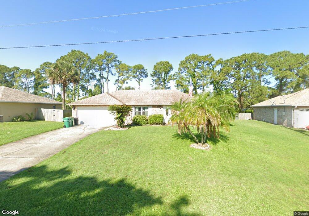
This home is located at 7240 Freeport Rd, Cocoa, FL 32927 and is currently estimated at $287,201, approximately $212 per square foot. 7240 Freeport Rd is a home located in Brevard County with nearby schools including Enterprise Elementary School, Space Coast Junior/Senior High School, and East Atlantic Prep of Brevard County.
Ownership History
Date
Name
Owned For
Owner Type
Purchase Details
Closed on
Jan 9, 2025
Sold by
Hull William E
Bought by
William E Hull Trust and Hull
Current Estimated Value
Purchase Details
Closed on
May 27, 2003
Sold by
Arpin Dorothy N
Bought by
Hull William and Hull Pamela
Home Financials for this Owner
Home Financials are based on the most recent Mortgage that was taken out on this home.
Original Mortgage
$41,000
Interest Rate
5.79%
Purchase Details
Closed on
Dec 30, 1998
Sold by
Tucker Thomas G
Bought by
Arpin Robert J and Arpin Dorothy N
Home Financials for this Owner
Home Financials are based on the most recent Mortgage that was taken out on this home.
Original Mortgage
$73,000
Interest Rate
6.87%
Purchase Details
Closed on
Oct 14, 1993
Sold by
Adams Nancy Lynn
Bought by
Tucker Thomas G
Home Financials for this Owner
Home Financials are based on the most recent Mortgage that was taken out on this home.
Original Mortgage
$77,520
Interest Rate
6.99%
Create a Home Valuation Report for This Property
The Home Valuation Report is an in-depth analysis detailing your home's value as well as a comparison with similar homes in the area
Home Values in the Area
Average Home Value in this Area
Purchase History
| Date | Buyer | Sale Price | Title Company |
|---|---|---|---|
| William E Hull Trust | $100 | None Listed On Document | |
| Hull William | $106,000 | Gulfatlantic Title | |
| Arpin Robert J | $83,000 | -- | |
| Tucker Thomas G | $76,000 | -- |
Source: Public Records
Mortgage History
| Date | Status | Borrower | Loan Amount |
|---|---|---|---|
| Previous Owner | Hull William | $41,000 | |
| Previous Owner | Arpin Robert J | $73,000 | |
| Previous Owner | Tucker Thomas G | $77,520 |
Source: Public Records
Tax History
| Year | Tax Paid | Tax Assessment Tax Assessment Total Assessment is a certain percentage of the fair market value that is determined by local assessors to be the total taxable value of land and additions on the property. | Land | Improvement |
|---|---|---|---|---|
| 2025 | $932 | $78,590 | -- | -- |
| 2024 | $900 | $76,380 | -- | -- |
| 2023 | $900 | $74,160 | $0 | $0 |
| 2022 | $906 | $72,000 | $0 | $0 |
| 2021 | $904 | $69,910 | $0 | $0 |
| 2020 | $857 | $68,950 | $0 | $0 |
| 2019 | $802 | $67,400 | $0 | $0 |
| 2018 | $801 | $66,150 | $0 | $0 |
| 2017 | $799 | $64,790 | $0 | $0 |
| 2016 | $803 | $63,460 | $18,000 | $45,460 |
| 2015 | $806 | $63,020 | $15,000 | $48,020 |
| 2014 | $809 | $62,520 | $11,000 | $51,520 |
Source: Public Records
Map
Nearby Homes
- TBD Freeport Rd
- 5740 Friendly St
- 7358 Crepe Myrtle Ct
- 7368 Crepe Myrtle Ct
- 7200 Oakwood Ave
- 7419 Hackberry Rd
- 7230 Venus Ave
- 7635 Fringe Place
- 5555 Brandon St
- 7065 Hundred Acre Dr
- 5303 Yaupon Holly Dr
- 6990 Bryant Rd
- 7545 Fringe Place
- 5242 Yaupon Holly Dr
- 6665 Addie Ave
- 5165 Patricia St
- 6815 Bryant Rd
- 1389 Moscato Dr
- 6105 Banyan St
- 5150 Melody St
- 7230 Freeport Rd
- 7250 Freeport Rd
- 7220 Freeport Rd
- 7245 Freeport Rd
- 7255 Freeport Rd
- 7260 Freeport Rd
- 7235 Freeport Rd
- 12 Lot Freeport
- 7210 Freeport Rd
- 7162 Freeport Rd
- 5750 Friendly St
- 7240 Kimball Ave
- 5740 Friendly St Unit 7
- 7250 Kimball Ave
- 7215 Freeport Rd
- 7230 Kimball Ave
- 7205 Freeport Rd
- 7190 Freeport Rd
- 5720 Friendly St
- 7200 Kimball Ave
Your Personal Tour Guide
Ask me questions while you tour the home.