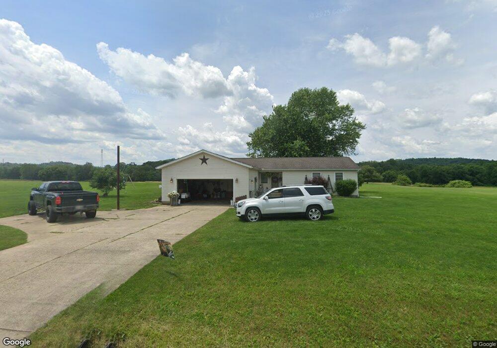
7241 Azalea Rd SW Unit 6 Bowerston, OH 44695
Estimated Value: $241,681 - $268,000
3
Beds
2
Baths
1,332
Sq Ft
$193/Sq Ft
Est. Value
About This Home
This home is located at 7241 Azalea Rd SW Unit 6, Bowerston, OH 44695 and is currently estimated at $256,670, approximately $192 per square foot. 7241 Azalea Rd SW Unit 6 is a home located in Carroll County with nearby schools including Conotton Valley Junior/Senior High School.
Ownership History
Date
Name
Owned For
Owner Type
Purchase Details
Closed on
Sep 24, 2024
Sold by
Burkhart Rhonda and Stevenson Rhonda
Bought by
Stevenson Rhonda and Stevenson Nicholas Scott
Current Estimated Value
Home Financials for this Owner
Home Financials are based on the most recent Mortgage that was taken out on this home.
Original Mortgage
$187,343
Outstanding Balance
$185,425
Interest Rate
6.49%
Mortgage Type
New Conventional
Estimated Equity
$71,245
Purchase Details
Closed on
Feb 13, 2018
Sold by
Leggett Eric C
Bought by
Burkhart Rhonda
Home Financials for this Owner
Home Financials are based on the most recent Mortgage that was taken out on this home.
Original Mortgage
$97,000
Interest Rate
4.38%
Mortgage Type
New Conventional
Purchase Details
Closed on
Dec 23, 2016
Sold by
Leggett Eric C
Bought by
Leggett Eric C and Burkhart Rhonda
Create a Home Valuation Report for This Property
The Home Valuation Report is an in-depth analysis detailing your home's value as well as a comparison with similar homes in the area
Home Values in the Area
Average Home Value in this Area
Purchase History
| Date | Buyer | Sale Price | Title Company |
|---|---|---|---|
| Stevenson Rhonda | -- | Doma Title Insurance Of Califo | |
| Burkhart Rhonda | -- | None Available | |
| Leggett Eric C | -- | None Available |
Source: Public Records
Mortgage History
| Date | Status | Borrower | Loan Amount |
|---|---|---|---|
| Open | Stevenson Rhonda | $187,343 | |
| Previous Owner | Burkhart Rhonda | $97,000 |
Source: Public Records
Tax History Compared to Growth
Tax History
| Year | Tax Paid | Tax Assessment Tax Assessment Total Assessment is a certain percentage of the fair market value that is determined by local assessors to be the total taxable value of land and additions on the property. | Land | Improvement |
|---|---|---|---|---|
| 2024 | $1,750 | $52,780 | $8,210 | $44,570 |
| 2023 | $1,737 | $52,780 | $8,210 | $44,570 |
| 2022 | $1,726 | $43,800 | $6,810 | $36,990 |
| 2021 | $1,460 | $43,800 | $6,810 | $36,990 |
| 2020 | $1,453 | $43,800 | $6,810 | $36,990 |
| 2019 | $1,825 | $43,803 | $6,815 | $36,988 |
| 2018 | $1,563 | $39,900 | $5,330 | $34,570 |
| 2017 | $1,563 | $39,900 | $5,330 | $34,570 |
| 2016 | $1,397 | $35,330 | $4,890 | $30,440 |
| 2015 | $1,397 | $35,330 | $4,890 | $30,440 |
| 2014 | $1,426 | $35,330 | $4,890 | $30,440 |
| 2013 | $1,418 | $35,330 | $4,890 | $30,440 |
Source: Public Records
Map
Nearby Homes
- 0 Deer Rd SW
- 8116 Deer Rd SW Unit 29B3
- 6090 Revere Rd SW
- 9218 Deacon Rd SW
- 7822 Hilltop Dr NW
- 8013 & 8019 East St SW
- 240 S Church St
- 8200 Cutler Rd SW
- 4414 Cumberland Rd SW Unit 9
- 2227 Elk Rd SW Unit 14A
- 9316 Lakewood Dr NE
- 29015 Taylor Rd
- 0 Cutler Rd NE Unit 5156445
- 0 Cutler Rd NE Unit 5156452
- 0 Cutler Rd NE Unit 5156457
- 9156 Cherry Ln NE
- 2319 Camille Rd SW Unit 17
- 8885 Locust St SW Unit 16J
- 530 Midvale Mine Rd SE
- 1121 Center St SW
- 7203 Azalea Rd SW
- 7263 Azalea Rd SW Unit 6
- 7260 Azalea Rd SW
- 7277 Azalea Rd SW Unit 6
- 7200 Azalea Rd SW
- 7321 Azalea Rd SW
- 7193 Cumberland Rd SW Unit 6
- 8073 Azalea Rd SW
- 5289 Deer Rd SW
- 5371 Deer Rd SW Unit 36
- 5170 Deer Rd SW
- 7083 Cumberland Rd SW Unit 6
- 8083 Azalea Rd SW
- 0 Deer Rd
- 6063 Deer Rd SW Unit 1
- 5281 Deer Rd SW
- 8125 Azalea Rd SW
- 0 Deer Rd SW
- 8135 Azalea Rd SW
- 8094 Cumberland Rd SW Unit 5