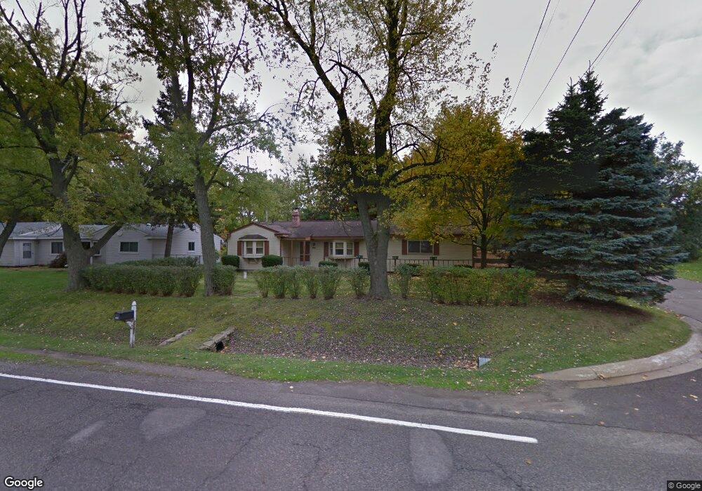
7241 Richardson Rd Unit Bldg-Unit West Bloomfield, MI 48323
Estimated Value: $275,000 - $296,000
3
Beds
1
Bath
992
Sq Ft
$291/Sq Ft
Est. Value
About This Home
This home is located at 7241 Richardson Rd Unit Bldg-Unit, West Bloomfield, MI 48323 and is currently estimated at $288,995, approximately $291 per square foot. 7241 Richardson Rd Unit Bldg-Unit is a home located in Oakland County with nearby schools including Walled Lake Central High School, Our Lady Of Refuge School, and St. Matthew Lutheran School.
Ownership History
Date
Name
Owned For
Owner Type
Purchase Details
Closed on
Sep 9, 2025
Sold by
Sadowski Mark C and Sadowski Nina E
Bought by
Mark C Sadowski And Nina E Sadowski Living Tr and Sadowski
Current Estimated Value
Purchase Details
Closed on
Aug 14, 2025
Sold by
Shanholtz Mark S
Bought by
Sadowski Mark and Sadowski Nina
Purchase Details
Closed on
Apr 15, 2022
Sold by
Nishith Patel
Bought by
Shanholtz Mark S
Home Financials for this Owner
Home Financials are based on the most recent Mortgage that was taken out on this home.
Original Mortgage
$7,500
Interest Rate
5.27%
Purchase Details
Closed on
Jan 4, 2019
Sold by
Sajkrupa Properties Llc
Bought by
Patel Nishith S
Purchase Details
Closed on
Jun 13, 2018
Sold by
Graham Paul D and Graham Living Trust
Bought by
Saikupa Properties Llc
Purchase Details
Closed on
Apr 4, 1996
Sold by
Graham Leonard Robert
Bought by
Leonard R Graham Tr
Create a Home Valuation Report for This Property
The Home Valuation Report is an in-depth analysis detailing your home's value as well as a comparison with similar homes in the area
Home Values in the Area
Average Home Value in this Area
Purchase History
| Date | Buyer | Sale Price | Title Company |
|---|---|---|---|
| Mark C Sadowski And Nina E Sadowski Living Tr | -- | None Listed On Document | |
| Mark C Sadowski And Nina E Sadowski Living Tr | -- | None Listed On Document | |
| Sadowski Mark | $290,000 | Capital Title | |
| Sadowski Mark | $290,000 | Capital Title | |
| Shanholtz Mark S | $195,000 | None Listed On Document | |
| Shanholtz Mark S | $195,000 | None Listed On Document | |
| Patel Nishith S | -- | None Available | |
| Patel Nishith S | -- | None Available | |
| Saikupa Properties Llc | $85,000 | Fidelity National Title | |
| Saikupa Properties Llc | $85,000 | Fidelity National Title | |
| Leonard R Graham Tr | -- | -- | |
| Leonard R Graham Tr | -- | -- |
Source: Public Records
Mortgage History
| Date | Status | Borrower | Loan Amount |
|---|---|---|---|
| Previous Owner | Shanholtz Mark S | $7,500 | |
| Previous Owner | Shanholtz Mark S | $191,468 |
Source: Public Records
Tax History Compared to Growth
Tax History
| Year | Tax Paid | Tax Assessment Tax Assessment Total Assessment is a certain percentage of the fair market value that is determined by local assessors to be the total taxable value of land and additions on the property. | Land | Improvement |
|---|---|---|---|---|
| 2024 | $1,894 | $82,920 | $0 | $0 |
| 2022 | $1,783 | $63,520 | $21,840 | $41,680 |
| 2021 | $3,142 | $61,640 | $0 | $0 |
| 2020 | $2,284 | $60,730 | $21,840 | $38,890 |
| 2018 | $1,409 | $53,720 | $17,990 | $35,730 |
| 2015 | -- | $44,220 | $0 | $0 |
| 2014 | -- | $40,770 | $0 | $0 |
| 2011 | -- | $35,840 | $0 | $0 |
Source: Public Records
Map
Nearby Homes
- 4245 Bunker Ave
- 4212 Greendale Ave
- 7337 Richardson Rd
- 4335 Crestdale Ave
- 7381 Crestmore St
- 6978 Colony Dr
- 6903 Dandison Blvd
- 3991 Fieldview Ave
- 4442 Borland St
- 7359 Woodlore Dr
- 6980 Hambro St
- 4066 Green Lake Rd
- 3965 Carrick Ave
- 0000 Langtoft
- 3950 Bradmore Ave
- 6675 Langtoft St
- 6768 Buckland Ave
- 7369 Sweetbriar
- 3632 Fieldview Ave
- 4540 Rolling Pine Ct
- 7231 Richardson Rd Unit Bldg-Unit
- 7231 Richardson Rd
- 4223 Forbush Ave
- 4220 Bunker Ave
- 4240 Bunker Ave
- 7242 Richardson Rd
- 7220 Richardson Rd
- 7175 Richardson Rd
- 7252 Richardson Rd
- 4263 Forbush Ave
- 4260 Bunker Ave
- 4163 Forbush Ave
- 4174 Bunker Ave
- 4171 Bunker Ave
- 7264 Richardson Rd
- 4254 Crestdale Ave
- 7200 Crestmore St
- 4234 Crestdale Ave
- 7311 Redriff Terrace
- 4153 Forbush Ave