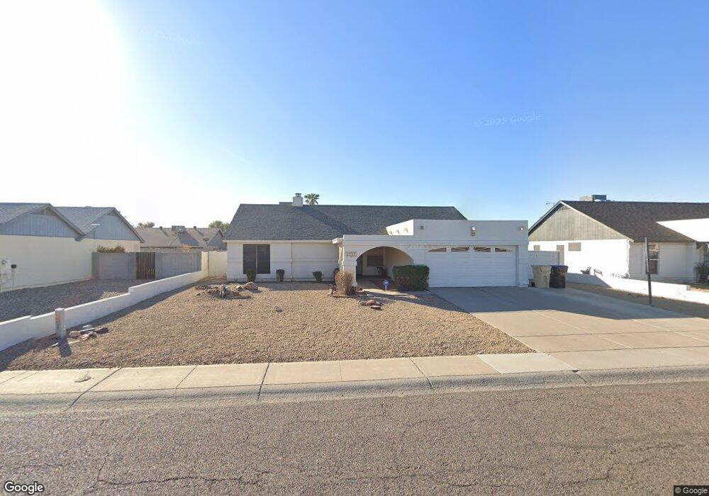
7241 W Laurel Ln Peoria, AZ 85345
Estimated Value: $316,760 - $436,000
--
Bed
2
Baths
1,623
Sq Ft
$246/Sq Ft
Est. Value
About This Home
This home is located at 7241 W Laurel Ln, Peoria, AZ 85345 and is currently estimated at $399,440, approximately $246 per square foot. 7241 W Laurel Ln is a home located in Maricopa County with nearby schools including Sundance Elementary School, Centennial High School, and Legacy Traditional School - Glendale.
Ownership History
Date
Name
Owned For
Owner Type
Purchase Details
Closed on
Aug 21, 2019
Sold by
Yeskin Arlene
Bought by
Yeskin Arlene
Current Estimated Value
Purchase Details
Closed on
Oct 29, 2003
Sold by
Bosworth D Bryan and Leoda Bosworth E
Bought by
Yeskin Arlene
Home Financials for this Owner
Home Financials are based on the most recent Mortgage that was taken out on this home.
Original Mortgage
$28,600
Interest Rate
5.94%
Mortgage Type
Credit Line Revolving
Create a Home Valuation Report for This Property
The Home Valuation Report is an in-depth analysis detailing your home's value as well as a comparison with similar homes in the area
Home Values in the Area
Average Home Value in this Area
Purchase History
| Date | Buyer | Sale Price | Title Company |
|---|---|---|---|
| Yeskin Arlene | -- | None Available | |
| Yeskin Arlene | $143,000 | Capital Title Agency Inc |
Source: Public Records
Mortgage History
| Date | Status | Borrower | Loan Amount |
|---|---|---|---|
| Previous Owner | Yeskin Arlene | $28,600 | |
| Previous Owner | Yeskin Arlene | $114,400 |
Source: Public Records
Tax History Compared to Growth
Tax History
| Year | Tax Paid | Tax Assessment Tax Assessment Total Assessment is a certain percentage of the fair market value that is determined by local assessors to be the total taxable value of land and additions on the property. | Land | Improvement |
|---|---|---|---|---|
| 2025 | $954 | $12,605 | -- | -- |
| 2024 | $966 | $12,005 | -- | -- |
| 2023 | $966 | $27,370 | $5,470 | $21,900 |
| 2022 | $946 | $20,950 | $4,190 | $16,760 |
| 2021 | $1,013 | $19,280 | $3,850 | $15,430 |
| 2020 | $1,023 | $17,970 | $3,590 | $14,380 |
| 2019 | $989 | $16,230 | $3,240 | $12,990 |
| 2018 | $957 | $15,010 | $3,000 | $12,010 |
| 2017 | $957 | $13,050 | $2,610 | $10,440 |
| 2016 | $948 | $13,330 | $2,660 | $10,670 |
| 2015 | $884 | $12,030 | $2,400 | $9,630 |
Source: Public Records
Map
Nearby Homes
- 7266 W Cherry Hills Dr
- 7157 W Cherry Hills Dr
- 7126 W Jenan Dr
- 7113 W Sunnyside Dr
- 7225 W Canterbury Dr
- 7243 W Sierra St
- 7214 W Columbine Dr
- 6938 W Jenan Dr
- 7126 W Columbine Dr
- 7220 W Larkspur Dr
- 11640 N 74th Dr
- 6914 W Sunnyside Dr Unit 3
- 7233 W Corrine Dr
- 7545 W Jenan Dr
- 7418 W Corrine Dr
- 12709 N 72nd Ave
- 7638 W Shaw Butte Dr
- 6849 W Wethersfield Rd
- 6821 W Cherry Hills Dr
- 6845 W Charter Oak Rd
- 7233 W Laurel Ln
- 7249 W Laurel Ln
- 7234 W Cherry Hills Dr
- 7242 W Cherry Hills Dr
- 7226 W Cherry Hills Dr
- 7257 W Laurel Ln
- 7225 W Laurel Ln
- 7242 W Laurel Ln
- 7250 W Cherry Hills Dr
- 7250 W Laurel Ln
- 7234 W Laurel Ln
- 7218 W Cherry Hills Dr
- 7265 W Laurel Ln
- 7258 W Laurel Ln
- 7217 W Laurel Ln
- 7258 W Cherry Hills Dr
- 7226 W Laurel Ln
- 7233 W Cherry Hills Dr
- 7210 W Cherry Hills Dr
- 7241 W Paradise Dr