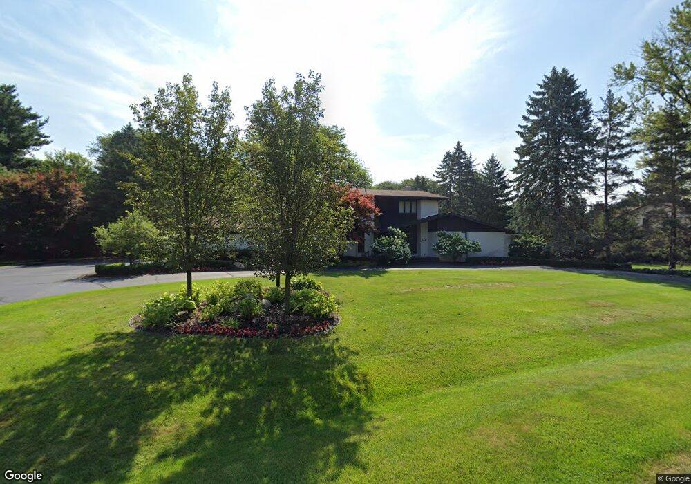
7243 Mohansic Dr Bloomfield Hills, MI 48301
Estimated Value: $788,294 - $1,056,000
4
Beds
4
Baths
3,608
Sq Ft
$252/Sq Ft
Est. Value
About This Home
This home is located at 7243 Mohansic Dr, Bloomfield Hills, MI 48301 and is currently estimated at $910,574, approximately $252 per square foot. 7243 Mohansic Dr is a home located in Oakland County with nearby schools including Wylie E. Groves High School, West Maple Elementary School, and Berkshire Middle School.
Ownership History
Date
Name
Owned For
Owner Type
Purchase Details
Closed on
Nov 30, 2004
Sold by
Greenspan Marshall J and Greenspan Benita M
Bought by
Shanbom Steven A and Shanbom Sherry C
Current Estimated Value
Home Financials for this Owner
Home Financials are based on the most recent Mortgage that was taken out on this home.
Original Mortgage
$487,000
Outstanding Balance
$245,350
Interest Rate
5.82%
Mortgage Type
Purchase Money Mortgage
Estimated Equity
$665,224
Purchase Details
Closed on
Apr 8, 2002
Sold by
Greenspan Marshall J
Bought by
Benita M Greenspan Tr
Purchase Details
Closed on
Dec 3, 2001
Sold by
Benita M Greenspan Tr
Bought by
Greenspan Marshall J
Create a Home Valuation Report for This Property
The Home Valuation Report is an in-depth analysis detailing your home's value as well as a comparison with similar homes in the area
Home Values in the Area
Average Home Value in this Area
Purchase History
| Date | Buyer | Sale Price | Title Company |
|---|---|---|---|
| Shanbom Steven A | $608,780 | Philip R Seaver Title Co Inc | |
| Benita M Greenspan Tr | -- | -- | |
| Greenspan Marshall J | -- | -- |
Source: Public Records
Mortgage History
| Date | Status | Borrower | Loan Amount |
|---|---|---|---|
| Open | Shanbom Steven A | $487,000 |
Source: Public Records
Tax History Compared to Growth
Tax History
| Year | Tax Paid | Tax Assessment Tax Assessment Total Assessment is a certain percentage of the fair market value that is determined by local assessors to be the total taxable value of land and additions on the property. | Land | Improvement |
|---|---|---|---|---|
| 2024 | $5,335 | $365,550 | $0 | $0 |
| 2023 | $5,120 | $331,650 | $0 | $0 |
| 2022 | $8,622 | $324,200 | $0 | $0 |
| 2021 | $8,694 | $302,790 | $0 | $0 |
| 2020 | $4,893 | $288,470 | $0 | $0 |
| 2019 | $8,680 | $281,780 | $0 | $0 |
| 2018 | $8,615 | $262,290 | $0 | $0 |
| 2017 | $8,610 | $252,130 | $0 | $0 |
| 2016 | $8,657 | $247,390 | $0 | $0 |
| 2015 | -- | $254,410 | $0 | $0 |
| 2014 | -- | $231,910 | $0 | $0 |
| 2011 | -- | $188,900 | $0 | $0 |
Source: Public Records
Map
Nearby Homes
- 2014 Waldons Ct
- 7371 Lindenmere Dr
- 2189 Colony Club Ct
- 7515 Hiddenbrook Ln
- 27170 W 14 Mile Rd
- 32620 Inkster Rd
- 4647 Private Lake Dr
- 6940 Castle Dr
- 6800 Crestway Dr
- 6420 Apple Grove Ln Unit 10
- 32696 Ravine Dr
- 4665 W Maple Rd
- 26565 Scenic Hwy
- 5241 S Pebblecreek Rd
- 4428 Old Trinity Ct
- 7209 Stonebrook Rd
- 6701 Franklin Rd
- 5312 Cambourne Place
- 7477 Gramercy Cir Unit 17
- 7479 Gramercy Cir Unit 16
- 7265 Mohansic Dr
- 7164 Lindenmere Dr
- 7150 Lindenmere Dr
- 7230 Mohansic Dr
- 7250 Mohansic Dr
- 4850 Kew Ct
- 7176 Lindenmere Dr
- 7284 Mohansic Dr Unit Bldg-Unit
- 7284 Mohansic Dr
- 7161 Lindenmere Dr
- 7241 Inkster Rd Unit Bldg-Unit
- 7241 Inkster Rd
- 4887 Beacon Hill Dr
- 4858 Beacon Hill Dr
- 4872 Beacon Hill Dr
- 7175 Lindenmere Dr
- 7147 Lindenmere Dr
- 7329 Mohansic Dr
- 4861 Kew Ct
- 7312 Mohansic Dr