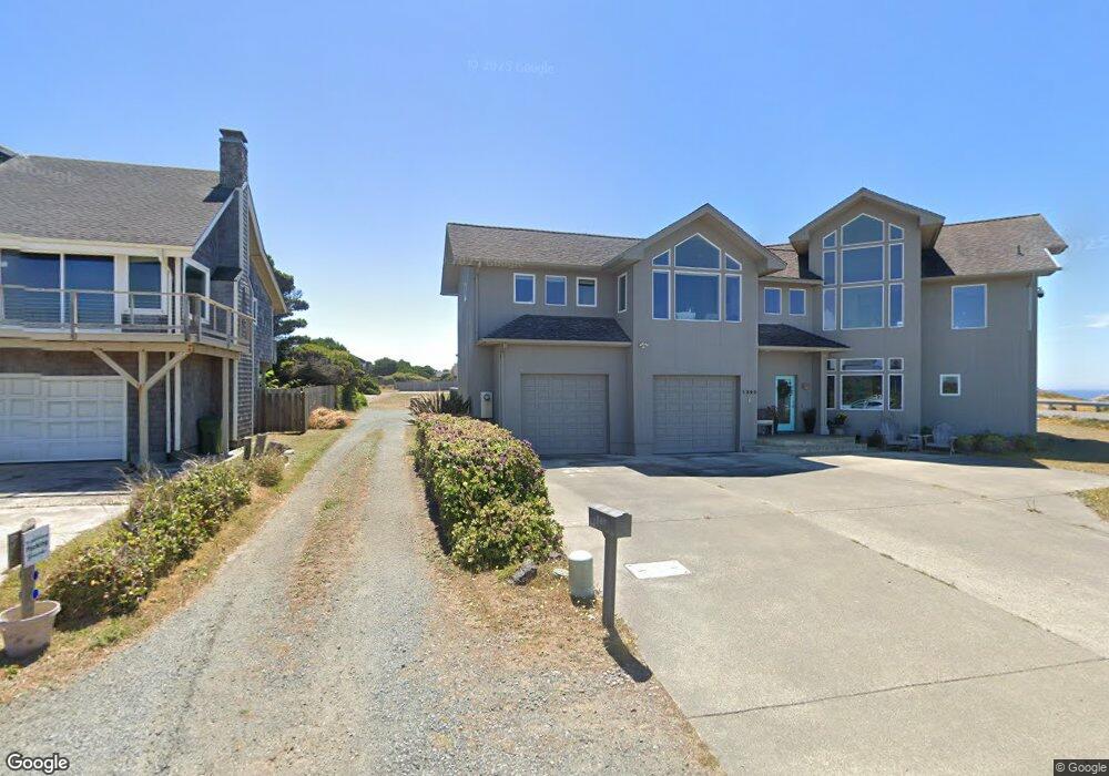
725 Beach Loop Dr SW Bandon, OR 97411
Estimated Value: $783,631 - $843,000
3
Beds
3
Baths
2,584
Sq Ft
$315/Sq Ft
Est. Value
About This Home
This home is located at 725 Beach Loop Dr SW, Bandon, OR 97411 and is currently estimated at $813,316, approximately $314 per square foot. 725 Beach Loop Dr SW is a home located in Coos County with nearby schools including Ocean Crest Elementary School, Harbor Lights Middle School, and Bandon Senior High School.
Ownership History
Date
Name
Owned For
Owner Type
Purchase Details
Closed on
Aug 27, 2022
Sold by
May Elizabeth A
Bought by
Robert And Elizabeth May Family Revocable Liv
Current Estimated Value
Purchase Details
Closed on
Apr 15, 2016
Sold by
Danielson John Kenneth and Danielson Paul Allen
Bought by
Danielson John K and Danielson Barbara L
Home Financials for this Owner
Home Financials are based on the most recent Mortgage that was taken out on this home.
Original Mortgage
$255,000
Interest Rate
3.73%
Mortgage Type
New Conventional
Purchase Details
Closed on
Apr 11, 2016
Sold by
Danielson John Kenneth
Bought by
Danielson John Kenneth and Danielson Paul Allen
Home Financials for this Owner
Home Financials are based on the most recent Mortgage that was taken out on this home.
Original Mortgage
$255,000
Interest Rate
3.73%
Mortgage Type
New Conventional
Create a Home Valuation Report for This Property
The Home Valuation Report is an in-depth analysis detailing your home's value as well as a comparison with similar homes in the area
Home Values in the Area
Average Home Value in this Area
Purchase History
| Date | Buyer | Sale Price | Title Company |
|---|---|---|---|
| Robert And Elizabeth May Family Revocable Liv | -- | -- | |
| Danielson John K | -- | Ticor Title Company | |
| Danielson John Kenneth | -- | None Available |
Source: Public Records
Mortgage History
| Date | Status | Borrower | Loan Amount |
|---|---|---|---|
| Previous Owner | Danielson John K | $255,000 |
Source: Public Records
Tax History Compared to Growth
Tax History
| Year | Tax Paid | Tax Assessment Tax Assessment Total Assessment is a certain percentage of the fair market value that is determined by local assessors to be the total taxable value of land and additions on the property. | Land | Improvement |
|---|---|---|---|---|
| 2025 | $3,749 | $340,320 | -- | -- |
| 2024 | $3,709 | $330,410 | -- | -- |
| 2023 | $3,612 | $320,790 | $0 | $0 |
| 2022 | $3,626 | $311,450 | $0 | $0 |
| 2021 | $3,484 | $302,380 | $0 | $0 |
| 2020 | $3,163 | $302,380 | $0 | $0 |
| 2019 | $3,153 | $285,030 | $0 | $0 |
| 2018 | $2,965 | $276,730 | $0 | $0 |
| 2017 | $2,896 | $268,670 | $0 | $0 |
| 2016 | $2,807 | $260,850 | $0 | $0 |
| 2015 | $2,650 | $253,260 | $0 | $0 |
| 2014 | $2,650 | $245,890 | $0 | $0 |
Source: Public Records
Map
Nearby Homes
- 1280 Ocean Dr SW
- 1257 7th St SW
- 0 Jetty Rd SW Unit 269553922
- 0 Jetty Rd SW Unit 267448665
- 000 Jetty Rd Unit 100
- 323 Madison Ave SW
- 875 Ocean Dr SW
- 0 Eighth St SW Unit 797186006
- 0 SW Eighth at Harrison Ave
- 535 Harrison Ave SW
- 875 12th St SW
- 737 11th St SW
- 1575 Beach Loop Dr SW
- 0 Franklin Ave SW Unit 23128327
- 390 4th St SW
- 1950 Beach Loop Dr SW
- 0 Franklin Rd SW Unit 6-10
- 1312 Village Loop
- 1313 Village Loop
- 0 1st St SW Unit 2502
- 1395 7th St SW
- 777 Beach Loop Dr SW
- 1375 7th St SW
- 1344 8th St SW
- 1333 7th St SW
- 750 Beach Loop Dr SW
- 1340 Ocean Dr SW
- 0 7th St_ocean SW Unit 18553835
- 0 7th St_ocean SW Unit 18554458
- 835 Beach Loop Dr SW
- 854 Newport Ave SW
- 1290 8th St SW
- 1265 7th St SW
- 1455 8th St SW
- 0 7th St SW Unit 168786
- 0 7th St SW Unit 201511284
- 0 7th St SW Unit 19139415
- 0 7th St SW Unit 8050604
- 0 7th St SW Unit 8054549
- 0 7th St SW Unit 11641941