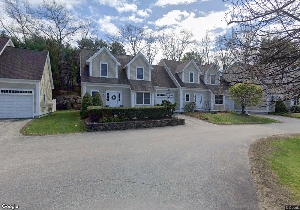
725 Boston Post Rd Unit 15 Sudbury, MA 01776
Estimated Value: $291,000 - $652,000
2
Beds
3
Baths
1,816
Sq Ft
$256/Sq Ft
Est. Value
About This Home
This home is located at 725 Boston Post Rd Unit 15, Sudbury, MA 01776 and is currently estimated at $465,448, approximately $256 per square foot. 725 Boston Post Rd Unit 15 is a home located in Middlesex County with nearby schools including Israel Loring Elementary School, Ephraim Curtis Middle School, and Lincoln-Sudbury Regional High School.
Ownership History
Date
Name
Owned For
Owner Type
Purchase Details
Closed on
Dec 3, 2018
Sold by
Asta-Ferrero Charli A
Bought by
Vert Lillian C
Current Estimated Value
Home Financials for this Owner
Home Financials are based on the most recent Mortgage that was taken out on this home.
Original Mortgage
$158,175
Outstanding Balance
$139,356
Interest Rate
4.8%
Mortgage Type
New Conventional
Estimated Equity
$326,092
Purchase Details
Closed on
Nov 17, 2004
Sold by
Carriage Lane Llc
Bought by
Asta-Ferrero Charli A
Home Financials for this Owner
Home Financials are based on the most recent Mortgage that was taken out on this home.
Original Mortgage
$165,000
Interest Rate
5.8%
Mortgage Type
Purchase Money Mortgage
Create a Home Valuation Report for This Property
The Home Valuation Report is an in-depth analysis detailing your home's value as well as a comparison with similar homes in the area
Home Values in the Area
Average Home Value in this Area
Purchase History
| Date | Buyer | Sale Price | Title Company |
|---|---|---|---|
| Vert Lillian C | $166,500 | -- | |
| Asta-Ferrero Charli A | $165,000 | -- |
Source: Public Records
Mortgage History
| Date | Status | Borrower | Loan Amount |
|---|---|---|---|
| Open | Vert Lillian C | $158,175 | |
| Previous Owner | Asta-Ferrero Charli A | $165,000 |
Source: Public Records
Tax History Compared to Growth
Tax History
| Year | Tax Paid | Tax Assessment Tax Assessment Total Assessment is a certain percentage of the fair market value that is determined by local assessors to be the total taxable value of land and additions on the property. | Land | Improvement |
|---|---|---|---|---|
| 2025 | $3,376 | $230,598 | $0 | $230,598 |
| 2024 | $3,164 | $216,543 | $0 | $216,543 |
| 2023 | $2,942 | $186,579 | $0 | $186,579 |
| 2022 | $3,159 | $174,995 | $0 | $174,995 |
| 2021 | $3,295 | $174,995 | $0 | $174,995 |
| 2020 | $2,492 | $135,053 | $0 | $135,053 |
| 2019 | $2,419 | $135,053 | $0 | $135,053 |
| 2018 | $2,422 | $135,053 | $0 | $135,053 |
| 2017 | $2,396 | $135,053 | $0 | $135,053 |
| 2016 | $2,771 | $155,700 | $0 | $155,700 |
| 2015 | $2,740 | $155,700 | $0 | $155,700 |
| 2014 | $2,807 | $155,700 | $0 | $155,700 |
Source: Public Records
Map
Nearby Homes
- 0 Boston Post Rd
- 20 Revolutionary Rd
- 54 Stone Rd
- 0 Robbins Rd
- 10 Hammond Cir
- 7 Adams Rd
- 46 Robert Best Rd
- 24 Woodland Rd
- 25 Bridle Path
- 128 Nobscot Rd
- 89 Bridle Path
- 30 Nobscot Rd Unit 14
- 40 Tall Pine Dr Unit 12
- 7 Saddle Ridge Rd
- 6 Mountain View Dr
- 100 Nobscot Dr
- 123 Dutton Rd
- 39 Austin Rd
- 1011 Boston Post Rd
- 32 Eaton Rd W
- 725 Boston Post Rd Unit 16
- 725 Boston Post Rd Unit 14
- 725 Boston Post Rd Unit 13
- 725 Boston Post Rd Unit 12
- 725 Boston Post Rd Unit 11
- 725 Boston Post Rd Unit 9
- 725 Boston Post Rd Unit 8
- 725 Boston Post Rd Unit 7
- 725 Boston Post Rd Unit 6
- 725 Boston Post Rd Unit 5
- 725 Boston Post Rd Unit 4
- 725 Boston Post Rd Unit 3
- 725 Boston Post Rd Unit 2
- 725 Boston Post Rd Unit 1
- 725 Boston Post Rd
- 725 Boston Post Rd Unit 5-14
- 725 Boston Post Rd Unit 4 729
- 34 Easy St
- 40 Easy St
- 40 Easy St