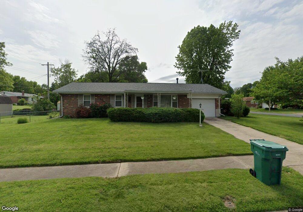
725 Courtesy Ln Florissant, MO 63033
Estimated Value: $175,000 - $192,000
3
Beds
2
Baths
1,144
Sq Ft
$160/Sq Ft
Est. Value
About This Home
This home is located at 725 Courtesy Ln, Florissant, MO 63033 and is currently estimated at $183,116, approximately $160 per square foot. 725 Courtesy Ln is a home located in St. Louis County with nearby schools including Parker Road Elementary School, Cross Keys Middle School, and McCluer North High School.
Ownership History
Date
Name
Owned For
Owner Type
Purchase Details
Closed on
Sep 17, 2001
Sold by
Wichlenski Helen A and Wichlenski John J
Bought by
Palermo Nicholas C
Current Estimated Value
Home Financials for this Owner
Home Financials are based on the most recent Mortgage that was taken out on this home.
Original Mortgage
$69,200
Outstanding Balance
$26,768
Interest Rate
6.88%
Estimated Equity
$156,348
Create a Home Valuation Report for This Property
The Home Valuation Report is an in-depth analysis detailing your home's value as well as a comparison with similar homes in the area
Home Values in the Area
Average Home Value in this Area
Purchase History
| Date | Buyer | Sale Price | Title Company |
|---|---|---|---|
| Palermo Nicholas C | $86,500 | -- |
Source: Public Records
Mortgage History
| Date | Status | Borrower | Loan Amount |
|---|---|---|---|
| Open | Palermo Nicholas C | $69,200 |
Source: Public Records
Tax History Compared to Growth
Tax History
| Year | Tax Paid | Tax Assessment Tax Assessment Total Assessment is a certain percentage of the fair market value that is determined by local assessors to be the total taxable value of land and additions on the property. | Land | Improvement |
|---|---|---|---|---|
| 2025 | $2,106 | $31,460 | $4,540 | $26,920 |
| 2024 | $2,106 | $27,150 | $4,540 | $22,610 |
| 2023 | $2,099 | $27,150 | $4,540 | $22,610 |
| 2022 | $1,990 | $22,630 | $4,010 | $18,620 |
| 2021 | $1,956 | $22,630 | $4,010 | $18,620 |
| 2020 | $1,744 | $18,960 | $4,540 | $14,420 |
| 2019 | $1,711 | $18,960 | $4,540 | $14,420 |
| 2018 | $1,602 | $15,850 | $2,190 | $13,660 |
| 2017 | $1,594 | $15,850 | $2,190 | $13,660 |
| 2016 | $1,555 | $15,070 | $2,950 | $12,120 |
| 2015 | $1,564 | $15,070 | $2,950 | $12,120 |
| 2014 | $1,780 | $17,750 | $4,770 | $12,980 |
Source: Public Records
Map
Nearby Homes
- 1965 Saint Catherine St
- 1040 Bluefield Dr
- 675 Pimlico Dr
- 505 Ridge Dr
- 1290 Saint Louis St
- 629 Aubuchon St
- 1200 Bluefield Dr
- 2340 Saint Catherine St
- 2425 Johnstown Dr
- 2240 Brook Dr
- 1980 Parker Rd
- 1090 Saint Joseph St
- 2505 Saint Catherine St
- 1130 Saint Francois St
- 1023 Saint Denis St
- 1060 Preakness Ln
- 12 Country Ln
- 2320 Allen Dr
- 2700 Suffolk Place
- 865 Boone St
- 1580 Saint Denis St
- 705 Courtesy Ln
- 720 Courtesy Ln
- 1985 Saint Louis St
- 1570 Saint Denis St
- 700 Courtesy Ln
- 1595 Saint Denis St
- 1965 Saint Louis St
- 1605 Saint Denis St
- 1575 Saint Denis St
- 1620 Saint Denis St
- 1620 Saint Denis St
- 1560 Saint Denis St
- 2055 Saint Louis St
- 1565 Saint Denis St
- 1945 Saint Louis St
- 1625 Saint Denis St
- 1640 Saint Denis St
- 1640 St Denis
- 2065 Saint Louis St