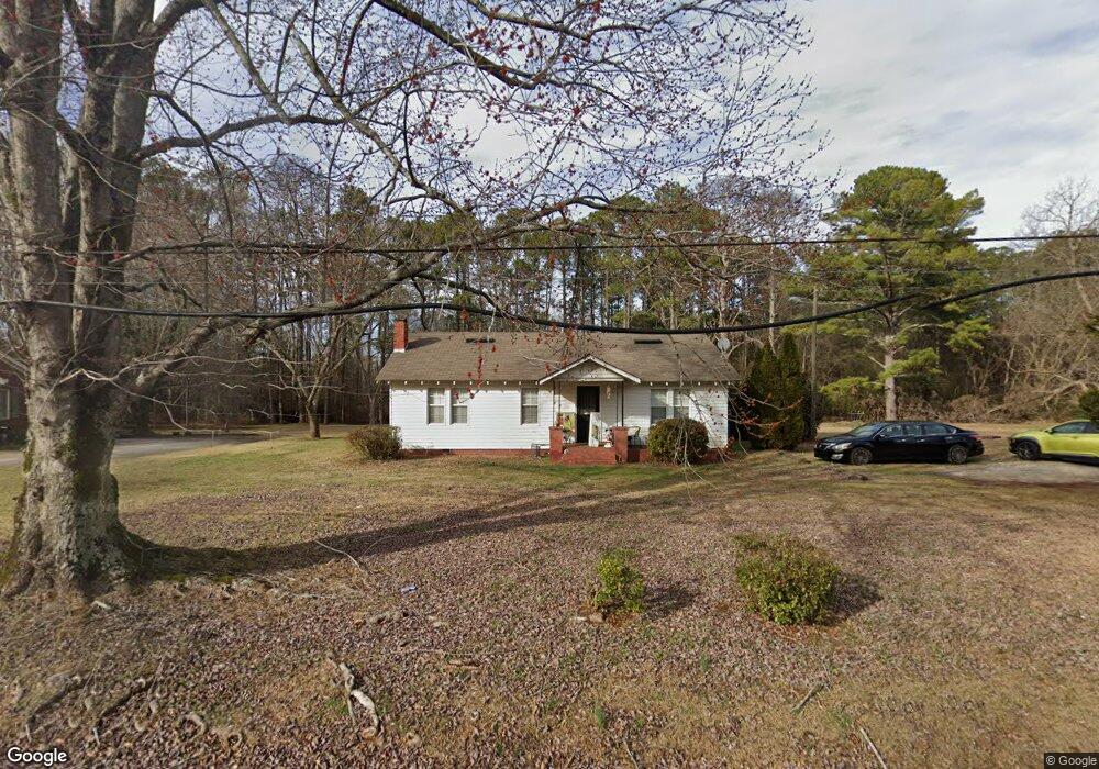
725 E Mcintosh Rd Griffin, GA 30223
Spalding County NeighborhoodEstimated Value: $75,000 - $193,000
2
Beds
1
Bath
1,236
Sq Ft
$99/Sq Ft
Est. Value
About This Home
This home is located at 725 E Mcintosh Rd, Griffin, GA 30223 and is currently estimated at $122,575, approximately $99 per square foot. 725 E Mcintosh Rd is a home located in Spalding County with nearby schools including Atkinson Elementary School, Cowan Road Middle School, and Spalding High School.
Ownership History
Date
Name
Owned For
Owner Type
Purchase Details
Closed on
Mar 21, 2019
Sold by
Powell Carla R
Bought by
Gunnels Loretta R
Current Estimated Value
Purchase Details
Closed on
Jan 6, 1981
Sold by
Thaxton Elizabeth P and Horton Dorothy T
Bought by
Gunnels Billy E and Gunnels Loretta R
Purchase Details
Closed on
Sep 19, 1980
Sold by
Thaxton Elizabeth P
Bought by
Thaxton Elizabeth P and Horton Doroth
Purchase Details
Closed on
Feb 18, 1938
Bought by
Thaxton Elizabeth P
Create a Home Valuation Report for This Property
The Home Valuation Report is an in-depth analysis detailing your home's value as well as a comparison with similar homes in the area
Home Values in the Area
Average Home Value in this Area
Purchase History
| Date | Buyer | Sale Price | Title Company |
|---|---|---|---|
| Gunnels Loretta R | -- | -- | |
| Gunnels Billy E | $20,000 | -- | |
| Thaxton Elizabeth P | -- | -- | |
| Thaxton Elizabeth P | -- | -- |
Source: Public Records
Tax History
| Year | Tax Paid | Tax Assessment Tax Assessment Total Assessment is a certain percentage of the fair market value that is determined by local assessors to be the total taxable value of land and additions on the property. | Land | Improvement |
|---|---|---|---|---|
| 2025 | $980 | $27,389 | $7,603 | $19,786 |
| 2024 | $969 | $27,389 | $7,603 | $19,786 |
| 2023 | $980 | $27,839 | $7,603 | $20,236 |
| 2022 | $878 | $24,150 | $6,082 | $18,068 |
| 2021 | $826 | $22,708 | $6,082 | $16,626 |
| 2020 | $728 | $19,937 | $6,082 | $13,855 |
| 2019 | $742 | $19,937 | $6,082 | $13,855 |
| 2018 | $712 | $18,628 | $6,082 | $12,546 |
| 2017 | $692 | $18,628 | $6,082 | $12,546 |
| 2016 | $705 | $18,629 | $6,082 | $12,546 |
| 2015 | $759 | $19,465 | $6,082 | $13,383 |
| 2014 | $774 | $19,465 | $6,082 | $13,383 |
Source: Public Records
Map
Nearby Homes
- 117 Lake Dr
- 932 Greer Rd
- 0 Short St Unit 10555372
- 0 Short St Unit 7572526
- 186 Connally Place
- NORTHW Northwood East Dr
- 1416 Spellman Ave
- 136 Henry Burch Dr
- 1324 Spellman Ave
- 411 E Northwoods Dr
- 1406 Canterbury Rd
- 32 UNIT MUTLIPL Multiple
- 0 Tuskegee Ave Unit 7674017
- 204 Custer Cir
- 132 Little Big Horn Rd
- 0 Jackson Rd Unit 10545729
- 204 Hailey Ln
- 1409 N Lee St
- NORTHWOOD EAST Northwood East Dr
- 221 Lexington Ave
- 723 E Mcintosh Rd
- 800 E Mcintosh Rd
- 801 E Mcintosh Rd
- 802 E Mcintosh Rd
- 798 E Mcintosh Rd
- 719 E Mcintosh Rd
- 803 E Mcintosh Rd
- 806 E Mcintosh Rd
- 804 E Mcintosh Rd
- 103 Mcintosh Cir
- 808 E Mcintosh Rd
- 715 E Mcintosh Rd
- 105 Mcintosh Cir
- 107 Mcintosh Cir
- 711 E Mcintosh Rd
- 109 Mcintosh Cir
- 0 E Mcintosh Cir Unit 20029388
- 0 E Mcintosh Cir Unit 31.85 Ac 8823786
- 111 Mcintosh Cir
- 104 Mcintosh Cir