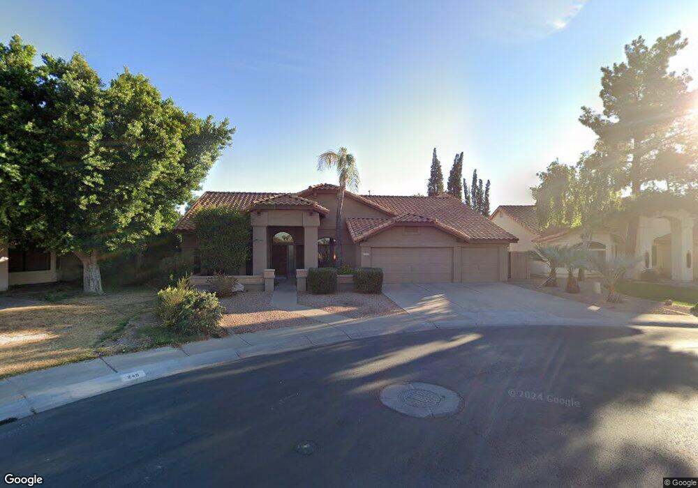
725 E Vaughn Ave Gilbert, AZ 85234
Heritage District NeighborhoodEstimated Value: $546,331 - $674,000
Studio
3
Baths
2,357
Sq Ft
$266/Sq Ft
Est. Value
About This Home
This home is located at 725 E Vaughn Ave, Gilbert, AZ 85234 and is currently estimated at $627,833, approximately $266 per square foot. 725 E Vaughn Ave is a home located in Maricopa County with nearby schools including Burk Elementary School, Neely Traditional Academy, and Mesquite Junior High School.
Ownership History
Date
Name
Owned For
Owner Type
Purchase Details
Closed on
Jan 14, 2020
Sold by
Frank Thomas
Bought by
Frank Thomas and Frank Lijuan Deng
Current Estimated Value
Purchase Details
Closed on
Jul 6, 2016
Sold by
Frank Thomas R and Frank Sharon A
Bought by
Frank Thomas R
Home Financials for this Owner
Home Financials are based on the most recent Mortgage that was taken out on this home.
Original Mortgage
$150,000
Outstanding Balance
$68,243
Interest Rate
3.66%
Mortgage Type
New Conventional
Estimated Equity
$559,590
Create a Home Valuation Report for This Property
The Home Valuation Report is an in-depth analysis detailing your home's value as well as a comparison with similar homes in the area
Home Values in the Area
Average Home Value in this Area
Purchase History
| Date | Buyer | Sale Price | Title Company |
|---|---|---|---|
| Frank Thomas | -- | None Available | |
| Frank Thomas R | -- | Accommodation |
Source: Public Records
Mortgage History
| Date | Status | Borrower | Loan Amount |
|---|---|---|---|
| Open | Frank Thomas R | $150,000 |
Source: Public Records
Tax History
| Year | Tax Paid | Tax Assessment Tax Assessment Total Assessment is a certain percentage of the fair market value that is determined by local assessors to be the total taxable value of land and additions on the property. | Land | Improvement |
|---|---|---|---|---|
| 2025 | $2,226 | $29,538 | -- | -- |
| 2024 | $2,158 | $28,131 | -- | -- |
| 2023 | $2,158 | $44,550 | $8,910 | $35,640 |
| 2022 | $2,093 | $34,260 | $6,850 | $27,410 |
| 2021 | $2,210 | $32,100 | $6,420 | $25,680 |
| 2020 | $2,177 | $30,060 | $6,010 | $24,050 |
| 2019 | $2,000 | $27,670 | $5,530 | $22,140 |
| 2018 | $1,939 | $25,730 | $5,140 | $20,590 |
| 2017 | $1,872 | $24,700 | $4,940 | $19,760 |
| 2016 | $1,927 | $22,580 | $4,510 | $18,070 |
| 2015 | $1,765 | $23,920 | $4,780 | $19,140 |
Source: Public Records
Map
Nearby Homes
- 339 N Silverado St
- 338 N Heritage Dr
- 850 E Vaughn Ave
- 926 E Hearne Way
- 830 E Bruce Ave
- 811 E Linda Ln
- 694 E Washington Ave
- 89 N Riata St
- 1033 E Hearne Way
- 18 S Silverado St
- 413 E Linda Ln Unit D
- 649 E Avenida Sierra Madre
- 436 N Larkspur St
- 1141 E Bruce Ave
- 231 N Cottonwood Dr
- 51 N Cottonwood Dr
- 1238 E Mineral Rd
- 229 N Palm St Unit TRLR
- 640 N Ironwood Way
- 142 E Hearne Way
- 719 E Vaughn Ave
- 249 N Silverado St
- 713 E Vaughn Ave
- 301 N Silverado St
- 231 N Silverado St
- 720 E Vaughn Ave
- 745 E Rogers Ct
- 707 E Vaughn Ave
- 714 E Vaughn Ave
- 307 N Silverado St Unit 2
- 225 N Silverado St Unit 2
- 232 N Silverado St
- 755 E Rogers Ct
- 232 N Honeysuckle Ln
- 708 E Vaughn Ave
- 750 E Rogers Ct
- 701 E Vaughn Ave
- 231 N Honeysuckle Ln
- 226 N Honeysuckle Ln
- 226 N Silverado St
Your Personal Tour Guide
Ask me questions while you tour the home.