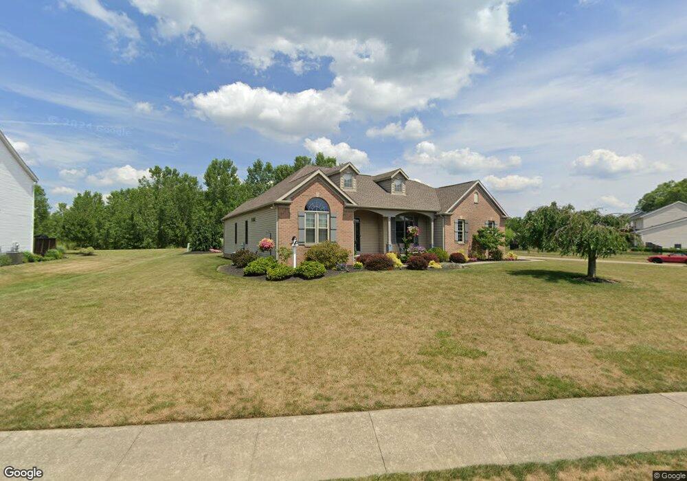
725 Glenbar St Louisville, OH 44641
Estimated Value: $287,000 - $430,000
3
Beds
2
Baths
1,866
Sq Ft
$187/Sq Ft
Est. Value
About This Home
This home is located at 725 Glenbar St, Louisville, OH 44641 and is currently estimated at $348,788, approximately $186 per square foot. 725 Glenbar St is a home located in Stark County with nearby schools including Louisville High School and St. Thomas Aquinas High School & Middle School.
Ownership History
Date
Name
Owned For
Owner Type
Purchase Details
Closed on
Jan 22, 2002
Sold by
Mccue Scott Homes
Bought by
Suarez Brian L and Suarez Lori C
Current Estimated Value
Home Financials for this Owner
Home Financials are based on the most recent Mortgage that was taken out on this home.
Original Mortgage
$170,000
Outstanding Balance
$70,063
Interest Rate
7.16%
Mortgage Type
Purchase Money Mortgage
Estimated Equity
$278,725
Purchase Details
Closed on
Oct 25, 2000
Sold by
Kauth Development Company Llc
Bought by
Scott Mccue Homes
Create a Home Valuation Report for This Property
The Home Valuation Report is an in-depth analysis detailing your home's value as well as a comparison with similar homes in the area
Home Values in the Area
Average Home Value in this Area
Purchase History
| Date | Buyer | Sale Price | Title Company |
|---|---|---|---|
| Suarez Brian L | $235,000 | -- | |
| Scott Mccue Homes | $39,400 | -- |
Source: Public Records
Mortgage History
| Date | Status | Borrower | Loan Amount |
|---|---|---|---|
| Open | Suarez Brian L | $170,000 |
Source: Public Records
Tax History Compared to Growth
Tax History
| Year | Tax Paid | Tax Assessment Tax Assessment Total Assessment is a certain percentage of the fair market value that is determined by local assessors to be the total taxable value of land and additions on the property. | Land | Improvement |
|---|---|---|---|---|
| 2025 | -- | $108,780 | $28,070 | $80,710 |
| 2024 | -- | $108,780 | $28,070 | $80,710 |
| 2023 | $3,964 | $90,100 | $22,580 | $67,520 |
| 2022 | $3,971 | $90,100 | $22,580 | $67,520 |
| 2021 | $3,982 | $90,100 | $22,580 | $67,520 |
| 2020 | $3,295 | $80,720 | $20,340 | $60,380 |
| 2019 | $3,312 | $82,320 | $22,050 | $60,270 |
| 2018 | $3,365 | $82,320 | $22,050 | $60,270 |
| 2017 | $3,077 | $72,630 | $18,590 | $54,040 |
| 2016 | $3,140 | $72,630 | $18,590 | $54,040 |
| 2015 | $3,149 | $72,630 | $18,590 | $54,040 |
| 2014 | $1,274 | $70,210 | $17,990 | $52,220 |
| 2013 | $1,641 | $70,210 | $17,990 | $52,220 |
Source: Public Records
Map
Nearby Homes
- 0 Glenbar St
- 524 Glenbar St
- 614 Reno Dr
- 0 Brookridge Ave
- 3580 Brookridge Ave Lot 15
- 5474 Ravenna Ave
- 428 Honeycrisp Dr NE
- 3047 Mcintosh Dr NE
- 432 Honeycrisp Dr NE
- 2962 Mcintosh Dr NE
- 2963 Mcintosh Dr NE
- 430 Honeycrisp Dr NE
- 2957 Mcintosh Dr NE
- 300 Kennedy St
- 316 E Reno Dr
- 1175 Sturbridge Dr
- 1149 Sturbridge Dr
- 910 Crosswyck Cir
- 1170 Winding Ridge Ave
- 325 Lincoln Ave
- 733 Glenbar St
- 617 Glenbar St
- 724 Glenbar St
- 801 Glenbar St
- 732 Glenbar St
- 607 Glenbar St
- 716 Glenbar St
- 805 Glenbar St
- 626 Glenbar St
- 523 Glenbar St
- 614 Glenbar St
- 815 Glenbar St
- 608 Glenbar St
- 515 Glenbar St
- 803 Reno Dr
- 830 Glenbar St
- 827 Glenbar St
- 813 Reno Dr
- 3575 Glenbar St Lot 10
- 3571 Glenbar St Lot 6