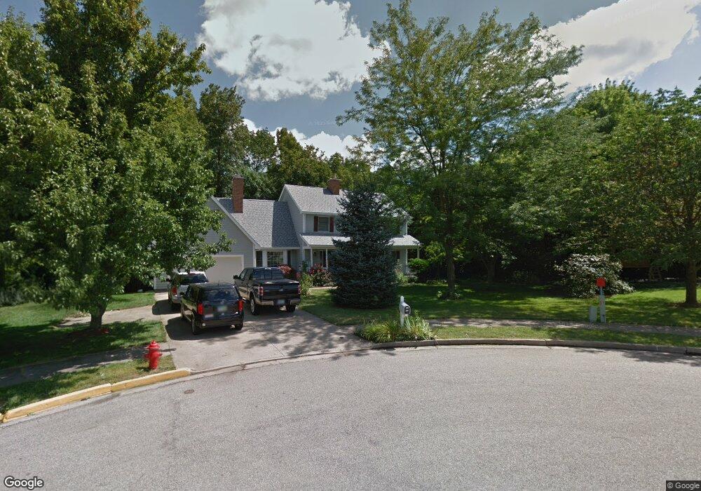
725 High Meadow Ln Oxford, OH 45056
Estimated Value: $470,339 - $565,000
4
Beds
3
Baths
3,384
Sq Ft
$149/Sq Ft
Est. Value
About This Home
This home is located at 725 High Meadow Ln, Oxford, OH 45056 and is currently estimated at $503,585, approximately $148 per square foot. 725 High Meadow Ln is a home located in Butler County with nearby schools including Talawanda Middle School, Talawanda High School, and Mcguffey Montessori School.
Ownership History
Date
Name
Owned For
Owner Type
Purchase Details
Closed on
May 23, 2006
Sold by
Spiker Janice and Spiker Barry
Bought by
Aylor James R and Ward Aylor Aileen A
Current Estimated Value
Home Financials for this Owner
Home Financials are based on the most recent Mortgage that was taken out on this home.
Original Mortgage
$276,000
Outstanding Balance
$161,850
Interest Rate
6.62%
Mortgage Type
Fannie Mae Freddie Mac
Estimated Equity
$341,735
Purchase Details
Closed on
Jul 12, 2002
Sold by
Faimon Donald R and Faimon Margaret A
Bought by
Mackey Janice
Purchase Details
Closed on
Jul 14, 1998
Sold by
Mcconocha Paul R and Mcconocha Diane M
Bought by
Faimon Donald R and Faimon Margaret A
Home Financials for this Owner
Home Financials are based on the most recent Mortgage that was taken out on this home.
Original Mortgage
$224,000
Interest Rate
7.15%
Mortgage Type
Purchase Money Mortgage
Purchase Details
Closed on
Feb 1, 1992
Create a Home Valuation Report for This Property
The Home Valuation Report is an in-depth analysis detailing your home's value as well as a comparison with similar homes in the area
Home Values in the Area
Average Home Value in this Area
Purchase History
| Date | Buyer | Sale Price | Title Company |
|---|---|---|---|
| Aylor James R | $345,000 | None Available | |
| Mackey Janice | $310,000 | -- | |
| Faimon Donald R | $280,000 | -- | |
| -- | $184,500 | -- |
Source: Public Records
Mortgage History
| Date | Status | Borrower | Loan Amount |
|---|---|---|---|
| Open | Aylor James R | $276,000 | |
| Previous Owner | Faimon Donald R | $224,000 |
Source: Public Records
Tax History Compared to Growth
Tax History
| Year | Tax Paid | Tax Assessment Tax Assessment Total Assessment is a certain percentage of the fair market value that is determined by local assessors to be the total taxable value of land and additions on the property. | Land | Improvement |
|---|---|---|---|---|
| 2024 | $4,594 | $124,630 | $23,960 | $100,670 |
| 2023 | $4,408 | $129,770 | $23,960 | $105,810 |
| 2022 | $3,616 | $93,100 | $23,960 | $69,140 |
| 2021 | $3,443 | $93,100 | $23,960 | $69,140 |
| 2020 | $3,600 | $93,100 | $23,960 | $69,140 |
| 2019 | $7,130 | $94,390 | $23,910 | $70,480 |
| 2018 | $3,849 | $94,390 | $23,910 | $70,480 |
| 2017 | $3,459 | $94,390 | $23,910 | $70,480 |
| 2016 | $3,268 | $86,290 | $23,910 | $62,380 |
| 2015 | $3,325 | $86,290 | $23,910 | $62,380 |
| 2014 | $3,682 | $86,290 | $23,910 | $62,380 |
| 2013 | $3,682 | $93,840 | $20,390 | $73,450 |
Source: Public Records
Map
Nearby Homes
- 812 Winding Brook Dr
- 509 White Oak Dr
- 6 Autumn Dr
- 60 Autumn Dr
- 7 Robin Ct
- 53 Great Horned Dr
- 59 Great Horned Dr
- 71 Great Horned Dr
- 74 Great Horned Dr
- 80 Great Horned Dr
- 1020 Tollgate Dr
- 715 W Chestnut St
- 446 Emerald Woods Dr
- Chatham Plan at Owls' Landing
- Newcastle Plan at Owls' Landing
- Holcombe Plan at Owls' Landing
- Henley Plan at Owls' Landing
- Bridgeport Plan at Owls' Landing
- 1985 Snowy Ln
- 744 High Meadow Ln
- 735 High Meadow Ln
- 11 Quail Ridge Dr
- 11 Lantern Ridge Rd
- 754 High Meadow Ln
- 25 Lantern Ridge Rd
- 12 Quail Ridge Dr
- 764 High Meadow Ln
- 745 High Meadow Ln
- 10 Quail Ridge Dr
- 37 Lantern Ridge Rd
- 21 Heather Ridge Ct
- 31 Heather Ridge Ct
- 15 Carrie Cir
- 12 Lantern Ridge Rd
- 17 Carrie Cir
- 11 Heather Ridge Ct
- 41 Heather Ridge Ct
- 13 Quail Ridge Dr
- 755 High Meadow Ln