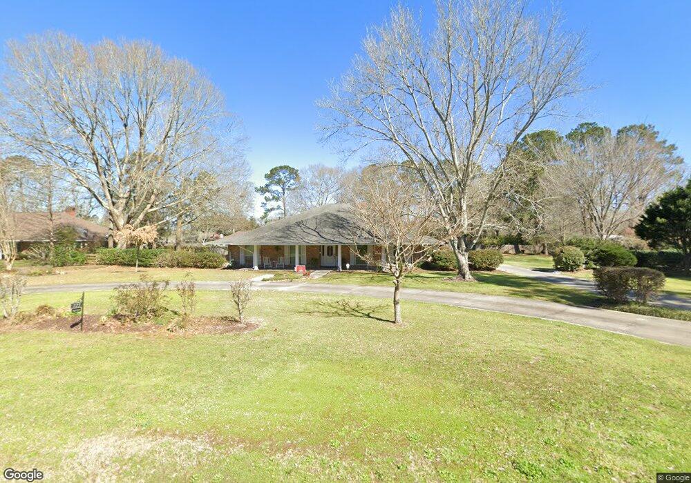
725 Maple St Denham Springs, LA 70726
Estimated Value: $308,000 - $634,747
4
Beds
3
Baths
3,227
Sq Ft
$146/Sq Ft
Est. Value
About This Home
This home is located at 725 Maple St, Denham Springs, LA 70726 and is currently estimated at $471,374, approximately $146 per square foot. 725 Maple St is a home located in Livingston Parish with nearby schools including Northside Elementary School, Denham Springs Junior High School, and Denham Springs High School.
Ownership History
Date
Name
Owned For
Owner Type
Purchase Details
Closed on
Jun 19, 2009
Sold by
Mayeux Judith B
Bought by
Latiolais Morrison Tony Scot and Latiolais Morrison Ranee
Current Estimated Value
Home Financials for this Owner
Home Financials are based on the most recent Mortgage that was taken out on this home.
Original Mortgage
$261,000
Outstanding Balance
$165,525
Interest Rate
4.84%
Mortgage Type
New Conventional
Estimated Equity
$305,849
Purchase Details
Closed on
May 16, 2007
Sold by
Mayeux Bryan James Barry and Mayeux Bryan Kimberly
Bought by
Mayeux Judith B
Home Financials for this Owner
Home Financials are based on the most recent Mortgage that was taken out on this home.
Original Mortgage
$219,000
Interest Rate
6.17%
Mortgage Type
New Conventional
Create a Home Valuation Report for This Property
The Home Valuation Report is an in-depth analysis detailing your home's value as well as a comparison with similar homes in the area
Home Values in the Area
Average Home Value in this Area
Purchase History
| Date | Buyer | Sale Price | Title Company |
|---|---|---|---|
| Latiolais Morrison Tony Scot | $290,000 | Champlin Title Inc | |
| Mayeux Judith B | $300,000 | Title Plus Llc |
Source: Public Records
Mortgage History
| Date | Status | Borrower | Loan Amount |
|---|---|---|---|
| Open | Latiolais Morrison Tony Scot | $261,000 | |
| Previous Owner | Mayeux Judith B | $219,000 |
Source: Public Records
Tax History Compared to Growth
Tax History
| Year | Tax Paid | Tax Assessment Tax Assessment Total Assessment is a certain percentage of the fair market value that is determined by local assessors to be the total taxable value of land and additions on the property. | Land | Improvement |
|---|---|---|---|---|
| 2024 | $3,097 | $32,425 | $5,110 | $27,315 |
| 2023 | $2,892 | $26,930 | $3,990 | $22,940 |
| 2022 | $2,914 | $26,930 | $3,990 | $22,940 |
| 2021 | $2,924 | $26,930 | $3,990 | $22,940 |
| 2020 | $2,887 | $26,930 | $3,990 | $22,940 |
| 2019 | $2,570 | $23,180 | $3,820 | $19,360 |
| 2018 | $2,601 | $23,180 | $3,820 | $19,360 |
| 2017 | $2,481 | $22,210 | $3,820 | $18,390 |
| 2015 | $1,933 | $24,490 | $3,820 | $20,670 |
| 2014 | $1,980 | $24,490 | $3,820 | $20,670 |
Source: Public Records
Map
Nearby Homes
- 704 White Oak Dr
- 723 Poplar St
- Lot 16 Southern Living Ln
- 353 Oak St
- Lot 17 Southern Living Ln
- 927 Robbie St
- Lot 19 Southern Living Ln
- 1170 Southern Living Ln
- Lot 58 Cockerham Rd
- 801 Westfield Dr
- 443 Cockerham Rd
- 405 N College St E
- 0 Meadowbrook Blvd
- 127 Joan St
- 141 La Maison Belle Dr
- 30633 John Dr
- 1630 Starlite Dr
- 8474 Harold Dr
- 434 Centerville St NE
- Lot 36 Camellia Way