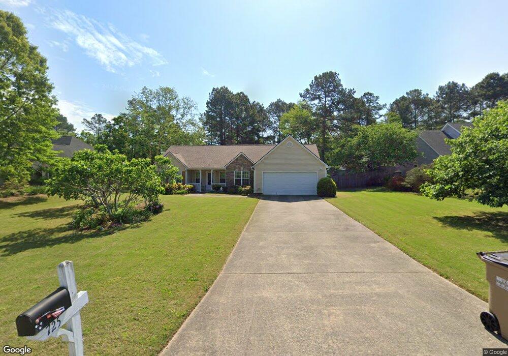
725 Michael Dr Unit 1 Winder, GA 30680
Estimated Value: $305,000 - $357,000
3
Beds
2
Baths
1,490
Sq Ft
$222/Sq Ft
Est. Value
About This Home
This home is located at 725 Michael Dr Unit 1, Winder, GA 30680 and is currently estimated at $330,658, approximately $221 per square foot. 725 Michael Dr Unit 1 is a home located in Barrow County with nearby schools including County Line Elementary School, Russell Middle School, and Winder-Barrow High School.
Ownership History
Date
Name
Owned For
Owner Type
Purchase Details
Closed on
Jan 30, 2015
Sold by
Rogers Doris G
Bought by
The Kozyreff Family Irrevocabl
Current Estimated Value
Purchase Details
Closed on
Aug 28, 2002
Sold by
Mcwaters Derrick W
Bought by
Rogers Doris G
Home Financials for this Owner
Home Financials are based on the most recent Mortgage that was taken out on this home.
Original Mortgage
$104,000
Interest Rate
6.49%
Mortgage Type
New Conventional
Create a Home Valuation Report for This Property
The Home Valuation Report is an in-depth analysis detailing your home's value as well as a comparison with similar homes in the area
Home Values in the Area
Average Home Value in this Area
Purchase History
| Date | Buyer | Sale Price | Title Company |
|---|---|---|---|
| The Kozyreff Family Irrevocabl | $133,000 | -- | |
| Rogers Doris G | $130,000 | -- | |
| Mcwaters Derrick W | -- | -- |
Source: Public Records
Mortgage History
| Date | Status | Borrower | Loan Amount |
|---|---|---|---|
| Previous Owner | Mcwaters Derrick W | $104,000 |
Source: Public Records
Tax History
| Year | Tax Paid | Tax Assessment Tax Assessment Total Assessment is a certain percentage of the fair market value that is determined by local assessors to be the total taxable value of land and additions on the property. | Land | Improvement |
|---|---|---|---|---|
| 2025 | $896 | $108,339 | $27,200 | $81,139 |
| 2024 | $2,677 | $105,920 | $27,200 | $78,720 |
| 2023 | $2,679 | $106,320 | $27,200 | $79,120 |
| 2022 | $2,416 | $82,260 | $20,000 | $62,260 |
| 2021 | $2,043 | $65,128 | $16,400 | $48,728 |
| 2020 | $1,906 | $60,395 | $13,600 | $46,795 |
| 2019 | $1,880 | $58,462 | $13,600 | $44,862 |
| 2018 | $1,741 | $54,596 | $13,600 | $40,996 |
| 2017 | $1,362 | $46,776 | $13,600 | $33,176 |
| 2016 | $1,452 | $45,574 | $13,600 | $31,974 |
| 2015 | $898 | $45,574 | $13,600 | $31,974 |
| 2014 | $331 | $39,781 | $7,448 | $32,333 |
| 2013 | -- | $38,213 | $7,448 | $30,765 |
Source: Public Records
Map
Nearby Homes
- 716 Michael Dr
- 615 Wellington Dr
- 311 Rockwell Church Rd NW
- 879 Hawk Creek Trail
- 569 Maddox Rd
- 854 Hawk Creek Trail
- 932 Century Oak Dr
- 857 Laurel Ln
- 909 Century Oak Dr Unit 2
- 139 Ashwood Ct
- 536 Valley View Dr
- 403 Ryan Cir
- 882 Whispering Way
- 2050 Whispering Way
- 845 Idlewood Rd
- 0 Gainesville Hwy Unit 10712053
- 0 E Northcrest Dr Unit 10648147
- 236 Hidden Ct
- 553 Rockwell Church Rd NW
- 469 Plantation Dr
- 721 Michael Dr Unit 1
- 729 Michael Dr Unit 1
- 719 Michael Dr
- 724 Michael Dr
- 724 Michael Dr
- 233 Alanna Ave
- 807 Carmon Ct
- 801 Carmon Ct
- 728 Michael Dr
- 715 Michael Dr Unit 1
- 722 Michael Dr
- 726 Michael Dr Unit 1
- 720 Michael Dr
- 810 Carmon Ct Unit 2
- 730 Michael Dr Unit 1
- 711 Michael Dr
- 732 Michael Dr Unit 1
- 732 Michael Dr Unit 1/15
- 732 Michael Dr
- 232 Alanna Ave Unit 1
Your Personal Tour Guide
Ask me questions while you tour the home.