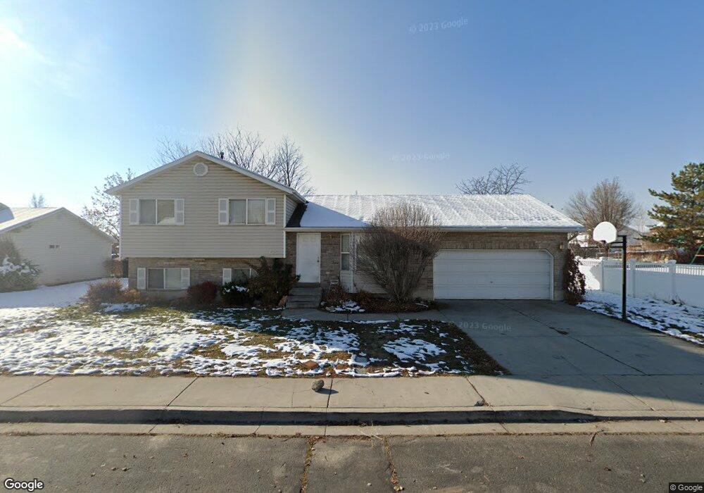
725 N 1010 W Pleasant Grove, UT 84062
Estimated Value: $503,000 - $541,000
5
Beds
3
Baths
1,902
Sq Ft
$277/Sq Ft
Est. Value
About This Home
This home is located at 725 N 1010 W, Pleasant Grove, UT 84062 and is currently estimated at $526,246, approximately $276 per square foot. 725 N 1010 W is a home located in Utah County with nearby schools including Mount Mahogany School, Pleasant Grove Junior High School, and Pleasant Grove High School.
Ownership History
Date
Name
Owned For
Owner Type
Purchase Details
Closed on
May 27, 2021
Sold by
Hpa Us1 Llc
Bought by
Hpa Ii Borrower 2021-1 Llc
Current Estimated Value
Home Financials for this Owner
Home Financials are based on the most recent Mortgage that was taken out on this home.
Original Mortgage
$414,586,005
Interest Rate
3%
Mortgage Type
New Conventional
Purchase Details
Closed on
Sep 17, 2020
Sold by
Juarez Janet R
Bought by
Hpa Us1 Llc
Purchase Details
Closed on
Jun 7, 2011
Sold by
Juarez Michael L
Bought by
Juarez Janet R
Home Financials for this Owner
Home Financials are based on the most recent Mortgage that was taken out on this home.
Original Mortgage
$119,000
Interest Rate
4.71%
Mortgage Type
New Conventional
Purchase Details
Closed on
Sep 19, 1996
Sold by
Ray L Construction Llc
Bought by
Juarez Michael L and Juarez Janet R
Home Financials for this Owner
Home Financials are based on the most recent Mortgage that was taken out on this home.
Original Mortgage
$115,000
Interest Rate
7.88%
Create a Home Valuation Report for This Property
The Home Valuation Report is an in-depth analysis detailing your home's value as well as a comparison with similar homes in the area
Home Values in the Area
Average Home Value in this Area
Purchase History
| Date | Buyer | Sale Price | Title Company |
|---|---|---|---|
| Hpa Ii Borrower 2021-1 Llc | -- | New Title Company Name | |
| Hpa Us1 Llc | -- | Metro National Title | |
| Juarez Janet R | -- | First American American Fork | |
| Juarez Michael L | -- | -- | |
| Ray L Construction Llc | -- | -- |
Source: Public Records
Mortgage History
| Date | Status | Borrower | Loan Amount |
|---|---|---|---|
| Previous Owner | Hpa Ii Borrower 2021-1 Llc | $414,586,005 | |
| Previous Owner | Juarez Janet R | $119,000 | |
| Previous Owner | Juarez Michael L | $115,000 |
Source: Public Records
Tax History Compared to Growth
Tax History
| Year | Tax Paid | Tax Assessment Tax Assessment Total Assessment is a certain percentage of the fair market value that is determined by local assessors to be the total taxable value of land and additions on the property. | Land | Improvement |
|---|---|---|---|---|
| 2025 | $1,959 | $252,450 | $192,600 | $266,400 |
| 2024 | $1,959 | $233,805 | $0 | $0 |
| 2023 | $1,933 | $236,170 | $0 | $0 |
| 2022 | $2,050 | $249,205 | $0 | $0 |
| 2021 | $1,810 | $335,000 | $129,000 | $206,000 |
| 2020 | $1,658 | $300,800 | $115,200 | $185,600 |
| 2019 | $1,462 | $274,300 | $111,700 | $162,600 |
| 2018 | $1,387 | $246,100 | $104,700 | $141,400 |
| 2017 | $1,363 | $128,755 | $0 | $0 |
| 2016 | $1,314 | $119,845 | $0 | $0 |
| 2015 | $1,292 | $111,540 | $0 | $0 |
| 2014 | $1,247 | $106,645 | $0 | $0 |
Source: Public Records
Map
Nearby Homes
- 1130 W State Rd
- 685 W 1000 N
- 909 W 1180 N
- 167 N Romney Ln Unit 203
- 1443 W 1010 N
- 1491 W 1010 N
- 1065 N 1420 W
- 1096 N 1420 St W Unit 27
- 123 N Romney Ln Unit 103
- 1078 W 70 N
- 1515 W 1010 St N
- 150 N 1300 W
- 1249 W Cambria Dr Unit 101
- 1598 W 220 N
- 1525 W 300 N
- 1498 W 1060 N Unit 5
- Lytham Plan at Grove Acres
- 1541 W 1060 N
- 295 N 1580 W
- 1541 W 250 N