Estimated Value: $559,042 - $583,000
3
Beds
2
Baths
1,741
Sq Ft
$330/Sq Ft
Est. Value
About This Home
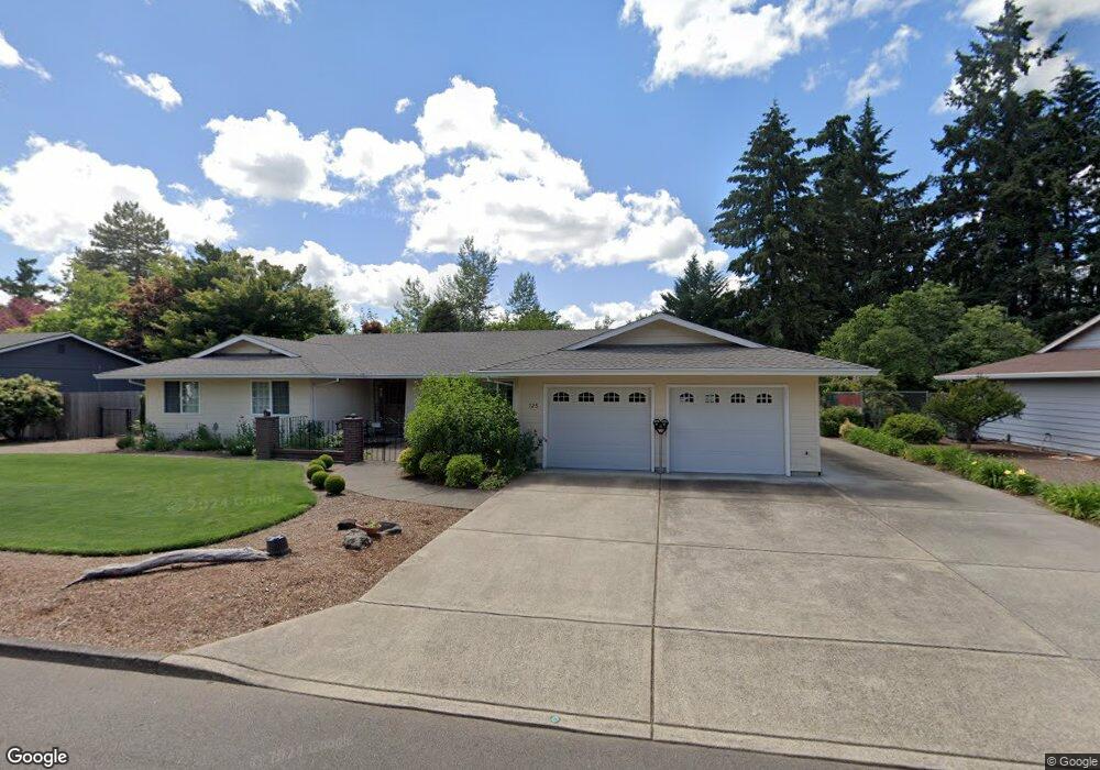
This home is located at 725 N Baker Dr, Canby, OR 97013 and is currently estimated at $575,261, approximately $330 per square foot. 725 N Baker Dr is a home located in Clackamas County with nearby schools including Josefa L. Sambrano Elementary School, Baker Prairie Middle School, and Canby High School.
Ownership History
Date
Name
Owned For
Owner Type
Purchase Details
Closed on
Dec 17, 2002
Sold by
Gwynne George L and Ackerman Joseph Herbert
Bought by
Pacholl Fred Ronald and Pacholl Cherrol G
Current Estimated Value
Home Financials for this Owner
Home Financials are based on the most recent Mortgage that was taken out on this home.
Original Mortgage
$100,000
Outstanding Balance
$39,878
Interest Rate
5.37%
Estimated Equity
$535,383
Create a Home Valuation Report for This Property
The Home Valuation Report is an in-depth analysis detailing your home's value as well as a comparison with similar homes in the area
Home Values in the Area
Average Home Value in this Area
Purchase History
| Date | Buyer | Sale Price | Title Company |
|---|---|---|---|
| Pacholl Fred Ronald | $190,000 | -- |
Source: Public Records
Mortgage History
| Date | Status | Borrower | Loan Amount |
|---|---|---|---|
| Open | Pacholl Fred Ronald | $100,000 |
Source: Public Records
Tax History Compared to Growth
Tax History
| Year | Tax Paid | Tax Assessment Tax Assessment Total Assessment is a certain percentage of the fair market value that is determined by local assessors to be the total taxable value of land and additions on the property. | Land | Improvement |
|---|---|---|---|---|
| 2025 | $6,411 | $361,716 | -- | -- |
| 2024 | $6,232 | $351,181 | -- | -- |
| 2023 | $6,232 | $340,953 | $0 | $0 |
| 2022 | $5,732 | $331,023 | $0 | $0 |
| 2021 | $5,520 | $321,382 | $0 | $0 |
| 2020 | $5,421 | $312,022 | $0 | $0 |
| 2019 | $5,163 | $302,934 | $0 | $0 |
| 2018 | $5,048 | $294,111 | $0 | $0 |
| 2017 | $4,920 | $285,545 | $0 | $0 |
| 2016 | $4,756 | $277,228 | $0 | $0 |
| 2015 | $4,592 | $269,153 | $0 | $0 |
| 2014 | $4,460 | $261,314 | $0 | $0 |
Source: Public Records
Map
Nearby Homes
- 978 N Alder St
- 960 N Aspen Ct
- 0 NW 10th Ave
- 850 NW 3rd Ave
- 812 NW 3rd Ave
- 916 NW 2nd Ave
- 442 NW 4th Ave
- 589 NW 3rd Ave
- 580 N Grant St
- 1198 SW 1st Ave
- 6869 S Knights Bridge Rd
- 184 NE 10th Ave
- 1614 NW 16th Ave
- 318 NE 9th Ave
- 431 SW 3rd Ave
- 187 NE 14th Ave
- 6815 S Knights Bridge Rd
- 1721 N Hyssop St
- 299 SW 3rd Ave
- 481 S Holly St