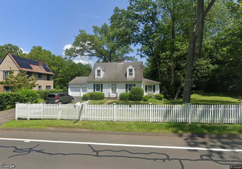
725 Racebrook Rd Orange, CT 06477
Estimated Value: $416,042 - $559,000
2
Beds
2
Baths
1,314
Sq Ft
$357/Sq Ft
Est. Value
About This Home
This home is located at 725 Racebrook Rd, Orange, CT 06477 and is currently estimated at $469,011, approximately $356 per square foot. 725 Racebrook Rd is a home located in New Haven County with nearby schools including Mary L. Tracy School, Race Brook School, and Amity Middle School: Orange.
Ownership History
Date
Name
Owned For
Owner Type
Purchase Details
Closed on
Jun 29, 1992
Sold by
Dilullo Michael and Dilullo Margaret A
Bought by
Janezek Mary
Current Estimated Value
Home Financials for this Owner
Home Financials are based on the most recent Mortgage that was taken out on this home.
Original Mortgage
$75,000
Interest Rate
8.22%
Mortgage Type
Purchase Money Mortgage
Purchase Details
Closed on
May 8, 1987
Sold by
Tartagni Joseph
Bought by
Dilullo Michael
Home Financials for this Owner
Home Financials are based on the most recent Mortgage that was taken out on this home.
Original Mortgage
$80,000
Interest Rate
9%
Mortgage Type
Purchase Money Mortgage
Create a Home Valuation Report for This Property
The Home Valuation Report is an in-depth analysis detailing your home's value as well as a comparison with similar homes in the area
Home Values in the Area
Average Home Value in this Area
Purchase History
| Date | Buyer | Sale Price | Title Company |
|---|---|---|---|
| Janezek Mary | $185,000 | -- | |
| Dilullo Michael | $210,000 | -- |
Source: Public Records
Mortgage History
| Date | Status | Borrower | Loan Amount |
|---|---|---|---|
| Closed | Dilullo Michael | $91,000 | |
| Closed | Dilullo Michael | $75,000 | |
| Previous Owner | Dilullo Michael | $80,000 |
Source: Public Records
Tax History Compared to Growth
Tax History
| Year | Tax Paid | Tax Assessment Tax Assessment Total Assessment is a certain percentage of the fair market value that is determined by local assessors to be the total taxable value of land and additions on the property. | Land | Improvement |
|---|---|---|---|---|
| 2025 | $6,504 | $223,500 | $113,000 | $110,500 |
| 2024 | $6,929 | $223,500 | $113,000 | $110,500 |
| 2023 | $5,250 | $162,500 | $82,500 | $80,000 |
| 2022 | $5,315 | $162,500 | $82,500 | $80,000 |
| 2021 | $5,403 | $162,500 | $82,500 | $80,000 |
| 2020 | $5,320 | $162,500 | $82,500 | $80,000 |
| 2019 | $5,296 | $162,500 | $82,500 | $80,000 |
| 2018 | $5,200 | $162,500 | $82,500 | $80,000 |
| 2017 | $5,115 | $153,700 | $88,500 | $65,200 |
| 2016 | $4,949 | $153,700 | $88,500 | $65,200 |
| 2015 | $4,826 | $153,700 | $88,500 | $65,200 |
| 2014 | $4,688 | $153,700 | $88,500 | $65,200 |
Source: Public Records
Map
Nearby Homes
- 30 Whitney Ln
- 700 Royal Ln
- 14 Ironwood Way
- 8 Farm River Rd
- 189 Derby Ave
- 691 Buttonball Rd
- 484 New England Ln
- 920 Green Cir
- 122 Derby Ave
- 25 Wedgewood Dr
- 24 Brierwood Dr
- 47 Sunset Dr
- 1025 Field Dr
- 846 Beechwood Rd
- 588 Summit Dr
- 17 Bunker Hill Rd
- 235 Sylvan Valley Rd
- 424 Racebrook Rd
- 342 Cedarwood Dr
- 460 Taulman Rd
- 727 Racebrook Rd
- 11 Muirfield Dr
- 735 Racebrook Rd
- 15 Muirfield Dr
- 739 Racebrook Rd
- 716 Racebrook Rd
- 19 Muirfield Dr
- 26 Muirfield Dr
- 715 Racebrook Rd
- 23 Muirfield Dr
- 741 Racebrook Rd
- 17 Woodside Dr
- 29 Muirfield Dr
- 712 Racebrook Rd
- 33 Woodside Dr
- 708 Racebrook Rd
- 747 Racebrook Rd
- 20 Woodside Dr
- 16 Woodside Dr
- 24 Woodside Dr