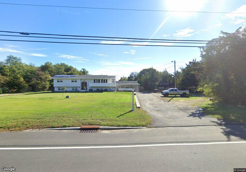
725 Route Us 9 N Marmora, NJ 08223
Estimated Value: $504,000 - $796,000
--
Bed
--
Bath
2,580
Sq Ft
$252/Sq Ft
Est. Value
About This Home
This home is located at 725 Route Us 9 N, Marmora, NJ 08223 and is currently estimated at $650,174, approximately $252 per square foot. 725 Route Us 9 N is a home located in Cape May County with nearby schools including Upper Township Primary School, Upper Township Elementary School, and Upper Township Middle School.
Ownership History
Date
Name
Owned For
Owner Type
Purchase Details
Closed on
Oct 7, 2022
Sold by
Potter Jay
Bought by
Zammit Keith and Zammit Kathryn A
Current Estimated Value
Purchase Details
Closed on
Mar 24, 2009
Sold by
Potter Frances M
Bought by
Potter Jay
Home Financials for this Owner
Home Financials are based on the most recent Mortgage that was taken out on this home.
Original Mortgage
$265,364
Interest Rate
4.92%
Mortgage Type
FHA
Create a Home Valuation Report for This Property
The Home Valuation Report is an in-depth analysis detailing your home's value as well as a comparison with similar homes in the area
Home Values in the Area
Average Home Value in this Area
Purchase History
| Date | Buyer | Sale Price | Title Company |
|---|---|---|---|
| Zammit Keith | $422,000 | Surety Title | |
| Zammit Keith | $422,000 | Surety Title | |
| Potter Jay | $326,000 | Foundation Title |
Source: Public Records
Mortgage History
| Date | Status | Borrower | Loan Amount |
|---|---|---|---|
| Previous Owner | Potter Jay | $265,364 |
Source: Public Records
Tax History Compared to Growth
Tax History
| Year | Tax Paid | Tax Assessment Tax Assessment Total Assessment is a certain percentage of the fair market value that is determined by local assessors to be the total taxable value of land and additions on the property. | Land | Improvement |
|---|---|---|---|---|
| 2025 | $8,671 | $377,800 | $156,900 | $220,900 |
| 2024 | $8,671 | $377,800 | $156,900 | $220,900 |
| 2023 | $7,994 | $377,800 | $156,900 | $220,900 |
| 2022 | $7,691 | $377,800 | $156,900 | $220,900 |
| 2021 | $5,480 | $377,800 | $156,900 | $220,900 |
| 2020 | $7,113 | $377,800 | $156,900 | $220,900 |
| 2019 | $6,917 | $377,800 | $156,900 | $220,900 |
| 2018 | $6,728 | $377,800 | $156,900 | $220,900 |
| 2017 | $6,641 | $377,800 | $156,900 | $220,900 |
| 2016 | $6,758 | $377,800 | $156,900 | $220,900 |
| 2015 | $6,569 | $377,800 | $156,900 | $220,900 |
| 2014 | $6,334 | $447,300 | $229,300 | $218,000 |
Source: Public Records
Map
Nearby Homes
- 527 N 527 N Shore Rd
- 601 2nd Ave
- 16 Lenape Ln
- 202 N Shore Rd
- 125 N Shore Rd
- 32 Norwood Rd
- 14 Lyndhurst Rd
- 1 Roosevelt Blvd
- 100 Reef Dr Unit 94
- 100 Reef Dr
- 1904 Glenwood Dr
- 14 Roberts Ave
- 9 Coral Ln
- 2019 Glenwood Dr
- 1901 Glenwood Dr
- 71 Spruce Rd
- 20 Gilbert Ln
- 38 Arkansas Ave
- 15 Waterway Rd
- 13 Waterway Rd
- 725 Route Us 9 S
- 725 N Shore Rd
- 731 N Shore Rd
- 2 Staples Ct
- 731 Route Us 9 N
- 732 N Shore
- 1 Staples Ct
- 730 Route Us 9 N
- 715 Route Us 9 N
- 716 Route Us 9 N
- 716 N Shore Rd S
- 2 South Dr
- 732 Route Us 9 N
- 737 Route Us 9 N
- 712 Route Us 9 N
- 4 Staples Ct
- 736 Route Us 9 N
- 731 Lincoln Ave
- 741 Steel Rd
- 741 Route Us 9 N