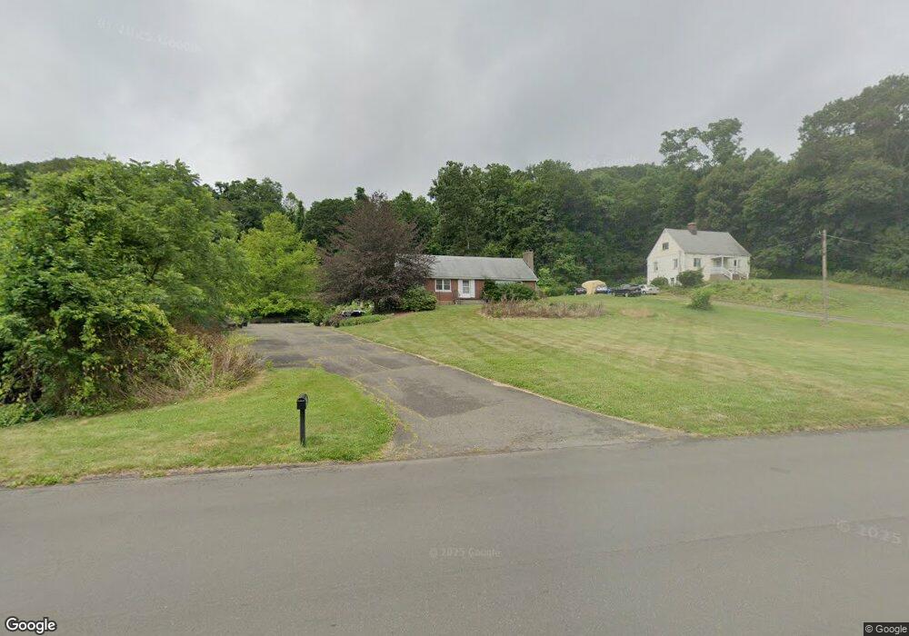
725 Sherman Ave Hamden, CT 06514
Estimated Value: $403,316 - $524,000
3
Beds
2
Baths
2,028
Sq Ft
$228/Sq Ft
Est. Value
About This Home
This home is located at 725 Sherman Ave, Hamden, CT 06514 and is currently estimated at $463,079, approximately $228 per square foot. 725 Sherman Ave is a home located in New Haven County with nearby schools including Hamden Middle School, Hamden High School, and Laurel Oaks Adventist School.
Ownership History
Date
Name
Owned For
Owner Type
Purchase Details
Closed on
May 13, 2003
Sold by
Schlosser Arlene B
Bought by
Woodruff Thomas W and Woodruff Kathryn D
Current Estimated Value
Home Financials for this Owner
Home Financials are based on the most recent Mortgage that was taken out on this home.
Original Mortgage
$188,000
Interest Rate
5.93%
Create a Home Valuation Report for This Property
The Home Valuation Report is an in-depth analysis detailing your home's value as well as a comparison with similar homes in the area
Home Values in the Area
Average Home Value in this Area
Purchase History
| Date | Buyer | Sale Price | Title Company |
|---|---|---|---|
| Woodruff Thomas W | $250,000 | -- |
Source: Public Records
Mortgage History
| Date | Status | Borrower | Loan Amount |
|---|---|---|---|
| Closed | Woodruff Thomas W | $188,000 | |
| Previous Owner | Woodruff Thomas W | $18,000 |
Source: Public Records
Tax History
| Year | Tax Paid | Tax Assessment Tax Assessment Total Assessment is a certain percentage of the fair market value that is determined by local assessors to be the total taxable value of land and additions on the property. | Land | Improvement |
|---|---|---|---|---|
| 2025 | $13,898 | $267,890 | $69,860 | $198,030 |
| 2024 | $10,378 | $186,620 | $49,210 | $137,410 |
| 2023 | $10,522 | $186,620 | $49,210 | $137,410 |
| 2022 | $10,354 | $186,620 | $49,210 | $137,410 |
| 2021 | $9,786 | $186,620 | $49,210 | $137,410 |
| 2020 | $8,733 | $168,000 | $85,260 | $82,740 |
| 2019 | $8,208 | $168,000 | $85,260 | $82,740 |
| 2018 | $8,057 | $168,000 | $85,260 | $82,740 |
| 2017 | $7,604 | $168,000 | $85,260 | $82,740 |
| 2016 | $7,620 | $168,000 | $85,260 | $82,740 |
| 2015 | $7,713 | $188,720 | $94,640 | $94,080 |
| 2014 | $7,536 | $188,720 | $94,640 | $94,080 |
Source: Public Records
Map
Nearby Homes
- 660 Sherman Ave
- 51 Greenes Ridge Rd
- 1020 Shepard Ave
- 116 Bender Rd
- 80 Flower Dr
- 46 Forest Ct N
- 110 Dickerman St
- 4 Raccio Park Rd
- 2974 Whitney Ave
- 93 Cannon St
- 1380 Paradise Ave
- 4183 Whitney Ave
- 71 Renshaw Rd
- 399 W Woods Rd
- 55 Forest St
- 5 Shepard Hill Rd
- 1 Pond Hollow Unit 1
- 151 Fans Rock Rd
- 26 Kelly Rd
- 25 Hamden Hills Dr Unit 69
- 709 Sherman Ave
- 730 Sherman Ave
- 60 Nutmeg Hill Rd
- 695 Sherman Ave
- 64 Nutmeg Hill Rd
- 26 Corporate Ridge Rd
- 36 Corporate Ridge Rd
- 16 Corporate Ridge Rd
- 16 Corporate Ridge Rd
- 44 Nutmeg Hill Rd
- 56 Nutmeg Hill Rd
- 50 Nutmeg Hill Rd
- 38 Nutmeg Hill Rd
- 736 Sherman Ave
- 700 Sherman Ave
- 32 Nutmeg Hill Rd
- 6 Corporate Ridge Rd
- 6 Corporate Ridge Rd
- 26 Nutmeg Hill Rd
- 59 Nutmeg Hill Rd
Your Personal Tour Guide
Ask me questions while you tour the home.