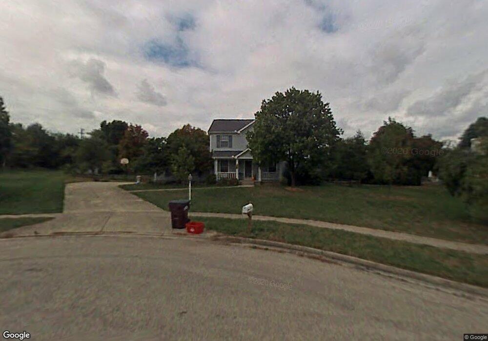
725 Woodspring Ct Beavercreek, OH 45430
Estimated Value: $408,346 - $454,000
3
Beds
3
Baths
2,288
Sq Ft
$184/Sq Ft
Est. Value
About This Home
This home is located at 725 Woodspring Ct, Beavercreek, OH 45430 and is currently estimated at $422,087, approximately $184 per square foot. 725 Woodspring Ct is a home located in Greene County with nearby schools including Valley Elementary School, Herman K Ankeney Middle School, and Beavercreek High School.
Ownership History
Date
Name
Owned For
Owner Type
Purchase Details
Closed on
Apr 20, 2004
Sold by
Runkle Steven L and Runkle Constance A
Bought by
Arrington Jeffrey G and Arrington Debra L
Current Estimated Value
Home Financials for this Owner
Home Financials are based on the most recent Mortgage that was taken out on this home.
Original Mortgage
$110,000
Outstanding Balance
$51,186
Interest Rate
5.5%
Mortgage Type
Unknown
Estimated Equity
$370,901
Purchase Details
Closed on
Dec 14, 1994
Sold by
Bell L Stanley
Bought by
Runkle Steven L and Runkle A
Home Financials for this Owner
Home Financials are based on the most recent Mortgage that was taken out on this home.
Original Mortgage
$115,000
Interest Rate
7.62%
Mortgage Type
New Conventional
Create a Home Valuation Report for This Property
The Home Valuation Report is an in-depth analysis detailing your home's value as well as a comparison with similar homes in the area
Home Values in the Area
Average Home Value in this Area
Purchase History
| Date | Buyer | Sale Price | Title Company |
|---|---|---|---|
| Arrington Jeffrey G | $217,500 | -- | |
| Runkle Steven L | $168,500 | -- |
Source: Public Records
Mortgage History
| Date | Status | Borrower | Loan Amount |
|---|---|---|---|
| Open | Arrington Jeffrey G | $110,000 | |
| Previous Owner | Runkle Steven L | $115,000 |
Source: Public Records
Tax History Compared to Growth
Tax History
| Year | Tax Paid | Tax Assessment Tax Assessment Total Assessment is a certain percentage of the fair market value that is determined by local assessors to be the total taxable value of land and additions on the property. | Land | Improvement |
|---|---|---|---|---|
| 2024 | $7,690 | $117,790 | $24,340 | $93,450 |
| 2023 | $7,690 | $117,790 | $24,340 | $93,450 |
| 2022 | $6,736 | $91,080 | $18,730 | $72,350 |
| 2021 | $6,599 | $91,080 | $18,730 | $72,350 |
| 2020 | $6,649 | $91,080 | $18,730 | $72,350 |
| 2019 | $6,854 | $85,620 | $17,420 | $68,200 |
| 2018 | $6,050 | $85,620 | $17,420 | $68,200 |
| 2017 | $5,618 | $85,620 | $17,420 | $68,200 |
| 2016 | $5,619 | $77,120 | $17,420 | $59,700 |
| 2015 | $5,585 | $77,120 | $17,420 | $59,700 |
| 2014 | $5,501 | $77,120 | $17,420 | $59,700 |
Source: Public Records
Map
Nearby Homes
- 3667 Creekwood Ct
- 615 Bendwood Way
- 3534 Sunset Bluff Dr
- 3700 Napanee Dr
- 4020 E Patterson Rd
- 3392 Greenburn Rd Unit 3392
- 795 Newton Dr
- 3608 Roselawn Dr
- 989 River Hills Rd
- 3854 Rexford Rd
- 684 Newton Dr
- 3998 Willowcrest Rd
- 465 Grange Hall Rd
- 3363 Maplewood Dr
- 3597 Echo Hill Ln
- 527 Viking Landing Ct
- 3330 Fair Oaks Dr
- 4134 Cambridge Trail
- 4011 Willow Run Dr
- 3917 E Summit Ridge Dr
- 721 Woodspring Ct
- 735 Woodspring Ct
- 3670 Shakertown Rd
- 3659 Greenstone Ct
- 3680 Shakertown Rd
- 743 Woodspring Ct
- 720 Woodspring Ct
- 728 Woodspring Ct
- 3648 Greenstone Ct
- 742 Woodspring Ct
- 3690 Shakertown Rd
- 720 Talowood Dr
- 749 Woodspring Ct
- 3679 Greenstone Ct
- 3658 Greenstone Ct
- 711 Farmbrook Dr
- 721 Farmbrook Dr
- 3689 Shakertown Rd
- 701 Farmbrook Dr
- 738 Briddlewood St