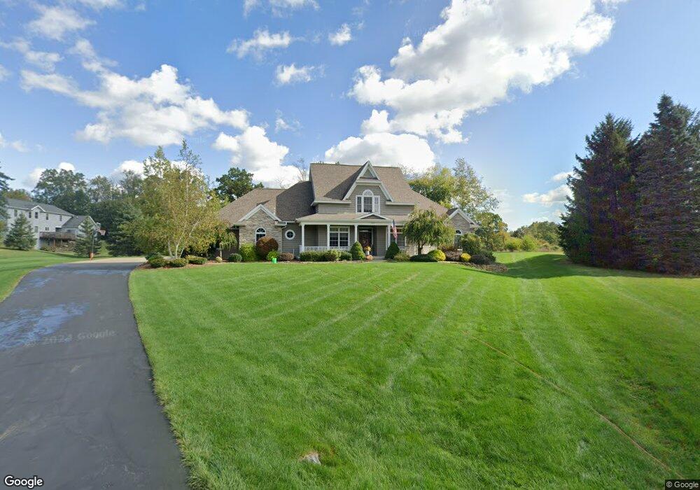
7254 Fairfield Ct Spring Arbor, MI 49283
Estimated Value: $508,000 - $610,230
4
Beds
5
Baths
2,855
Sq Ft
$199/Sq Ft
Est. Value
About This Home
This home is located at 7254 Fairfield Ct, Spring Arbor, MI 49283 and is currently estimated at $568,410, approximately $199 per square foot. 7254 Fairfield Ct is a home located in Jackson County with nearby schools including Western High School.
Ownership History
Date
Name
Owned For
Owner Type
Purchase Details
Closed on
Dec 8, 2016
Sold by
Morales Macchia John J F and Morales Campoy Florencia
Bought by
Kimble Michael A
Current Estimated Value
Home Financials for this Owner
Home Financials are based on the most recent Mortgage that was taken out on this home.
Original Mortgage
$359,910
Outstanding Balance
$290,800
Interest Rate
3.54%
Mortgage Type
New Conventional
Estimated Equity
$277,610
Purchase Details
Closed on
Sep 23, 2015
Sold by
Morales Macchia John J and Morales Campoy Florencia
Bought by
Morales Macchia John J F and Morales Campoy Florencia
Purchase Details
Closed on
Oct 21, 2013
Sold by
Ansel Brandon and Ansel Sarah
Bought by
Macchia John J
Create a Home Valuation Report for This Property
The Home Valuation Report is an in-depth analysis detailing your home's value as well as a comparison with similar homes in the area
Home Values in the Area
Average Home Value in this Area
Purchase History
| Date | Buyer | Sale Price | Title Company |
|---|---|---|---|
| Kimble Michael A | $399,900 | Attorney | |
| Morales Macchia John J F | -- | Attorney | |
| Macchia John J | $325,000 | Mst |
Source: Public Records
Mortgage History
| Date | Status | Borrower | Loan Amount |
|---|---|---|---|
| Open | Kimble Michael A | $359,910 |
Source: Public Records
Tax History Compared to Growth
Tax History
| Year | Tax Paid | Tax Assessment Tax Assessment Total Assessment is a certain percentage of the fair market value that is determined by local assessors to be the total taxable value of land and additions on the property. | Land | Improvement |
|---|---|---|---|---|
| 2025 | $7,598 | $286,300 | $0 | $0 |
| 2024 | $4,509 | $267,700 | $0 | $0 |
| 2023 | $4,511 | $265,300 | $0 | $0 |
| 2022 | $6,895 | $259,000 | $0 | $0 |
| 2021 | $6,770 | $238,140 | $0 | $0 |
| 2020 | $6,689 | $206,870 | $0 | $0 |
| 2019 | $6,359 | $187,340 | $0 | $0 |
| 2018 | $6,336 | $165,240 | $9,360 | $155,880 |
| 2017 | $6,033 | $162,690 | $0 | $0 |
| 2016 | $3,312 | $161,320 | $161,320 | $0 |
| 2015 | $136,110 | $150,080 | $150,080 | $0 |
| 2014 | $136,110 | $136,110 | $0 | $0 |
| 2013 | -- | $136,110 | $136,110 | $0 |
Source: Public Records
Map
Nearby Homes
- 132 Remington Dr
- 392 Richard St
- V/L S Dearing Rd Unit 40 Acres Vacant Land
- 2503 Milford Rd
- 125 Burr Oak Dr
- 0 King Rd Unit 25060444
- 2926 S Sandstone Rd
- 1864 Chapel Rd
- 8563 Mccain Rd
- 1570 Chapel Rd
- 6051 Riverside Dr
- 3352 Reynolds Rd
- 1126 Chapel Rd
- 1001 N Dearing Rd
- 5427 Vrooman Rd
- 5162 Vrooman Rd
- 4920 Slayton Rd
- 4849 Indian Creek Dr Unit 6
- 28 Engelhardt Strasse
- 4880 Indian Creek Dr Unit 26
- 7245 Fairfield Ct
- 7254 Fairfield Ct Unit 19
- 7255 Fairfield Ct
- 7246 Fairfield Ct
- 7253 Sydney Ct Unit 14
- 7255 Sydney Ct Unit 15
- 7255 Sydney Ct
- 7251 Sydney Ct
- 7251 Sydney Ct Unit 13
- 7244 Fairfield Ct Unit 16
- 7244 Fairfield Ct
- 7249 Sydney Ct Unit 12
- 7249 Sydney Ct
- 7264 Sydney Ct Unit 7
- 7264 Sydney Ct
- 173 Remington Dr
- 188 Remington Dr Unit 12
- 188 Remington Dr
- 188 Remington #12
- 165 Remington Dr