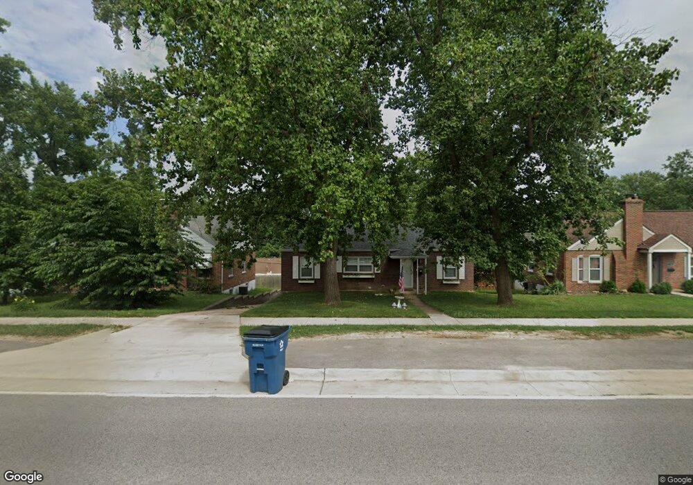
7254 Mackenzie Rd Saint Louis, MO 63123
Estimated Value: $204,000 - $267,000
3
Beds
2
Baths
1,118
Sq Ft
$213/Sq Ft
Est. Value
About This Home
This home is located at 7254 Mackenzie Rd, Saint Louis, MO 63123 and is currently estimated at $238,082, approximately $212 per square foot. 7254 Mackenzie Rd is a home located in St. Louis County with nearby schools including Mesnier Primary School, Gotsch Intermediate School, and Rogers Middle School.
Ownership History
Date
Name
Owned For
Owner Type
Purchase Details
Closed on
Aug 28, 2008
Sold by
K C Elliot Llc
Bought by
Heberlie Eric
Current Estimated Value
Home Financials for this Owner
Home Financials are based on the most recent Mortgage that was taken out on this home.
Original Mortgage
$130,000
Outstanding Balance
$86,693
Interest Rate
6.66%
Mortgage Type
VA
Estimated Equity
$151,389
Purchase Details
Closed on
Jul 31, 2007
Sold by
Jones David Lee and Jones Mary M
Bought by
K C Elliot Llc
Create a Home Valuation Report for This Property
The Home Valuation Report is an in-depth analysis detailing your home's value as well as a comparison with similar homes in the area
Home Values in the Area
Average Home Value in this Area
Purchase History
| Date | Buyer | Sale Price | Title Company |
|---|---|---|---|
| Heberlie Eric | $130,000 | Ort | |
| K C Elliot Llc | $75,000 | Clt |
Source: Public Records
Mortgage History
| Date | Status | Borrower | Loan Amount |
|---|---|---|---|
| Open | Heberlie Eric | $130,000 |
Source: Public Records
Tax History
| Year | Tax Paid | Tax Assessment Tax Assessment Total Assessment is a certain percentage of the fair market value that is determined by local assessors to be the total taxable value of land and additions on the property. | Land | Improvement |
|---|---|---|---|---|
| 2025 | $2,771 | $39,970 | $12,690 | $27,280 |
| 2024 | $2,771 | $34,120 | $9,060 | $25,060 |
| 2023 | $2,679 | $34,120 | $9,060 | $25,060 |
| 2022 | $2,628 | $30,480 | $9,980 | $20,500 |
| 2021 | $2,567 | $30,480 | $9,980 | $20,500 |
| 2020 | $2,530 | $28,030 | $8,820 | $19,210 |
| 2019 | $2,509 | $28,030 | $8,820 | $19,210 |
| 2018 | $2,176 | $21,450 | $6,140 | $15,310 |
| 2016 | $1,864 | $19,630 | $4,090 | $15,540 |
Source: Public Records
Map
Nearby Homes
- 7266 Mackenzie Rd
- 7072 Deerpath Dr
- 6931 Greenholly Dr
- 6870 Foxcroft Dr
- 6119 Archwood Ln
- 6112 Deerwood Dr
- 5201 Kingwood Dr
- 6123 Savio Dr
- 6700 Preservation Pkwy
- 6712 Preservation Pkwy
- 7410 Triwoods Dr Unit I
- 6804 Snowy Owl Ln
- 7647 Genesta St
- 7620 Genesta St
- 7310 Weil Ave
- 6830 Preservation Pkwy
- 7324 Weil Ave
- 5028 Shrewsbury Ave
- 6963 Chippewa St
- 7809 Genesta St
- 7248 Mackenzie Rd
- 7258 Mackenzie Rd
- 7244 Mackenzie Rd
- 7262 Mackenzie Rd
- 7233 Cranston Dr
- 7239 Cranston Dr
- 7221 Cranston Dr
- 7240 Mackenzie Rd
- 7245 Cranston Dr
- 7236 Mackenzie Rd
- 7215 Cranston Dr
- 7272 Mackenzie Rd
- 7251 Cranston Dr
- 7232 Mackenzie Rd
- 7232 Cranston Dr
- 7226 Cranston Dr
- 7211 Cranston Dr
- 7238 Cranston Dr
- 7220 Cranston Dr
- 7280 Mackenzie Rd
Your Personal Tour Guide
Ask me questions while you tour the home.