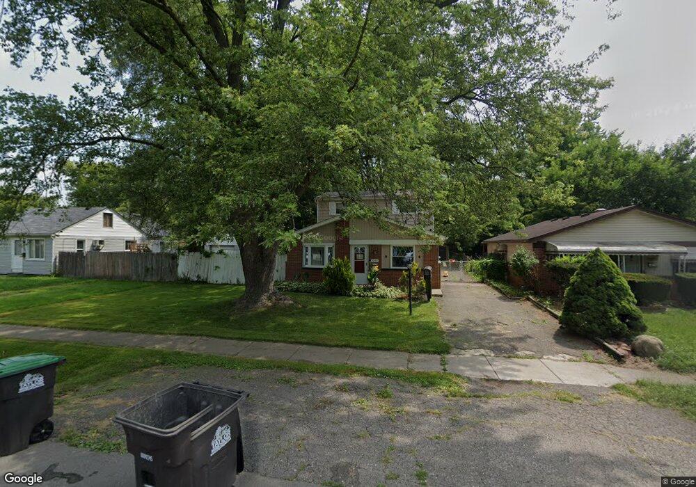
7255 Michael St Unit Bldg-Unit Taylor, MI 48180
Estimated Value: $167,571 - $216,000
Studio
1
Bath
1,444
Sq Ft
$128/Sq Ft
Est. Value
About This Home
This home is located at 7255 Michael St Unit Bldg-Unit, Taylor, MI 48180 and is currently estimated at $184,893, approximately $128 per square foot. 7255 Michael St Unit Bldg-Unit is a home located in Wayne County with nearby schools including Taylor Parks Elementary School, Hoover Middle School, and Taylor High School.
Ownership History
Date
Name
Owned For
Owner Type
Purchase Details
Closed on
Mar 30, 2018
Sold by
Bilbeisi Investments Llc
Bought by
Carr Michael R
Current Estimated Value
Home Financials for this Owner
Home Financials are based on the most recent Mortgage that was taken out on this home.
Original Mortgage
$103,098
Outstanding Balance
$88,518
Interest Rate
4.37%
Mortgage Type
FHA
Estimated Equity
$96,375
Purchase Details
Closed on
Aug 30, 2017
Sold by
Us Bank Na
Bought by
Bilberisi Investments Llc
Purchase Details
Closed on
Jun 20, 2017
Sold by
Wentz Loretta
Bought by
U S Bank N A
Purchase Details
Closed on
Oct 25, 2004
Sold by
Wentz Loretta and Wentz Joseph
Bought by
Wentz Loretta
Purchase Details
Closed on
Jan 13, 1998
Sold by
Win Carolyn J Morris D
Bought by
Jarrell Loretta
Create a Home Valuation Report for This Property
The Home Valuation Report is an in-depth analysis detailing your home's value as well as a comparison with similar homes in the area
Home Values in the Area
Average Home Value in this Area
Purchase History
| Date | Buyer | Sale Price | Title Company |
|---|---|---|---|
| Carr Michael R | $105,000 | Stewart Title | |
| Bilberisi Investments Llc | $37,000 | None Available | |
| U S Bank N A | -- | None Available | |
| Wentz Loretta | -- | First American Title | |
| Jarrell Loretta | $75,000 | -- |
Source: Public Records
Mortgage History
| Date | Status | Borrower | Loan Amount |
|---|---|---|---|
| Open | Carr Michael R | $103,098 |
Source: Public Records
Tax History
| Year | Tax Paid | Tax Assessment Tax Assessment Total Assessment is a certain percentage of the fair market value that is determined by local assessors to be the total taxable value of land and additions on the property. | Land | Improvement |
|---|---|---|---|---|
| 2025 | $2,320 | $74,600 | $0 | $0 |
| 2024 | $2,246 | $68,700 | $0 | $0 |
| 2023 | $2,680 | $63,800 | $0 | $0 |
| 2022 | $2,144 | $56,400 | $0 | $0 |
| 2021 | $2,358 | $53,700 | $0 | $0 |
| 2020 | $2,334 | $48,500 | $0 | $0 |
| 2019 | $233,336 | $44,000 | $0 | $0 |
| 2018 | $1,462 | $34,100 | $0 | $0 |
| 2017 | $1,425 | $34,800 | $0 | $0 |
| 2016 | $2,409 | $33,800 | $0 | $0 |
| 2015 | $3,450 | $34,500 | $0 | $0 |
| 2013 | $3,480 | $36,100 | $0 | $0 |
| 2012 | $1,561 | $35,200 | $10,600 | $24,600 |
Source: Public Records
Map
Nearby Homes
- 25255 Charles St
- 7536 Wilkie St
- 7550 Wilkie St
- 26016 5th St Unit RA196
- 26018 5th St Unit 197
- 26008 3rd St Unit RA086
- 26009 1st St Unit RA005
- 26020 5th St Unit RA198
- 26010 3rd St Unit RA087
- 26012 Gary St Unit RV061
- 6810 Oldham St
- 26017 4th St Unit RA175
- 26020 Gary St Unit RV065
- 26019 2nd St Unit RA070
- 26019 3rd St
- 26017 Gary St Unit RV093
- 26103 3rd St Unit RA125
- 26030 Lori St Unit RV014
- 26107 5th St Unit RA237
- 26034 Gary St Unit RV072
- 7255 Michael St
- 7275 Michael St
- 7237 Michael St
- 7301 Michael St
- 7229 Michael St
- 7325 Michael St
- 7304 Vivian St
- 7270 Vivian St
- 7236 Vivian St
- 7221 Michael St
- 7220 Vivian St
- 7326 Vivian St
- 7240 Michael St
- 7270 Michael St
- 7197 Michael St
- 7204 Vivian St
- 7320 Michael St
- 7196 Vivian St
- 7234 Michael St
- 25275 Charles St
Your Personal Tour Guide
Ask me questions while you tour the home.