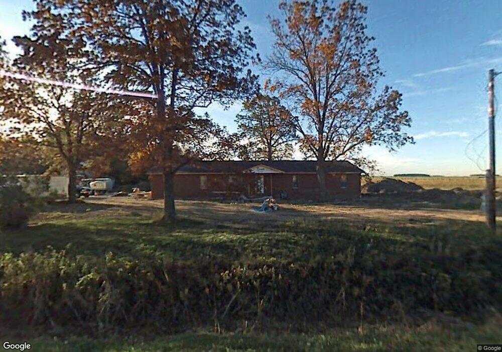
7257 Crocker Rd Rudolph, OH 43462
Estimated Value: $276,000 - $477,623
2
Beds
2
Baths
1,736
Sq Ft
$216/Sq Ft
Est. Value
About This Home
This home is located at 7257 Crocker Rd, Rudolph, OH 43462 and is currently estimated at $374,541, approximately $215 per square foot. 7257 Crocker Rd is a home located in Wood County with nearby schools including Bowling Green High School.
Ownership History
Date
Name
Owned For
Owner Type
Purchase Details
Closed on
Sep 25, 2003
Sold by
Coulter Lance R and Coulter Tina M
Bought by
Sheldrick Paul H and Sheldrick Melody A
Current Estimated Value
Home Financials for this Owner
Home Financials are based on the most recent Mortgage that was taken out on this home.
Original Mortgage
$46,750
Outstanding Balance
$21,996
Interest Rate
6.33%
Mortgage Type
Purchase Money Mortgage
Estimated Equity
$352,545
Create a Home Valuation Report for This Property
The Home Valuation Report is an in-depth analysis detailing your home's value as well as a comparison with similar homes in the area
Home Values in the Area
Average Home Value in this Area
Purchase History
| Date | Buyer | Sale Price | Title Company |
|---|---|---|---|
| Sheldrick Paul H | $55,000 | -- |
Source: Public Records
Mortgage History
| Date | Status | Borrower | Loan Amount |
|---|---|---|---|
| Open | Sheldrick Paul H | $46,750 |
Source: Public Records
Tax History Compared to Growth
Tax History
| Year | Tax Paid | Tax Assessment Tax Assessment Total Assessment is a certain percentage of the fair market value that is determined by local assessors to be the total taxable value of land and additions on the property. | Land | Improvement |
|---|---|---|---|---|
| 2024 | $4,460 | $133,840 | $40,810 | $93,030 |
| 2023 | $4,460 | $133,840 | $40,810 | $93,030 |
| 2021 | $3,869 | $116,310 | $35,530 | $80,780 |
| 2020 | $4,748 | $116,310 | $35,530 | $80,780 |
| 2019 | $4,293 | $100,530 | $28,880 | $71,650 |
| 2018 | $4,269 | $100,530 | $28,880 | $71,650 |
| 2017 | $4,315 | $100,530 | $28,880 | $71,650 |
| 2016 | $3,603 | $84,560 | $24,220 | $60,340 |
| 2015 | $3,603 | $86,350 | $26,010 | $60,340 |
| 2014 | $3,780 | $86,350 | $26,010 | $60,340 |
| 2013 | $3,712 | $86,350 | $26,010 | $60,340 |
Source: Public Records
Map
Nearby Homes
- 0 Potter Rd Unit 6135109
- 20236 Jerry City Rd
- 9863 Mitchell Rd
- 13136 Jerry City Rd
- 0 Jerry City Unit 6135112
- 0 S Dixie Hwy
- 165 Jackson St
- 22767 Defiance Pike
- 22856 Main St
- 233 & 235 N Main St
- 9097 Custar Rd
- 23117 Defiance Pike
- 323 W State St
- 112 N Beecher St
- 211 Patterson Place
- 209 Rudolph Rd
- 318 Belmont St
- 206 Rudolph Rd
- Lot 112 Foley Run
- 0 Eagleville Rd
- 7454 Wingston Rd
- 17205 Bays Rd
- 17261 Bays Rd
- 7910 Wingston Rd
- 17222 Bays Rd
- 17192 Bays Rd
- 17021 Bays Rd
- 17158 Bays Rd
- 17132 Bays Rd
- 17048 Bays Rd
- 16961 Jerry City Rd
- 17092 Bays Rd
- 16996 Bays Rd
- 17605 Bays Rd
- 8045 Wingston Rd
- 8080 Wingston Rd
- 17671 Bays Rd
- 8118 Wingston Rd
- 8141 Wingston Rd
- 17656 Bays Rd