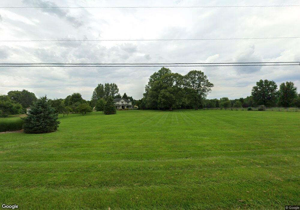
7259 State Route 48 Springboro, OH 45066
Clearcreek Township NeighborhoodEstimated Value: $1,169,000 - $1,298,000
4
Beds
4
Baths
4,248
Sq Ft
$291/Sq Ft
Est. Value
About This Home
This home is located at 7259 State Route 48, Springboro, OH 45066 and is currently estimated at $1,234,600, approximately $290 per square foot. 7259 State Route 48 is a home located in Warren County with nearby schools including Clearcreek Elementary School, Springboro Intermediate School, and Springboro Junior High School.
Ownership History
Date
Name
Owned For
Owner Type
Purchase Details
Closed on
Jul 31, 2014
Sold by
Clark Daniel A
Bought by
Vixie Douglas N and Vixie Marcia R
Current Estimated Value
Home Financials for this Owner
Home Financials are based on the most recent Mortgage that was taken out on this home.
Original Mortgage
$463,000
Outstanding Balance
$335,971
Interest Rate
2.87%
Mortgage Type
Adjustable Rate Mortgage/ARM
Estimated Equity
$898,629
Purchase Details
Closed on
Jun 13, 2011
Sold by
Clark Lynn A
Bought by
Clark Daniel A
Home Financials for this Owner
Home Financials are based on the most recent Mortgage that was taken out on this home.
Original Mortgage
$410,000
Interest Rate
4.75%
Mortgage Type
Future Advance Clause Open End Mortgage
Purchase Details
Closed on
Apr 29, 2008
Sold by
Link Scott and Link Jennifer E
Bought by
Clark Daniel A and Clark Lynn A
Home Financials for this Owner
Home Financials are based on the most recent Mortgage that was taken out on this home.
Original Mortgage
$576,000
Interest Rate
5.12%
Mortgage Type
Purchase Money Mortgage
Purchase Details
Closed on
Sep 12, 2006
Sold by
Morris Richard D and Morris Betty J
Bought by
Link Scott and Link Jennifer E
Home Financials for this Owner
Home Financials are based on the most recent Mortgage that was taken out on this home.
Original Mortgage
$475,900
Interest Rate
5.5%
Mortgage Type
Purchase Money Mortgage
Purchase Details
Closed on
May 1, 2000
Sold by
Davis Kay A
Bought by
Morris Richard D and Morris Betty J
Purchase Details
Closed on
Oct 15, 1991
Sold by
Gray Joan B and Gray Joan B
Bought by
Davis and Davis Michael H
Purchase Details
Closed on
Aug 28, 1990
Sold by
Gray John D and Gray Joan B.
Bought by
Gray and Gray Joan B
Purchase Details
Closed on
Jun 23, 1988
Sold by
Lawton George and Lawton George
Bought by
Gray and Gray John D
Create a Home Valuation Report for This Property
The Home Valuation Report is an in-depth analysis detailing your home's value as well as a comparison with similar homes in the area
Home Values in the Area
Average Home Value in this Area
Purchase History
| Date | Buyer | Sale Price | Title Company |
|---|---|---|---|
| Vixie Douglas N | $579,000 | None Available | |
| Clark Daniel A | -- | Triad Title Agency Inc | |
| Clark Daniel A | $720,000 | Triad Title Agency Inc | |
| Link Scott | $675,900 | Classic Title | |
| Morris Richard D | $85,000 | -- | |
| Davis | $52,500 | -- | |
| Gray | -- | -- | |
| Gray | $42,000 | -- |
Source: Public Records
Mortgage History
| Date | Status | Borrower | Loan Amount |
|---|---|---|---|
| Open | Vixie Douglas N | $463,000 | |
| Previous Owner | Clark Daniel A | $410,000 | |
| Previous Owner | Clark Daniel A | $576,000 | |
| Previous Owner | Link Scott | $475,900 |
Source: Public Records
Tax History Compared to Growth
Tax History
| Year | Tax Paid | Tax Assessment Tax Assessment Total Assessment is a certain percentage of the fair market value that is determined by local assessors to be the total taxable value of land and additions on the property. | Land | Improvement |
|---|---|---|---|---|
| 2024 | $15,059 | $368,740 | $114,600 | $254,140 |
| 2023 | $12,833 | $294,924 | $68,743 | $226,180 |
| 2022 | $12,833 | $294,924 | $68,744 | $226,181 |
| 2021 | $12,074 | $294,924 | $68,744 | $226,181 |
| 2020 | $11,348 | $239,775 | $55,888 | $183,887 |
| 2019 | $10,517 | $239,775 | $55,888 | $183,887 |
| 2018 | $10,515 | $239,775 | $55,888 | $183,887 |
| 2017 | $9,911 | $203,301 | $47,331 | $155,971 |
| 2016 | $10,314 | $203,301 | $47,331 | $155,971 |
| 2015 | $10,329 | $203,301 | $47,331 | $155,971 |
| 2014 | $10,283 | $191,120 | $45,350 | $145,770 |
| 2013 | $10,279 | $232,610 | $52,090 | $180,520 |
Source: Public Records
Map
Nearby Homes
- 7491 Country Brook Ct
- 441 Ohio 73
- 441 E State Route 73
- 1744 Harlan Rd
- 6455 N St Rt 48
- 710 White Cedar Way
- 0 Voltaire Ct Unit 1863060
- 8234 Voltaire Ct
- 8236 Wilde Ct
- 0 White Cedar Way Unit 1818661
- 7940 Bunnell Hill Rd
- 7412 Larkspur Ct
- 2566 E Lower Springboro Rd
- 2693 Ohio 73
- 8670 Hawthorne Place
- 639 Birchcreek Way
- 6415 Township Line Rd
- 7 Cumberland Ct
- 3 Cumberland Ct
- 6 Cumberland Ct
- 7259 State Route 48
- 7131 Ohio 48
- 7131 State Route 48
- 7131 State Route 48
- 7117 St Rt 48
- 7117 State Route 48
- 7257 State Route 48
- 7263 Ohio 48
- 7263 State Route 48
- 7048 State Route 48
- 7355 State Route 48
- 7371 State Route 48
- 7071 Ohio 48
- 7071 State Route 48
- 7071 State Route 48
- 7000 State Route 48
- 7101 Ohio 48
- 7101 Ohio 48
- 7399 State Route 48
- 7101 State Route 48
