Estimated Value: $189,320 - $259,000
3
Beds
1
Bath
1,216
Sq Ft
$187/Sq Ft
Est. Value
About This Home
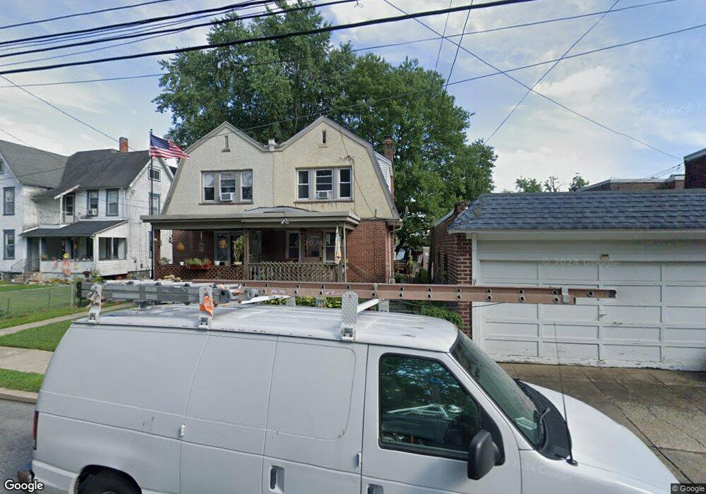
This home is located at 726 Bartram Ave, Darby, PA 19023 and is currently estimated at $227,830, approximately $187 per square foot. 726 Bartram Ave is a home located in Delaware County with nearby schools including Harris School, Academy Park High School, and Liberty Baptist Academy.
Ownership History
Date
Name
Owned For
Owner Type
Purchase Details
Closed on
Jun 11, 2003
Sold by
Dambrosio Michael A and Dambrosio Mary Jane
Bought by
Purcell Jamal
Current Estimated Value
Home Financials for this Owner
Home Financials are based on the most recent Mortgage that was taken out on this home.
Original Mortgage
$79,705
Outstanding Balance
$34,889
Interest Rate
5.77%
Mortgage Type
Purchase Money Mortgage
Estimated Equity
$192,941
Create a Home Valuation Report for This Property
The Home Valuation Report is an in-depth analysis detailing your home's value as well as a comparison with similar homes in the area
Home Values in the Area
Average Home Value in this Area
Purchase History
| Date | Buyer | Sale Price | Title Company |
|---|---|---|---|
| Purcell Jamal | $83,900 | -- |
Source: Public Records
Mortgage History
| Date | Status | Borrower | Loan Amount |
|---|---|---|---|
| Open | Purcell Jamal | $79,705 |
Source: Public Records
Tax History Compared to Growth
Tax History
| Year | Tax Paid | Tax Assessment Tax Assessment Total Assessment is a certain percentage of the fair market value that is determined by local assessors to be the total taxable value of land and additions on the property. | Land | Improvement |
|---|---|---|---|---|
| 2025 | $3,874 | $85,550 | $20,540 | $65,010 |
| 2024 | $3,874 | $85,550 | $20,540 | $65,010 |
| 2023 | $3,772 | $85,550 | $20,540 | $65,010 |
| 2022 | $3,628 | $85,550 | $20,540 | $65,010 |
| 2021 | $4,997 | $85,550 | $20,540 | $65,010 |
| 2020 | $3,971 | $62,470 | $16,920 | $45,550 |
| 2019 | $3,828 | $62,470 | $16,920 | $45,550 |
| 2018 | $3,743 | $62,470 | $0 | $0 |
| 2017 | $3,673 | $62,470 | $0 | $0 |
| 2016 | $343 | $62,470 | $0 | $0 |
| 2015 | $343 | $62,470 | $0 | $0 |
| 2014 | $343 | $62,470 | $0 | $0 |
Source: Public Records
Map
Nearby Homes
- 815 Clifton Ave
- 921 Pitman Ave
- 924 Pitman Ave
- 933 Bedford Ave
- 308 Clifton Ave
- 1011 Clifton Ave
- 909 Walnut St
- 605 Andrews Ave
- 222 Collingdale Ave
- 416 Jackson Ave
- 230 Felton Ave
- 515 Andrews Ave
- 235 Felton Ave
- 1018 Broad St
- 316 Westmont Dr
- 1011 Andrews Ave
- 539 Pershing Ave
- 1025 Andrews Ave
- 1119 Chestnut St
- 238 Jackson Ave
- 724 Bartram Ave
- 619 Clifton Ave
- 621 Clifton Ave
- 617 Clifton Ave
- 615 Clifton Ave
- 722 Bartram Ave
- 613 Clifton Ave
- 714 Bartram Ave
- 727 Bartram Ave Unit 727 Bartram
- 727 Bartram Ave
- 703 Clifton Ave Unit A
- 703 Clifton Ave
- 609 Clifton Ave
- 712 Bartram Ave
- 725 Bartram Ave
- 725 Bartram Ave
- 719 Blackstone Ave
- 709 Clifton Ave
- 612 Clifton Ave
- 717 Blackstone Ave