Estimated Value: $178,000 - $207,816
4
Beds
1
Bath
1,538
Sq Ft
$128/Sq Ft
Est. Value
About This Home
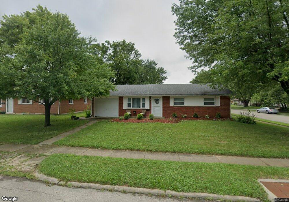
This home is located at 726 Buckskin Trail, Xenia, OH 45385 and is currently estimated at $196,454, approximately $127 per square foot. 726 Buckskin Trail is a home located in Greene County with nearby schools including Xenia High School, Summit Academy Community School for Alternative Learners - Xenia, and Legacy Christian Academy.
Ownership History
Date
Name
Owned For
Owner Type
Purchase Details
Closed on
Apr 16, 2018
Sold by
Wilson Timothy
Bought by
Kincade Jonathan D and Moore Jessica M
Current Estimated Value
Home Financials for this Owner
Home Financials are based on the most recent Mortgage that was taken out on this home.
Original Mortgage
$95,060
Outstanding Balance
$81,750
Interest Rate
4.44%
Mortgage Type
New Conventional
Estimated Equity
$114,704
Purchase Details
Closed on
Jan 17, 2017
Bought by
Wilson Lou Ellen
Purchase Details
Closed on
Mar 13, 1998
Sold by
Brammer John K and Brammer Melanie L
Bought by
Wilson Roger A and Wilson Lou Ellen
Home Financials for this Owner
Home Financials are based on the most recent Mortgage that was taken out on this home.
Original Mortgage
$68,700
Interest Rate
7.14%
Create a Home Valuation Report for This Property
The Home Valuation Report is an in-depth analysis detailing your home's value as well as a comparison with similar homes in the area
Home Values in the Area
Average Home Value in this Area
Purchase History
| Date | Buyer | Sale Price | Title Company |
|---|---|---|---|
| Kincade Jonathan D | $98,000 | None Available | |
| Wilson Lou Ellen | -- | -- | |
| Wilson Roger A | $85,900 | Home Site Title Agency Inc |
Source: Public Records
Mortgage History
| Date | Status | Borrower | Loan Amount |
|---|---|---|---|
| Open | Kincade Jonathan D | $95,060 | |
| Previous Owner | Wilson Roger A | $68,700 |
Source: Public Records
Tax History Compared to Growth
Tax History
| Year | Tax Paid | Tax Assessment Tax Assessment Total Assessment is a certain percentage of the fair market value that is determined by local assessors to be the total taxable value of land and additions on the property. | Land | Improvement |
|---|---|---|---|---|
| 2024 | $2,291 | $53,530 | $10,570 | $42,960 |
| 2023 | $2,291 | $53,530 | $10,570 | $42,960 |
| 2022 | $1,934 | $38,550 | $6,220 | $32,330 |
| 2021 | $1,960 | $38,550 | $6,220 | $32,330 |
| 2020 | $1,878 | $38,550 | $6,220 | $32,330 |
| 2019 | $1,491 | $28,820 | $6,300 | $22,520 |
| 2018 | $1,043 | $28,820 | $6,300 | $22,520 |
| 2017 | $869 | $28,820 | $6,300 | $22,520 |
| 2016 | $869 | $25,620 | $6,300 | $19,320 |
| 2015 | $872 | $25,620 | $6,300 | $19,320 |
| 2014 | $834 | $25,620 | $6,300 | $19,320 |
Source: Public Records
Map
Nearby Homes
- 1144 Rockwell Dr
- 1208 Bellbrook Ave
- 1272 Bellbrook Ave
- 1342 Kylemore Dr
- 1618 Navajo Dr
- 1778 Arapaho Dr
- 1568 Cheyenne Dr
- 1223 June Dr
- 1233 June Dr
- 1283 June Dr
- 1391 June Dr
- 1653 Seneca Dr
- 1403 Texas Dr
- 1769 Gayhart Dr
- 121 S Progress Dr
- 305-325 Bellbrook Ave
- 1866 Roxbury Dr
- 1829 Gayhart Dr
- 453 Walnut St
- 2758 Wyoming Dr
- 738 Buckskin Trail
- 801 Moccasin Trail
- 702 Buckskin Trail
- 766 Buckskin Trail
- 813 Moccasin Trail
- 733 Buckskin Trail
- 717 Buckskin Trail
- 802 Moccasin Trail
- 796 Buckskin Trail
- 690 Buckskin Trail
- 745 Buckskin Trail
- 707 Buckskin Trail
- 825 Moccasin Trail
- 808 Buckskin Trail
- 816 Moccasin Trail
- 753 Buckskin Trail
- 693 Buckskin Trail
- 678 Buckskin Trail
- 820 Buckskin Trail
- 828 Moccasin Trail