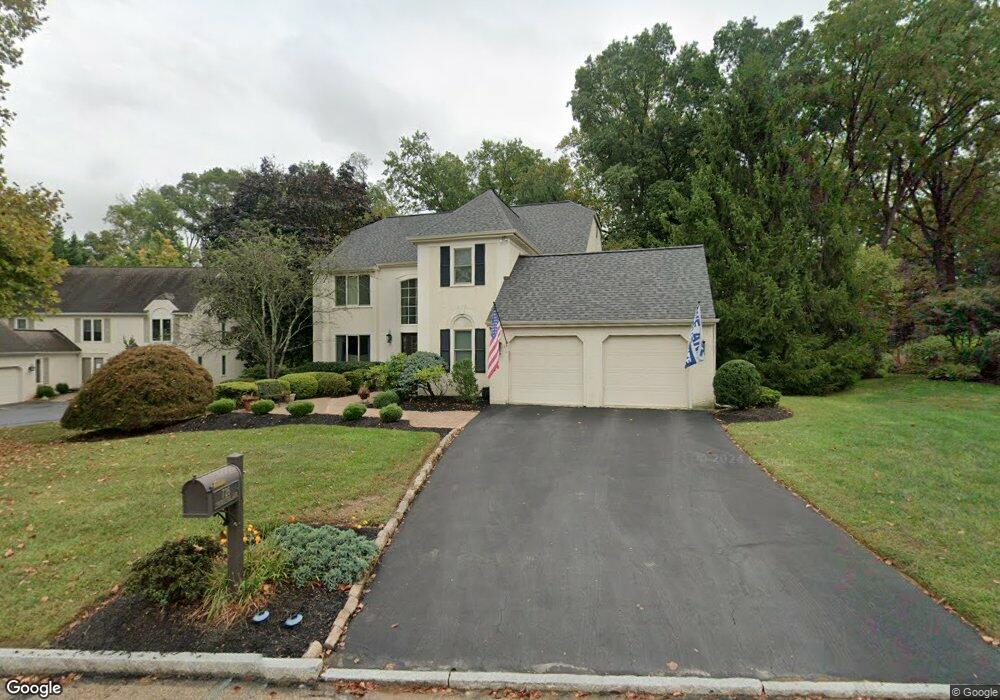
726 Cornerstone Ln Bryn Mawr, PA 19010
Estimated Value: $1,093,836 - $1,481,000
4
Beds
3
Baths
3,360
Sq Ft
$367/Sq Ft
Est. Value
About This Home
This home is located at 726 Cornerstone Ln, Bryn Mawr, PA 19010 and is currently estimated at $1,231,459, approximately $366 per square foot. 726 Cornerstone Ln is a home located in Delaware County with nearby schools including Ithan Elementary School, Radnor Middle School, and Radnor Senior High School.
Ownership History
Date
Name
Owned For
Owner Type
Purchase Details
Closed on
Apr 24, 1997
Sold by
Volochine Anatoly P and Volochine Galina
Bought by
Abrams Andrew C and Abrams Wendy F
Current Estimated Value
Home Financials for this Owner
Home Financials are based on the most recent Mortgage that was taken out on this home.
Original Mortgage
$214,500
Outstanding Balance
$27,636
Interest Rate
7.85%
Mortgage Type
Purchase Money Mortgage
Estimated Equity
$1,203,823
Purchase Details
Closed on
Nov 8, 1995
Sold by
Volochine Anatoly P
Bought by
Volochine Anatoly P and Volochine Galina
Purchase Details
Closed on
Oct 8, 1994
Sold by
Fusco Vincent A and Fusco Sharon
Bought by
Volochine Anatoly P
Home Financials for this Owner
Home Financials are based on the most recent Mortgage that was taken out on this home.
Original Mortgage
$243,000
Interest Rate
9.17%
Mortgage Type
Purchase Money Mortgage
Create a Home Valuation Report for This Property
The Home Valuation Report is an in-depth analysis detailing your home's value as well as a comparison with similar homes in the area
Home Values in the Area
Average Home Value in this Area
Purchase History
| Date | Buyer | Sale Price | Title Company |
|---|---|---|---|
| Abrams Andrew C | $405,000 | Commonwealth Land Title Ins | |
| Volochine Anatoly P | -- | -- | |
| Volochine Anatoly P | $405,000 | Commonwealth Land Title Ins |
Source: Public Records
Mortgage History
| Date | Status | Borrower | Loan Amount |
|---|---|---|---|
| Open | Abrams Andrew C | $214,500 | |
| Previous Owner | Volochine Anatoly P | $243,000 |
Source: Public Records
Tax History Compared to Growth
Tax History
| Year | Tax Paid | Tax Assessment Tax Assessment Total Assessment is a certain percentage of the fair market value that is determined by local assessors to be the total taxable value of land and additions on the property. | Land | Improvement |
|---|---|---|---|---|
| 2025 | $13,988 | $615,000 | $193,800 | $421,200 |
| 2024 | $13,988 | $691,840 | $193,800 | $498,040 |
| 2023 | $13,433 | $691,840 | $193,800 | $498,040 |
| 2022 | $13,287 | $691,840 | $193,800 | $498,040 |
| 2021 | $21,342 | $691,840 | $193,800 | $498,040 |
| 2020 | $13,717 | $394,320 | $157,660 | $236,660 |
| 2019 | $13,330 | $394,320 | $157,660 | $236,660 |
| 2018 | $13,069 | $394,320 | $0 | $0 |
| 2017 | $12,795 | $394,320 | $0 | $0 |
| 2016 | $2,164 | $394,320 | $0 | $0 |
| 2015 | $2,164 | $394,320 | $0 | $0 |
| 2014 | $2,164 | $394,320 | $0 | $0 |
Source: Public Records
Map
Nearby Homes
- 124 Carli Dr
- 700 S Roberts Rd
- 403 Atwater Rd
- 39 Haymarket Ln
- 560 S Bryn Mawr Ave
- 937 Hunt Rd
- 130 Drakes Drum Dr
- 119 Bella Dr Unit 2MD
- 633 Foxfields Rd
- 115 Bella Dr Unit 4
- 117 Bella Dr Unit 3AD
- 209 James Rd
- 408 Barbara Ln Unit B
- 306 Summit Dr
- 103 Summit Dr Unit A
- 103 Summit Dr Unit B
- 202 Summit Dr Unit B
- 813 Hunt Rd
- 4302 Parkview Dr
- 40 Parkridge Dr Unit 40
- 728 Cornerstone Ln
- 724 Cornerstone Ln
- 723 Cornerstone Ln
- 730 Cornerstone Ln
- 721 Cornerstone Ln
- 722 Cornerstone Ln
- 732 Cornerstone Ln
- 727 Cornerstone Ln
- 57 Brennan Dr
- 65 Brennan Dr
- 719 Cornerstone Ln
- 61 Brennan Dr
- 9 Fieldstone Ln
- 720 Cornerstone Ln
- 734 Cornerstone Ln
- 53 Brennan Dr
- 717 Cornerstone Ln
- 5 Fieldstone Ln
- 729 Cornerstone Ln
- 69 Brennan Dr