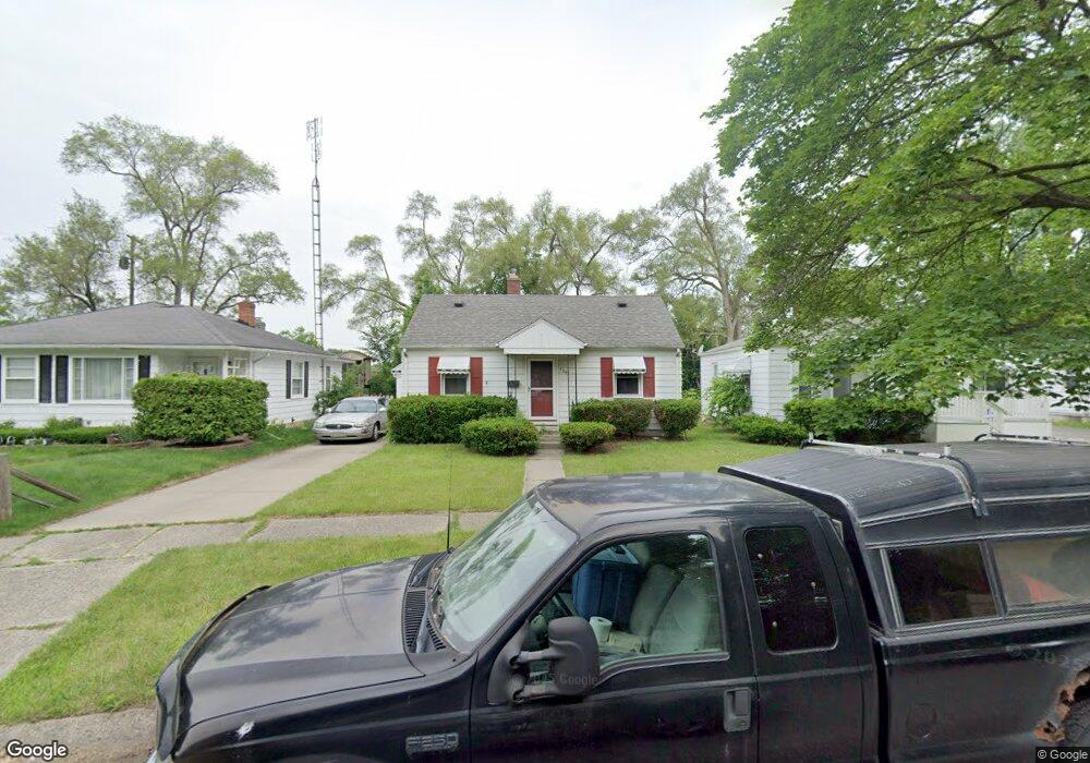
726 Hubbard Ave Flint, MI 48503
Glendale NeighborhoodEstimated Value: $58,000 - $70,000
3
Beds
1
Bath
938
Sq Ft
$69/Sq Ft
Est. Value
About This Home
This home is located at 726 Hubbard Ave, Flint, MI 48503 and is currently estimated at $65,012, approximately $69 per square foot. 726 Hubbard Ave is a home located in Genesee County with nearby schools including Durant-Tuuri-Mott Elementary School, St. Paul Lutheran School, and First Flint Seventh-day Adventist Christian School.
Ownership History
Date
Name
Owned For
Owner Type
Purchase Details
Closed on
Aug 1, 2019
Sold by
Lazar Paul A and Lazar Susan P
Bought by
Goldsmith Gloria Jean
Current Estimated Value
Purchase Details
Closed on
Jan 26, 2005
Sold by
Trantham Arla Kay and Gill Arla Kaye
Bought by
Lazar Paul A and Kirby Susan P
Purchase Details
Closed on
May 1, 2000
Sold by
Trantham W Trantham A and Trantham C J
Bought by
Trantham Arla Kaye
Create a Home Valuation Report for This Property
The Home Valuation Report is an in-depth analysis detailing your home's value as well as a comparison with similar homes in the area
Home Values in the Area
Average Home Value in this Area
Purchase History
| Date | Buyer | Sale Price | Title Company |
|---|---|---|---|
| Goldsmith Gloria Jean | -- | None Available | |
| Lazar Paul A | $53,000 | Cislo Title Company | |
| Trantham Arla Kaye | -- | Metropolitan Title Company |
Source: Public Records
Tax History
| Year | Tax Paid | Tax Assessment Tax Assessment Total Assessment is a certain percentage of the fair market value that is determined by local assessors to be the total taxable value of land and additions on the property. | Land | Improvement |
|---|---|---|---|---|
| 2025 | $1,040 | $28,500 | $0 | $0 |
| 2024 | $940 | $23,800 | $0 | $0 |
| 2023 | $923 | $17,500 | $0 | $0 |
| 2022 | $0 | $13,900 | $0 | $0 |
| 2021 | $960 | $13,900 | $0 | $0 |
| 2020 | $864 | $12,600 | $0 | $0 |
| 2019 | $1,067 | $12,400 | $0 | $0 |
| 2018 | $1,066 | $12,100 | $0 | $0 |
| 2017 | $1,077 | $0 | $0 | $0 |
| 2016 | $1,070 | $0 | $0 | $0 |
| 2015 | -- | $0 | $0 | $0 |
| 2014 | -- | $0 | $0 | $0 |
| 2012 | -- | $15,300 | $0 | $0 |
Source: Public Records
Map
Nearby Homes
- 3302 Van Buren Ave
- 916 Mann Ave
- 3517 Norwood Dr
- 0000 Beecher Rd
- 960 Mann Ave
- 863 Tacken St
- 3709 Brentwood Dr
- 976 Barney Ave
- 3824 Mann Hall Ave
- 911 Hughes Ave
- 870 Tacken St
- 3617 Sherwood Dr
- 874 Tacken St
- 3320 Pencombe Place
- 612 Bradley Ave
- 1017 Stocker Ave
- 320 Sheffield Ave
- 932 Bradley Ave
- 314 Sheffield Ave
- 2663 W Court St
- 722 Hubbard Ave
- 730 Hubbard Ave
- 718 Hubbard Ave
- 734 Hubbard Ave
- 729 Westcombe Ave
- 725 Westcombe Ave
- 714 Hubbard Ave
- 721 Westcombe Ave
- 727 Hubbard Ave
- 719 Hubbard Ave
- 802 Hubbard Ave
- 733 Westcombe Ave
- 733 Hubbard Ave
- 710 Hubbard Ave
- 717 Westcombe Ave
- 711 Hubbard Ave
- 713 Westcombe Ave
- 801 Hubbard Ave
- 806 Hubbard Ave
- 706 Hubbard Ave
Your Personal Tour Guide
Ask me questions while you tour the home.