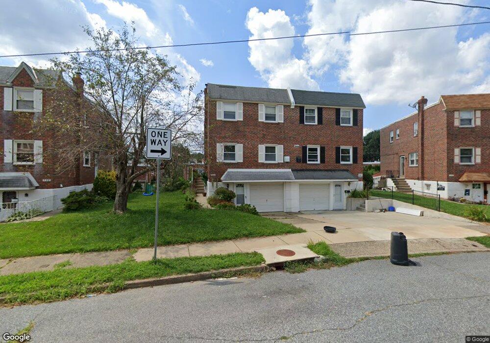
726 Kentwood St Philadelphia, PA 19116
Somerton NeighborhoodEstimated Value: $339,000 - $386,000
4
Beds
1
Bath
1,554
Sq Ft
$235/Sq Ft
Est. Value
About This Home
This home is located at 726 Kentwood St, Philadelphia, PA 19116 and is currently estimated at $365,928, approximately $235 per square foot. 726 Kentwood St is a home with nearby schools including Loesche William H School, CCA Baldi Middle School, and George Washington High School.
Ownership History
Date
Name
Owned For
Owner Type
Purchase Details
Closed on
Aug 15, 2007
Sold by
Ginsburg Morton and Ginsberg Marilynne E
Bought by
Punnoose Sajini T
Current Estimated Value
Home Financials for this Owner
Home Financials are based on the most recent Mortgage that was taken out on this home.
Original Mortgage
$223,198
Outstanding Balance
$141,533
Interest Rate
6.78%
Mortgage Type
FHA
Estimated Equity
$224,395
Create a Home Valuation Report for This Property
The Home Valuation Report is an in-depth analysis detailing your home's value as well as a comparison with similar homes in the area
Home Values in the Area
Average Home Value in this Area
Purchase History
| Date | Buyer | Sale Price | Title Company |
|---|---|---|---|
| Punnoose Sajini T | $225,000 | None Available |
Source: Public Records
Mortgage History
| Date | Status | Borrower | Loan Amount |
|---|---|---|---|
| Open | Punnoose Sajini T | $223,198 |
Source: Public Records
Tax History Compared to Growth
Tax History
| Year | Tax Paid | Tax Assessment Tax Assessment Total Assessment is a certain percentage of the fair market value that is determined by local assessors to be the total taxable value of land and additions on the property. | Land | Improvement |
|---|---|---|---|---|
| 2026 | $3,782 | $334,800 | $66,960 | $267,840 |
| 2025 | $3,782 | $334,800 | $66,960 | $267,840 |
| 2024 | $3,782 | $334,800 | $66,960 | $267,840 |
| 2023 | $3,782 | $270,200 | $54,040 | $216,160 |
| 2022 | $2,360 | $225,200 | $54,040 | $171,160 |
| 2021 | $2,990 | $0 | $0 | $0 |
| 2020 | $2,990 | $0 | $0 | $0 |
| 2019 | $2,815 | $0 | $0 | $0 |
| 2018 | $2,238 | $0 | $0 | $0 |
| 2017 | $2,658 | $0 | $0 | $0 |
| 2016 | $2,238 | $0 | $0 | $0 |
| 2015 | $2,143 | $0 | $0 | $0 |
| 2014 | -- | $189,900 | $49,280 | $140,620 |
| 2012 | -- | $25,312 | $5,570 | $19,742 |
Source: Public Records
Map
Nearby Homes
- 770 Selmer Rd
- 10236 Selmer Terrace
- 10236 Jeanes St
- 10752 Jeanes St
- 412 Avon Place
- 1120 Chesworth Rd
- 859 Selmer Rd
- 375 Avon St
- 9975 Woodfern Rd
- 1112 Selmer Rd
- 9945 Jeanes St
- 9962 Woodfern Rd
- 11003 Stevens Rd
- 9933 Medway Rd
- 11012 Audubon Ave
- 9908 00 Bustleton Ave Unit F9
- 813 Piermont St
- 9949 Woodfern Rd
- 9908 Bustleton Ave Unit H23
- 825 Delray St
- 724 Kentwood St
- 728 Kentwood St
- 730 Kentwood St
- 722 Kentwood St
- 720 Kentwood St
- 715 Greymont St
- 732 Kentwood St
- 713 Greymont St
- 717 Greymont St
- 711 Greymont St
- 719 Greymont St
- 734 Kentwood St
- 709 Greymont St
- 718 Kentwood St
- 721 Greymont St
- 736 Kentwood St
- 707 Greymont St
- 716 Kentwood St
- 723 Greymont St
- 738 Kentwood St