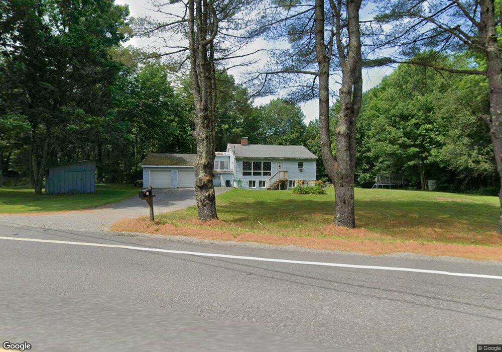
726 Smithfield Rd Belgrade, ME 04917
Estimated Value: $298,414 - $404,000
3
Beds
2
Baths
1,836
Sq Ft
$185/Sq Ft
Est. Value
About This Home
This home is located at 726 Smithfield Rd, Belgrade, ME 04917 and is currently estimated at $338,854, approximately $184 per square foot. 726 Smithfield Rd is a home located in Kennebec County with nearby schools including Ralph M. Atwood Primary School, China Primary School, and Williams Elementary School.
Ownership History
Date
Name
Owned For
Owner Type
Purchase Details
Closed on
Nov 29, 2010
Sold by
Harfoush Belinda L
Bought by
Terrill Derick R and Terrill Jillian J
Current Estimated Value
Home Financials for this Owner
Home Financials are based on the most recent Mortgage that was taken out on this home.
Original Mortgage
$134,900
Outstanding Balance
$87,864
Interest Rate
4.25%
Mortgage Type
Commercial
Estimated Equity
$250,990
Create a Home Valuation Report for This Property
The Home Valuation Report is an in-depth analysis detailing your home's value as well as a comparison with similar homes in the area
Home Values in the Area
Average Home Value in this Area
Purchase History
| Date | Buyer | Sale Price | Title Company |
|---|---|---|---|
| Terrill Derick R | -- | -- |
Source: Public Records
Mortgage History
| Date | Status | Borrower | Loan Amount |
|---|---|---|---|
| Open | Terrill Derick R | $134,900 |
Source: Public Records
Tax History
| Year | Tax Paid | Tax Assessment Tax Assessment Total Assessment is a certain percentage of the fair market value that is determined by local assessors to be the total taxable value of land and additions on the property. | Land | Improvement |
|---|---|---|---|---|
| 2025 | $2,463 | $232,400 | $42,800 | $189,600 |
| 2024 | $2,208 | $232,400 | $42,800 | $189,600 |
| 2023 | $2,080 | $232,400 | $42,800 | $189,600 |
| 2022 | $1,989 | $129,300 | $31,800 | $97,500 |
| 2021 | $1,989 | $129,300 | $31,800 | $97,500 |
| 2020 | $1,989 | $129,300 | $31,800 | $97,500 |
| 2019 | $1,989 | $129,300 | $31,800 | $97,500 |
| 2018 | $1,888 | $129,300 | $31,800 | $97,500 |
| 2017 | $1,862 | $129,300 | $31,800 | $97,500 |
| 2016 | $1,810 | $129,300 | $31,800 | $97,500 |
| 2015 | $1,753 | $128,400 | $31,800 | $96,600 |
| 2013 | $1,534 | $128,400 | $31,800 | $96,600 |
Source: Public Records
Map
Nearby Homes
- 0 Mutton Hill Rd Unit 1624223
- Lot 5 Horse Point Rd
- 303 McGrath Pond Rd
- 9 Snug Harbor Rd
- 19 Olivia Ave
- 20 E Side Trail
- 106 Pinewoods Trail
- 269 Summer St
- 117 Taylor Woods Rd
- 103 Taylor Woods Rd
- Lot 11 McGrath Pond Loop Rd
- 133 Smithfield Rd
- 30 Porter Dr
- 21 Delisle Ln
- 71 Smithfield Rd
- Lot 13 Jacques Ln
- 11 Jacques Ln
- 66 Summer St
- 12 Jacques Ln
- 122 Belgrade Rd
- 0 Rainbow Rd Unit 649195
- 0 Rainbow Rd Unit 1029169
- 736 Smithfield Rd
- 716 Smithfield Rd
- 17 Rainbow Rd
- 711 Smithfield Rd
- 746 Smithfield Rd
- 27 Rainbow Rd
- 754 Smithfield Rd
- 30 Rainbow Rd
- 17 Horseshoe Ln
- 11 Horseshoe Ln
- 692 Smithfield Rd
- 691 Smithfield Rd
- 772 Smithfield Rd
- 764 Smithfield Rd
- 771 Smithfield Rd
- 677 Smithfield Rd
- 662 Smithfield Rd
- 788 Smithfield Rd