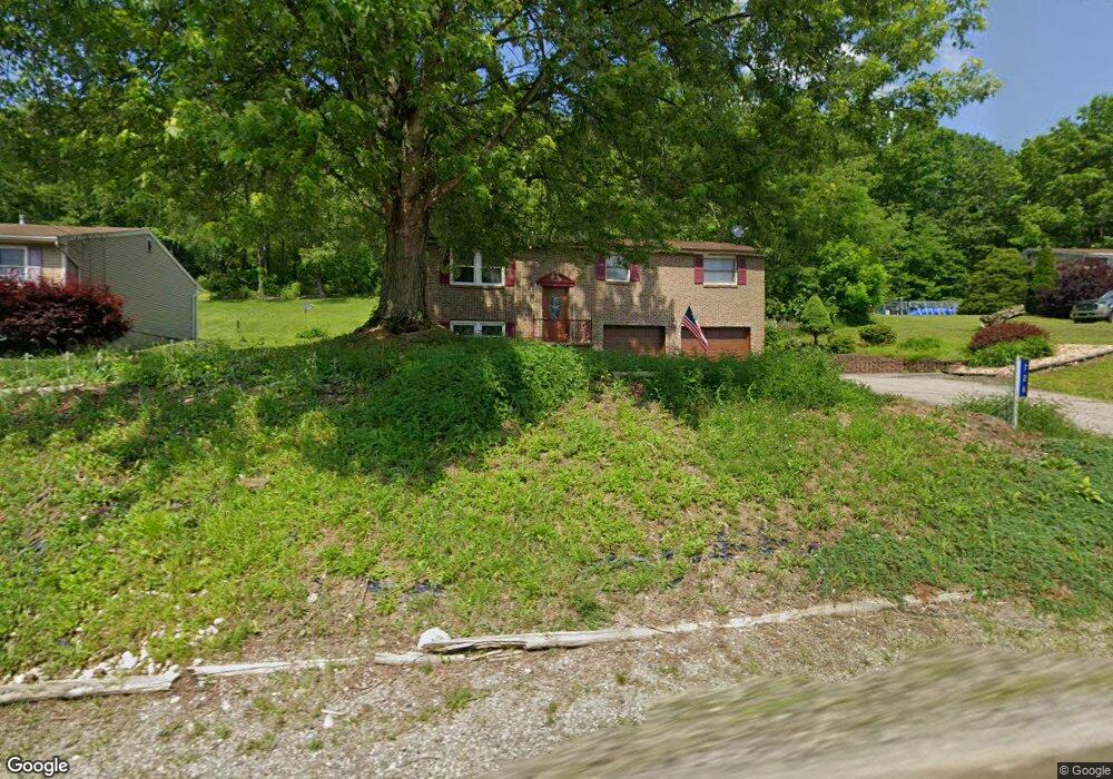
726 State Route 356 Apollo, PA 15613
Allegheny Township NeighborhoodEstimated Value: $116,547 - $280,000
3
Beds
2
Baths
--
Sq Ft
0.59
Acres
About This Home
This home is located at 726 State Route 356, Apollo, PA 15613 and is currently estimated at $228,387. 726 State Route 356 is a home located in Westmoreland County with nearby schools including Kiski Area High School.
Ownership History
Date
Name
Owned For
Owner Type
Purchase Details
Closed on
Oct 23, 2009
Sold by
Ray Roger K and Ray Melissa S
Bought by
Stang Sonya E and Stang Kurt C
Current Estimated Value
Home Financials for this Owner
Home Financials are based on the most recent Mortgage that was taken out on this home.
Original Mortgage
$117,300
Outstanding Balance
$76,517
Interest Rate
5.06%
Mortgage Type
New Conventional
Estimated Equity
$151,870
Purchase Details
Closed on
Feb 9, 2001
Sold by
Schmude Thomas E and Schmude Judith M
Bought by
Ray Roger K and Ray Melissa S
Home Financials for this Owner
Home Financials are based on the most recent Mortgage that was taken out on this home.
Original Mortgage
$85,000
Interest Rate
7.08%
Mortgage Type
Purchase Money Mortgage
Create a Home Valuation Report for This Property
The Home Valuation Report is an in-depth analysis detailing your home's value as well as a comparison with similar homes in the area
Home Values in the Area
Average Home Value in this Area
Purchase History
| Date | Buyer | Sale Price | Title Company |
|---|---|---|---|
| Stang Sonya E | $115,000 | None Available | |
| Ray Roger K | $95,000 | -- |
Source: Public Records
Mortgage History
| Date | Status | Borrower | Loan Amount |
|---|---|---|---|
| Open | Stang Sonya E | $117,300 | |
| Previous Owner | Ray Roger K | $85,000 |
Source: Public Records
Tax History Compared to Growth
Tax History
| Year | Tax Paid | Tax Assessment Tax Assessment Total Assessment is a certain percentage of the fair market value that is determined by local assessors to be the total taxable value of land and additions on the property. | Land | Improvement |
|---|---|---|---|---|
| 2025 | $3,936 | $25,950 | $3,630 | $22,320 |
| 2024 | $3,734 | $25,950 | $3,630 | $22,320 |
| 2023 | $3,414 | $25,950 | $3,630 | $22,320 |
| 2022 | $3,337 | $25,950 | $3,630 | $22,320 |
| 2021 | $3,337 | $25,950 | $3,630 | $22,320 |
| 2020 | $3,328 | $25,950 | $3,630 | $22,320 |
| 2019 | $3,315 | $25,950 | $3,630 | $22,320 |
| 2018 | $3,263 | $25,950 | $3,630 | $22,320 |
| 2017 | $3,186 | $25,950 | $3,630 | $22,320 |
| 2016 | $3,138 | $25,950 | $3,630 | $22,320 |
| 2015 | $3,138 | $25,950 | $3,630 | $22,320 |
| 2014 | $3,122 | $25,950 | $3,630 | $22,320 |
Source: Public Records
Map
Nearby Homes
- 620 Cedar Ridge Dr
- 894 State Route 356
- 844 Hawk Valley Dr
- 519 Dogwood Ct
- 501 State Route 356
- 716 Pennsylvania 356
- 1179 School Rd
- 704-706 Holland St
- 512 Watson St
- 528 Longfellow St
- 533A Walnut St
- 439 Longfellow St
- 2632 River Rd
- 231 Whittier St
- 1316 Hancock Ave
- 217 Karen Dr
- 311 Lowell St
- 314 1/2 Lowell St
- 628 Pine Run Rd
- 314 Lowell St Unit 1/2
- 732 State Route 356
- 720 State Route 356
- 727 State Route 356
- 735 State Route 356
- 731 State Route 356
- 740 State Route 356
- 739 State Route 356
- 717 State Route 356
- 743 State Route 356
- 125 State Route 356
- 746 State Route 356
- 754 State Route 356
- 700 State Route 356
- 758 State Route 356
- 764 State Route 356
- 762 State Route 356
- 686 State Route 356
- 766 State Route 356
- 766 State Route 356
- 772 State Route 356