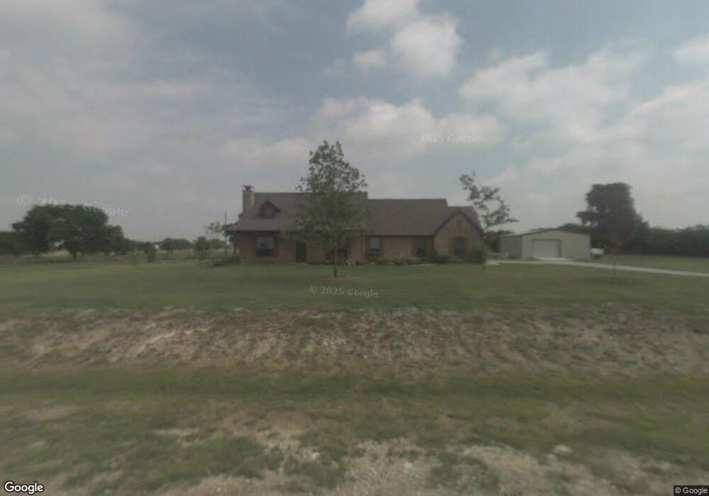
7260 Hunnington Dr Sanger, TX 76266
Estimated Value: $419,799 - $536,000
3
Beds
2
Baths
1,800
Sq Ft
$271/Sq Ft
Est. Value
About This Home
This home is located at 7260 Hunnington Dr, Sanger, TX 76266 and is currently estimated at $487,700, approximately $270 per square foot. 7260 Hunnington Dr is a home located in Denton County with nearby schools including Chisholm Trail Elementary School, Clear Creek Intermediate School, and Sanger Sixth Grade Campus.
Ownership History
Date
Name
Owned For
Owner Type
Purchase Details
Closed on
Dec 28, 2005
Sold by
S & T Custom Homes Inc
Bought by
Mckinzie Jeffery and Mckinzie Rhonda M
Current Estimated Value
Home Financials for this Owner
Home Financials are based on the most recent Mortgage that was taken out on this home.
Original Mortgage
$141,600
Outstanding Balance
$82,387
Interest Rate
6.87%
Mortgage Type
Fannie Mae Freddie Mac
Estimated Equity
$405,313
Create a Home Valuation Report for This Property
The Home Valuation Report is an in-depth analysis detailing your home's value as well as a comparison with similar homes in the area
Home Values in the Area
Average Home Value in this Area
Purchase History
| Date | Buyer | Sale Price | Title Company |
|---|---|---|---|
| Mckinzie Jeffery | -- | Denton Co Title Co |
Source: Public Records
Mortgage History
| Date | Status | Borrower | Loan Amount |
|---|---|---|---|
| Open | Mckinzie Jeffery | $141,600 |
Source: Public Records
Tax History Compared to Growth
Tax History
| Year | Tax Paid | Tax Assessment Tax Assessment Total Assessment is a certain percentage of the fair market value that is determined by local assessors to be the total taxable value of land and additions on the property. | Land | Improvement |
|---|---|---|---|---|
| 2025 | $3,716 | $347,000 | $92,801 | $254,199 |
| 2024 | $4,869 | $358,705 | $0 | $0 |
| 2023 | $3,294 | $326,095 | $88,862 | $424,711 |
| 2022 | $4,917 | $296,450 | $90,413 | $278,365 |
| 2021 | $3,932 | $290,316 | $40,800 | $249,516 |
| 2020 | $3,849 | $245,000 | $40,800 | $204,200 |
| 2019 | $3,895 | $237,976 | $40,800 | $197,176 |
| 2018 | $3,726 | $226,000 | $40,800 | $185,200 |
| 2017 | $3,579 | $215,554 | $40,800 | $174,754 |
| 2016 | $3,211 | $214,189 | $31,102 | $183,087 |
| 2015 | $2,895 | $200,426 | $31,102 | $169,324 |
| 2013 | -- | $184,209 | $31,102 | $153,107 |
Source: Public Records
Map
Nearby Homes
- 7240 Hunnington Dr
- 11087 Chisum Rd
- 9715 Fm 2450
- 000 Fm 2450
- 6810 Hunnington Dr
- 12142 Fm 2450
- 8623 Chisum Rd
- TBD Cashs Mill Rd
- 13709 Cash Mill Rd
- 13721 Cash Mill Rd
- 13743 Cashs Mill
- 11007 Farm To Market Road 2450
- 10902 Clear Creek Rd W
- 59.66 Rd
- 9494 Waide Rd
- 10916 Fm 2450
- 90.54 + Unit ACRES 14134 Cashs
- 14134 Cashs Mill Rd
- 10350 W Clear Creek Rd
- 6362 Belz Rd
- 7250 Hunnington Dr
- 7270 Hunnington Dr
- 7261 Hunnington Dr
- 7271 Hunnington Dr
- 12642 Fm 2450
- 7251 Hunnington Dr
- 12629 Fm 2450
- 7241 Hunnington Dr
- 7230 Hunnington Dr
- 12766 Fm 2450
- 12778 Fm 2450
- 12627 Fm 2450
- 7220 Hunnington Dr
- 12623 Fm 2450
- 12786 Fm2450
- 7221 Hunnington Dr
- 12803 Fm 2450
- 12631 Fm 2450 Spur
- 7210 Hunnington Dr
- 7211 Hunnington Dr