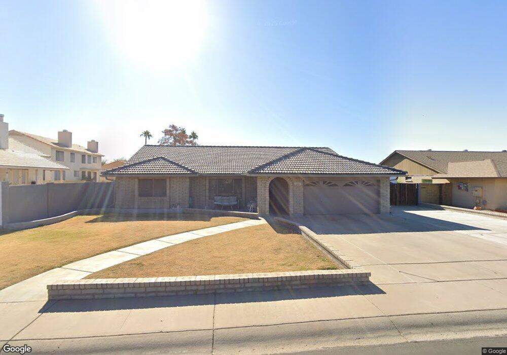
7261 W Bloomfield Rd Peoria, AZ 85381
Estimated Value: $422,798 - $478,000
--
Bed
2
Baths
1,988
Sq Ft
$232/Sq Ft
Est. Value
About This Home
This home is located at 7261 W Bloomfield Rd, Peoria, AZ 85381 and is currently estimated at $461,200, approximately $231 per square foot. 7261 W Bloomfield Rd is a home located in Maricopa County with nearby schools including Oakwood Elementary School, Cactus High School, and Legacy Traditional School - Glendale.
Ownership History
Date
Name
Owned For
Owner Type
Purchase Details
Closed on
Nov 6, 2023
Sold by
Michelle L Brown Living Trust
Bought by
Michelle L Brown Living Trust and Brown
Current Estimated Value
Purchase Details
Closed on
Oct 23, 2023
Sold by
Brown Michelle L
Bought by
Michelle L Brown Living Trust and Brown
Purchase Details
Closed on
Jun 30, 2021
Sold by
Brown Jerry L and Brown Lynn M
Bought by
Brown Michelle L
Home Financials for this Owner
Home Financials are based on the most recent Mortgage that was taken out on this home.
Original Mortgage
$280,000
Interest Rate
2.9%
Mortgage Type
New Conventional
Create a Home Valuation Report for This Property
The Home Valuation Report is an in-depth analysis detailing your home's value as well as a comparison with similar homes in the area
Home Values in the Area
Average Home Value in this Area
Purchase History
| Date | Buyer | Sale Price | Title Company |
|---|---|---|---|
| Michelle L Brown Living Trust | -- | None Listed On Document | |
| Michelle L Brown Living Trust | -- | None Listed On Document | |
| Brown Michelle L | $400,000 | First American Title Ins Co |
Source: Public Records
Mortgage History
| Date | Status | Borrower | Loan Amount |
|---|---|---|---|
| Previous Owner | Brown Michelle L | $280,000 |
Source: Public Records
Tax History Compared to Growth
Tax History
| Year | Tax Paid | Tax Assessment Tax Assessment Total Assessment is a certain percentage of the fair market value that is determined by local assessors to be the total taxable value of land and additions on the property. | Land | Improvement |
|---|---|---|---|---|
| 2025 | $1,355 | $17,892 | -- | -- |
| 2024 | $1,372 | $17,040 | -- | -- |
| 2023 | $1,372 | $31,380 | $6,270 | $25,110 |
| 2022 | $1,343 | $24,660 | $4,930 | $19,730 |
| 2021 | $1,684 | $22,650 | $4,530 | $18,120 |
| 2020 | $1,695 | $22,370 | $4,470 | $17,900 |
| 2019 | $1,643 | $19,480 | $3,890 | $15,590 |
| 2018 | $1,594 | $18,600 | $3,720 | $14,880 |
| 2017 | $1,590 | $17,350 | $3,470 | $13,880 |
| 2016 | $1,571 | $16,310 | $3,260 | $13,050 |
| 2015 | $1,462 | $15,950 | $3,190 | $12,760 |
Source: Public Records
Map
Nearby Homes
- 7214 W Columbine Dr
- 7220 W Larkspur Dr
- 7233 W Corrine Dr
- 7418 W Corrine Dr
- 7126 W Columbine Dr
- 12709 N 72nd Ave
- 7301 W Sweetwater Ave
- 7266 W Cherry Hills Dr
- 7157 W Cherry Hills Dr
- 7191 W Surrey Ave
- 7638 W Shaw Butte Dr
- 7113 W Sunnyside Dr
- 7126 W Jenan Dr
- 13051 N 75th Dr
- 7537 W Dreyfus Dr
- 12677 N 77th Dr
- 7326 W Pershing Ave
- 7544 W Dreyfus Dr
- 7225 W Canterbury Dr
- 11640 N 74th Dr
- 7267 W Bloomfield Rd
- 12360 N 72nd Dr
- 7262 W Charter Oak Rd
- 12350 N 72nd Dr
- 7268 W Charter Oak Rd
- 7262 W Bloomfield Rd
- 7273 W Bloomfield Rd
- 12450 N 72nd Dr
- 7268 W Bloomfield Rd
- 7274 W Charter Oak Rd
- 7274 W Bloomfield Rd
- 7279 W Bloomfield Rd Unit 1
- 12460 N 72nd Dr
- 12330 N 72nd Dr
- 12359 N 72nd Dr
- 7261 W Charter Oak Rd
- 7280 W Charter Oak Rd
- 12463 N 73rd Ave
- 12349 N 72nd Dr