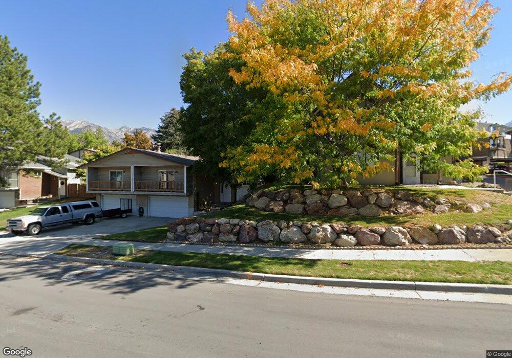
7265 S 1950 E Unit 23 Salt Lake City, UT 84121
Estimated Value: $328,000 - $387,000
2
Beds
2
Baths
1,457
Sq Ft
$249/Sq Ft
Est. Value
About This Home
This home is located at 7265 S 1950 E Unit 23, Salt Lake City, UT 84121 and is currently estimated at $362,682, approximately $248 per square foot. 7265 S 1950 E Unit 23 is a home located in Salt Lake County with nearby schools including Ridgecrest School, Butler Middle School, and Brighton High School.
Ownership History
Date
Name
Owned For
Owner Type
Purchase Details
Closed on
Feb 4, 2020
Sold by
Croft Family Llc Series Two
Bought by
Russell David Jake and Bagley Terrence F
Current Estimated Value
Home Financials for this Owner
Home Financials are based on the most recent Mortgage that was taken out on this home.
Original Mortgage
$148,000
Outstanding Balance
$131,390
Interest Rate
3.74%
Mortgage Type
New Conventional
Estimated Equity
$231,292
Purchase Details
Closed on
Jul 15, 2019
Sold by
Croft Carol J
Bought by
Croft Family Llc Series Two
Purchase Details
Closed on
Aug 29, 2008
Sold by
Croft Carol J
Bought by
Croft Lynn D and Croft Carol J
Purchase Details
Closed on
Feb 23, 1995
Sold by
Croft Lynn D
Bought by
Croft Carol J
Purchase Details
Closed on
Feb 22, 1995
Sold by
Croft Lynn D
Bought by
Croft Carol J
Create a Home Valuation Report for This Property
The Home Valuation Report is an in-depth analysis detailing your home's value as well as a comparison with similar homes in the area
Home Values in the Area
Average Home Value in this Area
Purchase History
| Date | Buyer | Sale Price | Title Company |
|---|---|---|---|
| Russell David Jake | -- | Meridian Title | |
| Croft Family Llc Series Two | -- | None Available | |
| Croft Lynn D | -- | None Available | |
| Croft Carol J | -- | -- | |
| Croft Carol J | -- | -- |
Source: Public Records
Mortgage History
| Date | Status | Borrower | Loan Amount |
|---|---|---|---|
| Open | Russell David Jake | $148,000 |
Source: Public Records
Tax History Compared to Growth
Tax History
| Year | Tax Paid | Tax Assessment Tax Assessment Total Assessment is a certain percentage of the fair market value that is determined by local assessors to be the total taxable value of land and additions on the property. | Land | Improvement |
|---|---|---|---|---|
| 2025 | $1,856 | $336,900 | $66,500 | $270,400 |
| 2024 | $1,856 | $330,900 | $61,600 | $269,300 |
| 2023 | $1,998 | $346,500 | $58,500 | $288,000 |
| 2022 | $1,977 | $338,300 | $57,400 | $280,900 |
| 2021 | $1,591 | $226,600 | $48,000 | $178,600 |
| 2020 | $1,624 | $217,400 | $43,900 | $173,500 |
| 2019 | $1,478 | $192,100 | $43,900 | $148,200 |
| 2018 | $1,426 | $192,700 | $43,900 | $148,800 |
| 2017 | $1,246 | $163,300 | $36,900 | $126,400 |
| 2016 | $1,178 | $149,700 | $57,600 | $92,100 |
| 2015 | $1,395 | $164,300 | $55,800 | $108,500 |
| 2014 | $1,320 | $151,100 | $52,000 | $99,100 |
Source: Public Records
Map
Nearby Homes
- 7265 S 1950 E Unit 14
- 7265 S 1950 E Unit 18
- 1938 E 7130 S
- 1920 E 7130 S
- 1895 E 7160 S
- 2099 Worchester Dr
- 2134 Somerset Dr
- 2057 E Castle Hill Ave
- 2110 Lonsdale Dr
- 7187 Villandrie Ln
- 7195 S Villandrie Ln
- 7094 S Cadens Cove
- 2129 E Villaire Ave
- 7034 S Cadens Cove
- 7364 S Chris Ln
- 7138 S Chris Ln
- 1695 E Ensign Place
- 2249 Tompkins Dr
- 2262 E Emerald Hills Ct Unit 8
- 2268 E 7160 S
- 7265 S 1950 E Unit 28
- 7265 S 1950 E Unit 9
- 7265 S 1950 E Unit 7
- 7265 S 1950 E Unit 16
- 7265 S 1950 E Unit 10
- 7265 S 1950 E Unit 29
- 7265 S 1950 E Unit 4
- 7265 S 1950 E Unit 6
- 7265 S 1950 E Unit 5
- 7265 S 1950 E Unit 25
- 7265 S 1950 E Unit 17
- 7265 S 1950 E Unit 27
- 7265 S 1950 E Unit 21
- 7265 S 1950 E Unit 26
- 7265 S 1950 E Unit 20
- 7265 S 1950 E Unit 8
- 7265 S 1950 E Unit 11
- 7265 S 1950 E Unit 1
- 7265 S 1950 E Unit 3
- 7265 S 1950 E Unit 24