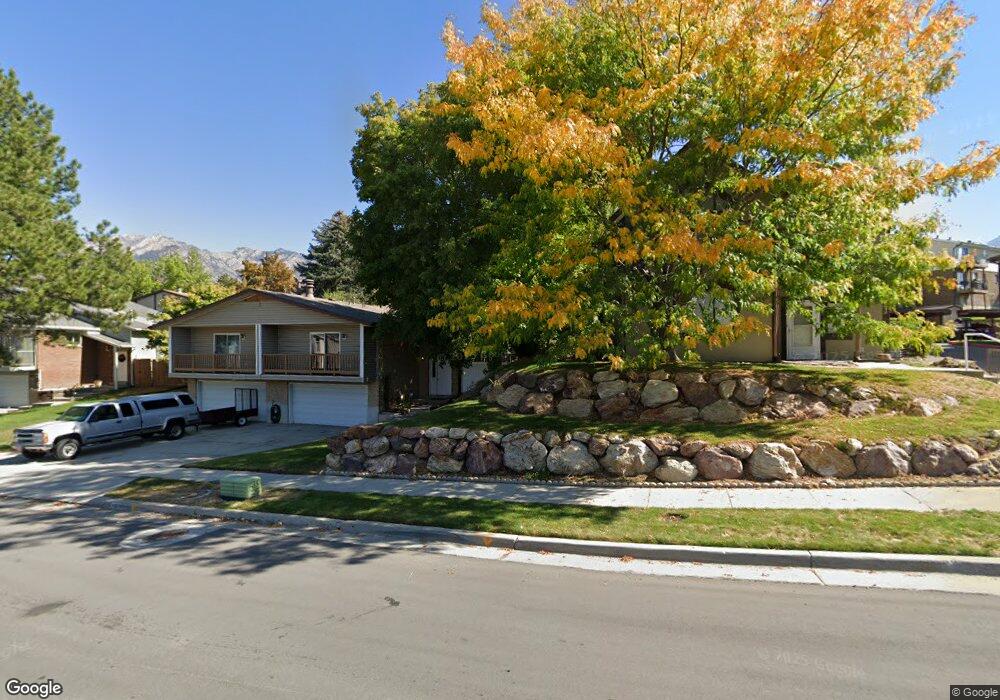
7265 S 1950 E Unit 6 Salt Lake City, UT 84121
Estimated Value: $375,200 - $490,000
3
Beds
3
Baths
2,046
Sq Ft
$217/Sq Ft
Est. Value
About This Home
This home is located at 7265 S 1950 E Unit 6, Salt Lake City, UT 84121 and is currently estimated at $444,300, approximately $217 per square foot. 7265 S 1950 E Unit 6 is a home located in Salt Lake County with nearby schools including Ridgecrest School, Butler Middle School, and Brighton High School.
Ownership History
Date
Name
Owned For
Owner Type
Purchase Details
Closed on
Nov 3, 2022
Sold by
Baker Michael R
Bought by
Baker Michael R and Baker Maria Carrillo
Current Estimated Value
Purchase Details
Closed on
Jul 30, 2018
Sold by
Butler Jacque N
Bought by
Baker Michael R and Sandoval Maria Guadalupe Carrillo
Home Financials for this Owner
Home Financials are based on the most recent Mortgage that was taken out on this home.
Original Mortgage
$243,912
Interest Rate
4.6%
Mortgage Type
New Conventional
Purchase Details
Closed on
Dec 14, 2006
Sold by
Croft Carol J
Bought by
Butler Jacque N
Create a Home Valuation Report for This Property
The Home Valuation Report is an in-depth analysis detailing your home's value as well as a comparison with similar homes in the area
Home Values in the Area
Average Home Value in this Area
Purchase History
| Date | Buyer | Sale Price | Title Company |
|---|---|---|---|
| Baker Michael R | -- | Real Advantage Title Insurance | |
| Baker Michael R | -- | First American Title | |
| Butler Jacque N | -- | Meridian Title |
Source: Public Records
Mortgage History
| Date | Status | Borrower | Loan Amount |
|---|---|---|---|
| Previous Owner | Baker Michael R | $243,912 |
Source: Public Records
Tax History Compared to Growth
Tax History
| Year | Tax Paid | Tax Assessment Tax Assessment Total Assessment is a certain percentage of the fair market value that is determined by local assessors to be the total taxable value of land and additions on the property. | Land | Improvement |
|---|---|---|---|---|
| 2025 | $2,553 | $470,600 | $66,500 | $404,100 |
| 2024 | $2,553 | $455,200 | $61,600 | $393,600 |
| 2023 | $2,730 | $473,400 | $58,500 | $414,900 |
| 2022 | $2,577 | $440,900 | $57,400 | $383,500 |
| 2021 | $2,080 | $296,200 | $48,000 | $248,200 |
| 2020 | $2,151 | $287,800 | $43,900 | $243,900 |
| 2019 | $1,894 | $246,100 | $43,900 | $202,200 |
| 2018 | $1,400 | $189,200 | $43,900 | $145,300 |
| 2017 | $1,295 | $169,700 | $36,900 | $132,800 |
| 2016 | $1,302 | $165,500 | $57,600 | $107,900 |
| 2015 | $1,456 | $171,500 | $54,200 | $117,300 |
| 2014 | $1,364 | $156,200 | $50,300 | $105,900 |
Source: Public Records
Map
Nearby Homes
- 7265 S 1950 E Unit 14
- 7265 S 1950 E Unit 18
- 1938 E 7130 S
- 2099 Worchester Dr
- 1920 E 7130 S
- 1895 E 7160 S
- 2134 Somerset Dr
- 2110 Lonsdale Dr
- 2057 E Castle Hill Ave
- 7187 Villandrie Ln
- 7195 S Villandrie Ln
- 2129 E Villaire Ave
- 7094 S Cadens Cove
- 7034 S Cadens Cove
- 7364 S Chris Ln
- 2249 Tompkins Dr
- 7138 S Chris Ln
- 2262 E Emerald Hills Ct Unit 8
- 2188 E Country View Ln
- 2268 E 7160 S
- 7265 S 1950 E Unit 28
- 7265 S 1950 E Unit 9
- 7265 S 1950 E Unit 7
- 7265 S 1950 E Unit 16
- 7265 S 1950 E Unit 10
- 7265 S 1950 E Unit 29
- 7265 S 1950 E Unit 4
- 7265 S 1950 E Unit 5
- 7265 S 1950 E Unit 25
- 7265 S 1950 E Unit 17
- 7265 S 1950 E Unit 27
- 7265 S 1950 E Unit 21
- 7265 S 1950 E Unit 26
- 7265 S 1950 E Unit 20
- 7265 S 1950 E Unit 8
- 7265 S 1950 E Unit 11
- 7265 S 1950 E Unit 1
- 7265 S 1950 E Unit 3
- 7265 S 1950 E Unit 23
- 7265 S 1950 E Unit 24