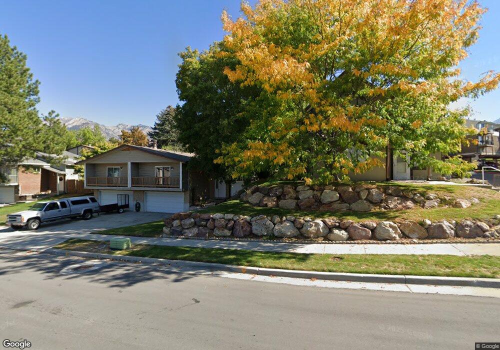
7265 S 1950 E Unit 7 Salt Lake City, UT 84121
Estimated Value: $415,000 - $502,000
4
Beds
3
Baths
2,232
Sq Ft
$205/Sq Ft
Est. Value
About This Home
This home is located at 7265 S 1950 E Unit 7, Salt Lake City, UT 84121 and is currently estimated at $456,831, approximately $204 per square foot. 7265 S 1950 E Unit 7 is a home located in Salt Lake County with nearby schools including Ridgecrest School, Butler Middle School, and Brighton High School.
Ownership History
Date
Name
Owned For
Owner Type
Purchase Details
Closed on
Mar 9, 2018
Bought by
Lee Margaret Z
Current Estimated Value
Home Financials for this Owner
Home Financials are based on the most recent Mortgage that was taken out on this home.
Original Mortgage
$178,480
Outstanding Balance
$153,232
Interest Rate
4.46%
Estimated Equity
$303,599
Purchase Details
Closed on
Nov 17, 2016
Sold by
Mcphil Daniel J
Bought by
Jervis Jessica M
Purchase Details
Closed on
Nov 27, 2006
Sold by
Dch Holdings Lc
Bought by
Mcphail Daniel J
Home Financials for this Owner
Home Financials are based on the most recent Mortgage that was taken out on this home.
Original Mortgage
$45,000
Interest Rate
6.32%
Mortgage Type
Stand Alone Second
Purchase Details
Closed on
Dec 3, 1998
Sold by
Nelson Ray Clyde and Nelson Norman J
Bought by
Larson Norman M and Larson Carole M
Create a Home Valuation Report for This Property
The Home Valuation Report is an in-depth analysis detailing your home's value as well as a comparison with similar homes in the area
Home Values in the Area
Average Home Value in this Area
Purchase History
| Date | Buyer | Sale Price | Title Company |
|---|---|---|---|
| Lee Margaret Z | -- | -- | |
| Jervis Jessica M | -- | Trustees Title & Escrow Lc | |
| Mcphail Daniel J | -- | Integrated Title Ins Svcs | |
| Dch Holdings Lc | -- | Integrated Title Ins Svcs | |
| Larson Norman M | -- | Superior Title Company |
Source: Public Records
Mortgage History
| Date | Status | Borrower | Loan Amount |
|---|---|---|---|
| Open | Lee Margaret Z | $178,480 | |
| Closed | Lee Margaret Z | -- | |
| Previous Owner | Mcphail Daniel J | $45,000 | |
| Previous Owner | Mcphail Daniel J | $180,000 |
Source: Public Records
Tax History Compared to Growth
Tax History
| Year | Tax Paid | Tax Assessment Tax Assessment Total Assessment is a certain percentage of the fair market value that is determined by local assessors to be the total taxable value of land and additions on the property. | Land | Improvement |
|---|---|---|---|---|
| 2025 | $2,307 | $424,800 | $66,500 | $358,300 |
| 2024 | $2,307 | $411,400 | $61,600 | $349,800 |
| 2023 | $2,483 | $430,500 | $58,500 | $372,000 |
| 2022 | $2,421 | $414,200 | $57,400 | $356,800 |
| 2021 | $1,848 | $263,200 | $48,000 | $215,200 |
| 2020 | $1,927 | $257,900 | $43,900 | $214,000 |
| 2019 | $1,682 | $218,600 | $43,900 | $174,700 |
| 2018 | $1,623 | $219,300 | $43,900 | $175,400 |
| 2017 | $1,604 | $210,200 | $36,900 | $173,300 |
| 2016 | $1,354 | $172,100 | $57,600 | $114,500 |
| 2015 | $1,561 | $183,900 | $55,800 | $128,100 |
| 2014 | $1,463 | $167,500 | $52,000 | $115,500 |
Source: Public Records
Map
Nearby Homes
- 7265 S 1950 E Unit 14
- 7265 S 1950 E Unit 18
- 1938 E 7130 S
- 1920 E 7130 S
- 1895 E 7160 S
- 2099 Worchester Dr
- 2134 Somerset Dr
- 2057 E Castle Hill Ave
- 2110 Lonsdale Dr
- 7187 Villandrie Ln
- 7195 S Villandrie Ln
- 7094 S Cadens Cove
- 2129 E Villaire Ave
- 7034 S Cadens Cove
- 7364 S Chris Ln
- 7138 S Chris Ln
- 1695 E Ensign Place
- 2249 Tompkins Dr
- 2262 E Emerald Hills Ct Unit 8
- 2268 E 7160 S
- 7265 S 1950 E Unit 28
- 7265 S 1950 E Unit 9
- 7265 S 1950 E Unit 16
- 7265 S 1950 E Unit 10
- 7265 S 1950 E Unit 29
- 7265 S 1950 E Unit 4
- 7265 S 1950 E Unit 6
- 7265 S 1950 E Unit 5
- 7265 S 1950 E Unit 25
- 7265 S 1950 E Unit 17
- 7265 S 1950 E Unit 27
- 7265 S 1950 E Unit 21
- 7265 S 1950 E Unit 26
- 7265 S 1950 E Unit 20
- 7265 S 1950 E Unit 8
- 7265 S 1950 E Unit 11
- 7265 S 1950 E Unit 1
- 7265 S 1950 E Unit 3
- 7265 S 1950 E Unit 23
- 7265 S 1950 E Unit 24