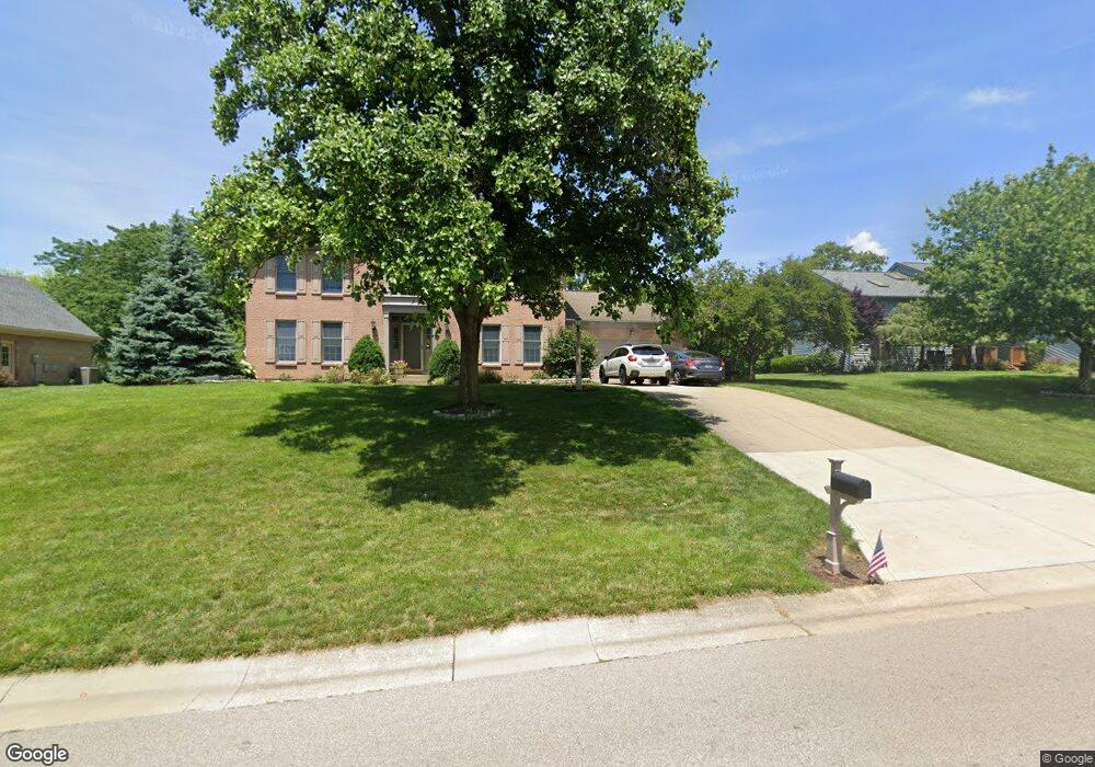
7265 Wethersfield Dr West Chester, OH 45069
West Chester Township NeighborhoodEstimated Value: $447,000 - $503,000
4
Beds
3
Baths
2,868
Sq Ft
$166/Sq Ft
Est. Value
About This Home
This home is located at 7265 Wethersfield Dr, West Chester, OH 45069 and is currently estimated at $476,516, approximately $166 per square foot. 7265 Wethersfield Dr is a home located in Butler County with nearby schools including Endeavor Elementary School, Lakota Plains Junior School, and Lakota West High School.
Ownership History
Date
Name
Owned For
Owner Type
Purchase Details
Closed on
Sep 7, 2023
Sold by
Jones Gregory L and Jones Annette
Bought by
Jones Family Trust and Jones
Current Estimated Value
Purchase Details
Closed on
Oct 22, 1996
Sold by
Jonas Michael
Bought by
Jones Gregory L and Jones Annette
Home Financials for this Owner
Home Financials are based on the most recent Mortgage that was taken out on this home.
Original Mortgage
$108,000
Interest Rate
8.44%
Mortgage Type
Balloon
Purchase Details
Closed on
Mar 1, 1992
Purchase Details
Closed on
Jul 1, 1990
Create a Home Valuation Report for This Property
The Home Valuation Report is an in-depth analysis detailing your home's value as well as a comparison with similar homes in the area
Home Values in the Area
Average Home Value in this Area
Purchase History
| Date | Buyer | Sale Price | Title Company |
|---|---|---|---|
| Jones Family Trust | -- | None Listed On Document | |
| Jones Gregory L | $195,000 | -- | |
| -- | $164,000 | -- | |
| -- | $30,000 | -- |
Source: Public Records
Mortgage History
| Date | Status | Borrower | Loan Amount |
|---|---|---|---|
| Previous Owner | Jones Gregory L | $108,000 |
Source: Public Records
Tax History Compared to Growth
Tax History
| Year | Tax Paid | Tax Assessment Tax Assessment Total Assessment is a certain percentage of the fair market value that is determined by local assessors to be the total taxable value of land and additions on the property. | Land | Improvement |
|---|---|---|---|---|
| 2024 | $5,292 | $128,230 | $20,110 | $108,120 |
| 2023 | $5,255 | $125,420 | $20,110 | $105,310 |
| 2022 | $5,502 | $98,870 | $20,110 | $78,760 |
| 2021 | $5,016 | $95,120 | $20,110 | $75,010 |
| 2020 | $5,135 | $95,120 | $20,110 | $75,010 |
| 2019 | $7,787 | $81,260 | $19,250 | $62,010 |
| 2018 | $4,602 | $81,260 | $19,250 | $62,010 |
| 2017 | $4,684 | $81,260 | $19,250 | $62,010 |
| 2016 | $4,669 | $76,290 | $19,250 | $57,040 |
| 2015 | $4,663 | $76,290 | $19,250 | $57,040 |
| 2014 | $5,122 | $76,290 | $19,250 | $57,040 |
| 2013 | $5,122 | $81,480 | $19,250 | $62,230 |
Source: Public Records
Map
Nearby Homes
- 7229 W Hartford Ct
- 0 Walnut Creek Dr Unit 1850153
- 5241 Hamilton Mason Rd
- 7392 Wheatland Meadow Ct
- 6993 Clawson Ridge Ct
- 5146 Mountview Ct
- 7350 Keltner Dr
- 7257 Clawson Ct
- 6674 Southampton Ln
- 7213 Quail Run Dr
- 4625 Guildford Dr
- 8330 Park Place
- 5108 Grandin Ridge Dr
- 5168 Grandin Ridge Dr
- 8354 Park Place
- 7695 Fox Chase Dr
- 5577 Dove Ln
- 7077 Parliament Place
- 6940 Crown Pointe Dr
- 6875 Crown Pointe Dr
- 7275 Wethersfield Dr
- 7255 Wethersfield Dr
- 7238 W Hartford Ct
- 7230 W Hartford Ct
- 7285 Wethersfield Dr
- 7246 W Hartford Ct
- 7262 Wethersfield Dr
- 7235 Walnut Creek Dr
- 7282 Wethersfield Dr
- 7272 Wethersfield Dr
- 7250 Wethersfield Dr
- 7295 Wethersfield Dr
- 7256 W Hartford Ct
- 7222 W Hartford Ct
- 7223 Walnut Creek Dr
- 7268 W Hartford Ct
- 7292 Wethersfield Dr
- 7221 W Hartford Ct
- 7265 Walnut Creek Dr
- 7280 W Hartford Ct