Estimated Value: $249,873 - $304,000
3
Beds
3
Baths
1,701
Sq Ft
$160/Sq Ft
Est. Value
About This Home
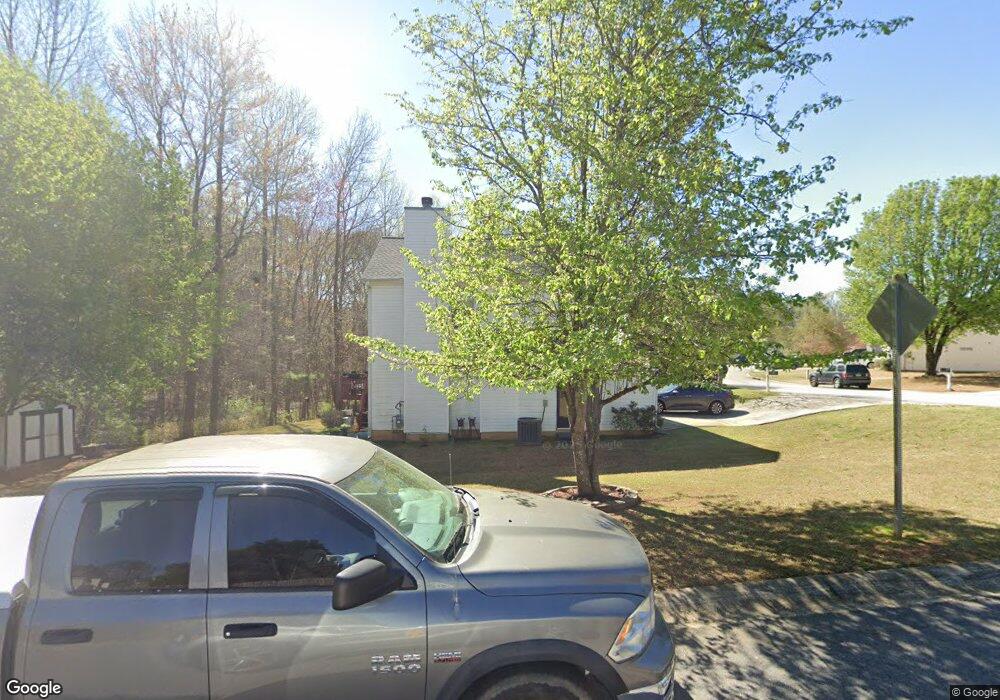
This home is located at 7267 New Dale Rd, Rex, GA 30273 and is currently estimated at $271,718, approximately $159 per square foot. 7267 New Dale Rd is a home located in Clayton County with nearby schools including Roberta T. Smith Elementary School, Rex Mill Middle School, and Mount Zion High School.
Ownership History
Date
Name
Owned For
Owner Type
Purchase Details
Closed on
Feb 28, 2025
Sold by
Edwards Jennifer J
Bought by
Hopkins Mayya Lynn
Current Estimated Value
Purchase Details
Closed on
Dec 9, 2003
Sold by
Hud
Bought by
Edwards Jennifer J
Home Financials for this Owner
Home Financials are based on the most recent Mortgage that was taken out on this home.
Original Mortgage
$120,000
Interest Rate
5.97%
Mortgage Type
New Conventional
Purchase Details
Closed on
Jul 1, 2003
Sold by
Chase Manhattan Mtg
Bought by
Hud
Purchase Details
Closed on
Mar 31, 1999
Sold by
Gt Architecture Contractors Co
Bought by
Lester James W
Home Financials for this Owner
Home Financials are based on the most recent Mortgage that was taken out on this home.
Original Mortgage
$112,066
Interest Rate
7.08%
Mortgage Type
FHA
Create a Home Valuation Report for This Property
The Home Valuation Report is an in-depth analysis detailing your home's value as well as a comparison with similar homes in the area
Home Values in the Area
Average Home Value in this Area
Purchase History
| Date | Buyer | Sale Price | Title Company |
|---|---|---|---|
| Hopkins Mayya Lynn | -- | -- | |
| Edwards Jennifer J | -- | -- | |
| Hud | -- | -- | |
| Chase Manhattan Mtg | $116,929 | -- | |
| Lester James W | $113,000 | -- |
Source: Public Records
Mortgage History
| Date | Status | Borrower | Loan Amount |
|---|---|---|---|
| Previous Owner | Edwards Jennifer J | $120,000 | |
| Previous Owner | Lester James W | $112,066 |
Source: Public Records
Tax History Compared to Growth
Tax History
| Year | Tax Paid | Tax Assessment Tax Assessment Total Assessment is a certain percentage of the fair market value that is determined by local assessors to be the total taxable value of land and additions on the property. | Land | Improvement |
|---|---|---|---|---|
| 2024 | $1,750 | $98,200 | $7,200 | $91,000 |
| 2023 | $3,583 | $99,240 | $7,200 | $92,040 |
| 2022 | $2,752 | $79,160 | $7,200 | $71,960 |
| 2021 | $2,267 | $66,440 | $7,200 | $59,240 |
| 2020 | $1,879 | $56,037 | $7,200 | $48,837 |
| 2019 | $1,594 | $48,336 | $6,400 | $41,936 |
| 2018 | $1,418 | $45,610 | $6,400 | $39,210 |
| 2017 | $814 | $29,072 | $6,400 | $22,672 |
| 2016 | $814 | $29,072 | $6,400 | $22,672 |
| 2015 | $801 | $0 | $0 | $0 |
| 2014 | $341 | $17,600 | $6,400 | $11,200 |
Source: Public Records
Map
Nearby Homes
- 6870 Diamond Dr
- 7106 Oakwood Cir Unit 1
- 6891 Dresden Dr
- 3552 Topaz Terrace
- 3535 Henley St
- 3401 Mosswood Ln
- 3700 Hudson Ct
- 7027 Biscayne Blvd
- 7166 Thunder Ridge
- 6737 Biscayne Blvd
- 0 Lakeland Rd Unit 7648836
- 0 Lakeland Rd Unit 10603417
- 3353 Medina Dr
- 6702 Saganaw Dr
- 3315 Canterbury Trail
- 0 Daniel Dr Unit 10628491
- 6750 Sunset Hills Blvd
- 6646 Creek Turn Dr
- 3189 Glen Hollow Dr
- 7259 New Dale Rd
- 3601 Mosswood Ln
- 7281 New Dale Rd Unit 52
- 7281 New Dale Rd
- 7251 New Dale Rd Unit III
- 7260 New Dale Rd
- 7248 New Dale Rd
- 3610 Mosswood Ln
- 3607 Mosswood Ln
- 7289 New Dale Rd Unit 3
- 7243 New Dale Rd
- 7276 New Dale Rd
- 7276 New Dale Rd Unit III
- 7238 New Dale Rd Unit 3
- 3615 Mosswood Ln
- 3573 Mosswood Ln Unit III
- 3620 Mosswood Ln
- 7235 New Dale Rd
- 7284 New Dale Rd
- 7297 New Dale Rd Unit III