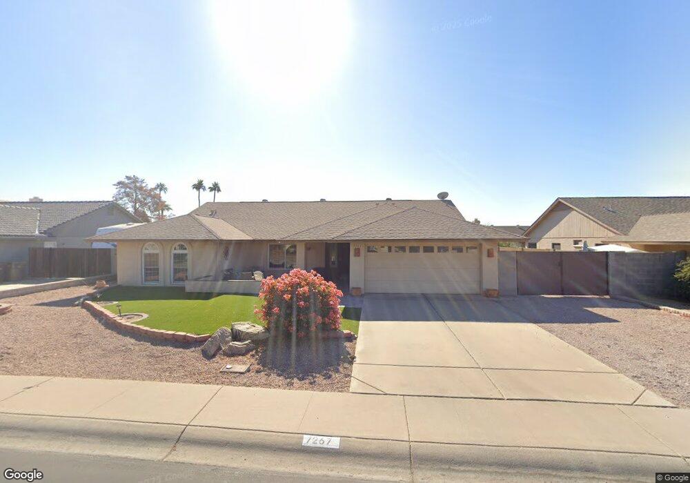
7267 W Bloomfield Rd Peoria, AZ 85381
Estimated Value: $420,461 - $503,000
--
Bed
2
Baths
2,111
Sq Ft
$225/Sq Ft
Est. Value
About This Home
This home is located at 7267 W Bloomfield Rd, Peoria, AZ 85381 and is currently estimated at $475,365, approximately $225 per square foot. 7267 W Bloomfield Rd is a home located in Maricopa County with nearby schools including Oakwood Elementary School, Cactus High School, and Legacy Traditional School - Glendale.
Ownership History
Date
Name
Owned For
Owner Type
Purchase Details
Closed on
Oct 20, 1999
Sold by
Riviere William C and Riviere Virginia
Bought by
Blair Steven L and Blair Luanne R
Current Estimated Value
Home Financials for this Owner
Home Financials are based on the most recent Mortgage that was taken out on this home.
Original Mortgage
$133,000
Outstanding Balance
$39,698
Interest Rate
7.68%
Mortgage Type
New Conventional
Estimated Equity
$435,667
Purchase Details
Closed on
Jul 7, 1998
Sold by
Stapleton Pamela A
Bought by
Riviere William C and Riviere Virginia
Home Financials for this Owner
Home Financials are based on the most recent Mortgage that was taken out on this home.
Original Mortgage
$118,065
Interest Rate
6.88%
Mortgage Type
New Conventional
Create a Home Valuation Report for This Property
The Home Valuation Report is an in-depth analysis detailing your home's value as well as a comparison with similar homes in the area
Home Values in the Area
Average Home Value in this Area
Purchase History
| Date | Buyer | Sale Price | Title Company |
|---|---|---|---|
| Blair Steven L | $140,000 | Capital Title Agency | |
| Riviere William C | $138,900 | Capital Title Agency |
Source: Public Records
Mortgage History
| Date | Status | Borrower | Loan Amount |
|---|---|---|---|
| Open | Blair Steven L | $133,000 | |
| Previous Owner | Riviere William C | $118,065 |
Source: Public Records
Tax History Compared to Growth
Tax History
| Year | Tax Paid | Tax Assessment Tax Assessment Total Assessment is a certain percentage of the fair market value that is determined by local assessors to be the total taxable value of land and additions on the property. | Land | Improvement |
|---|---|---|---|---|
| 2025 | $1,470 | $19,416 | -- | -- |
| 2024 | $1,489 | $18,491 | -- | -- |
| 2023 | $1,489 | $33,910 | $6,780 | $27,130 |
| 2022 | $1,458 | $26,380 | $5,270 | $21,110 |
| 2021 | $1,561 | $24,270 | $4,850 | $19,420 |
| 2020 | $1,575 | $24,070 | $4,810 | $19,260 |
| 2019 | $1,524 | $21,310 | $4,260 | $17,050 |
| 2018 | $1,474 | $20,070 | $4,010 | $16,060 |
| 2017 | $1,474 | $18,550 | $3,710 | $14,840 |
| 2016 | $1,460 | $17,630 | $3,520 | $14,110 |
| 2015 | $1,362 | $17,330 | $3,460 | $13,870 |
Source: Public Records
Map
Nearby Homes
- 7214 W Columbine Dr
- 7220 W Larkspur Dr
- 7233 W Corrine Dr
- 7418 W Corrine Dr
- 7126 W Columbine Dr
- 12709 N 72nd Ave
- 7301 W Sweetwater Ave
- 7266 W Cherry Hills Dr
- 7157 W Cherry Hills Dr
- 7191 W Surrey Ave
- 7638 W Shaw Butte Dr
- 7113 W Sunnyside Dr
- 7126 W Jenan Dr
- 13051 N 75th Dr
- 7537 W Dreyfus Dr
- 12677 N 77th Dr
- 7326 W Pershing Ave
- 7544 W Dreyfus Dr
- 7225 W Canterbury Dr
- 11640 N 74th Dr
- 7261 W Bloomfield Rd
- 7273 W Bloomfield Rd
- 7268 W Charter Oak Rd
- 7274 W Charter Oak Rd
- 7262 W Charter Oak Rd
- 7268 W Bloomfield Rd
- 7279 W Bloomfield Rd Unit 1
- 7274 W Bloomfield Rd
- 12360 N 72nd Dr
- 7262 W Bloomfield Rd
- 12350 N 72nd Dr
- 7280 W Charter Oak Rd
- 12450 N 72nd Dr
- 12463 N 73rd Ave
- 7261 W Charter Oak Rd
- 12460 N 72nd Dr
- 7267 W Charter Oak Rd
- 7273 W Charter Oak Rd
- 12330 N 72nd Dr