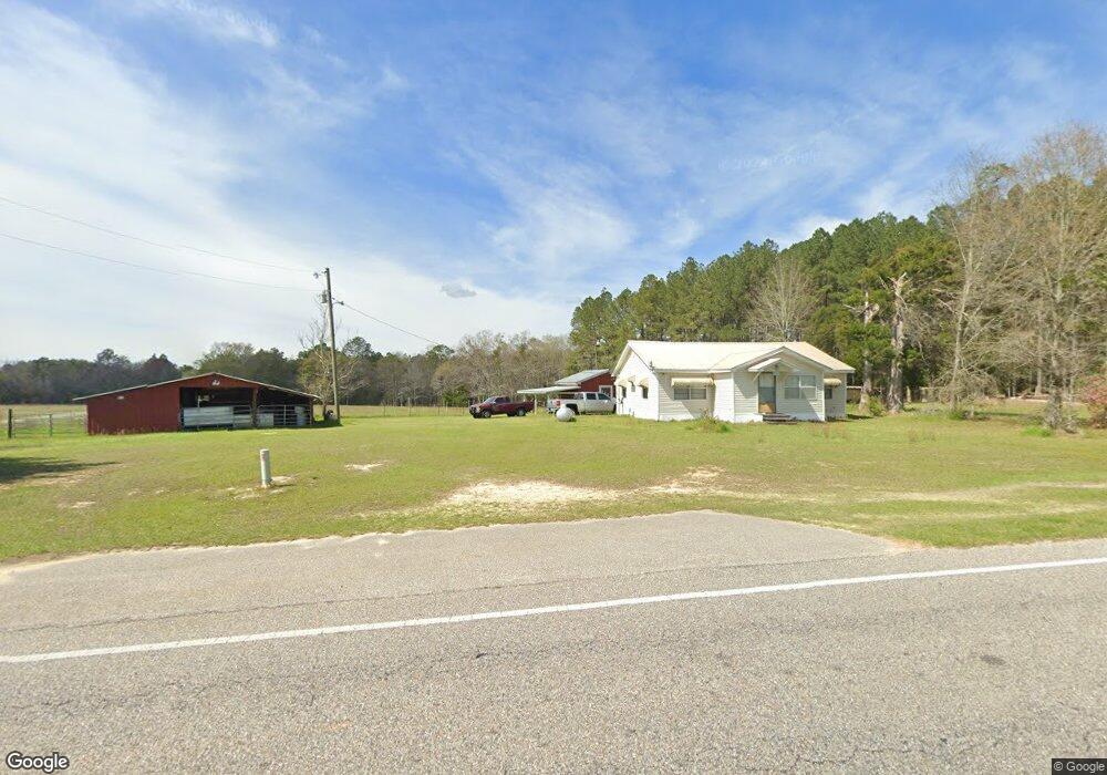
7268 State Highway 153 Samson, AL 36477
Estimated Value: $137,000 - $151,000
3
Beds
2
Baths
1,238
Sq Ft
$116/Sq Ft
Est. Value
About This Home
This home is located at 7268 State Highway 153, Samson, AL 36477 and is currently estimated at $143,252, approximately $115 per square foot. 7268 State Highway 153 is a home located in Geneva County.
Ownership History
Date
Name
Owned For
Owner Type
Purchase Details
Closed on
Oct 18, 2006
Sold by
Thomason James W and Thomason Rita M
Bought by
Parker Richard A
Current Estimated Value
Home Financials for this Owner
Home Financials are based on the most recent Mortgage that was taken out on this home.
Original Mortgage
$72,031
Interest Rate
6.01%
Mortgage Type
Stand Alone First
Create a Home Valuation Report for This Property
The Home Valuation Report is an in-depth analysis detailing your home's value as well as a comparison with similar homes in the area
Home Values in the Area
Average Home Value in this Area
Purchase History
| Date | Buyer | Sale Price | Title Company |
|---|---|---|---|
| Parker Richard A | -- | -- |
Source: Public Records
Mortgage History
| Date | Status | Borrower | Loan Amount |
|---|---|---|---|
| Closed | Parker Richard A | $72,031 |
Source: Public Records
Tax History Compared to Growth
Tax History
| Year | Tax Paid | Tax Assessment Tax Assessment Total Assessment is a certain percentage of the fair market value that is determined by local assessors to be the total taxable value of land and additions on the property. | Land | Improvement |
|---|---|---|---|---|
| 2024 | $139 | $6,040 | $1,500 | $4,540 |
| 2023 | $139 | $5,340 | $1,520 | $3,820 |
| 2022 | $116 | $5,300 | $1,500 | $3,800 |
| 2021 | $107 | $5,020 | $1,500 | $3,520 |
| 2020 | $95 | $4,660 | $1,480 | $3,180 |
| 2019 | $85 | $4,340 | $1,480 | $2,860 |
| 2018 | $81 | $4,220 | $1,480 | $2,740 |
| 2017 | $80 | $4,200 | $1,460 | $2,740 |
| 2016 | $80 | $4,200 | $1,460 | $2,740 |
| 2015 | $81 | $4,220 | $1,460 | $2,760 |
| 2014 | $78 | $4,120 | $1,460 | $2,660 |
| 2013 | $78 | $4,120 | $1,460 | $2,660 |
Source: Public Records
Map
Nearby Homes
- 7257 State Highway 153
- 0 Co Rd 10
- 0 Cuthriell Rd
- 239 Aubie Rd
- 3223 Alford Rd
- Tract#6201 8 Mile Cemetery Rd Unit 2
- Tract#6201 Doyle Morgan Rd
- Tract#6201 W Co Hwy 181 Nat B-01
- Tract#6201 W County Hwy 181 Unit Nat B-01
- 0 Gopher Ridge Rd
- 601 Oak Grove Rd
- M-8 Acres S St Hwy 87
- S-8 Acres S St Hwy 87
- N-8 Acres S St Hwy 87
- M-8 Acres S St Hwy 87
- S-8 Acres S St Hwy 87
- N-8 Acres S St Hwy 87
- 725 Dock Wilson Rd
- 0 Circle R Farm Dr Unit 7428123
- 0 Circle R Farm Dr Unit 387121