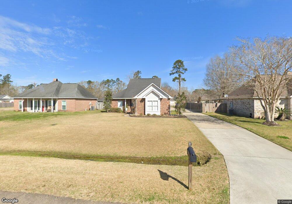
7269 Mosspoint Ln Denham Springs, LA 70706
Estimated Value: $206,000 - $238,000
4
Beds
2
Baths
1,406
Sq Ft
$161/Sq Ft
Est. Value
About This Home
This home is located at 7269 Mosspoint Ln, Denham Springs, LA 70706 and is currently estimated at $226,039, approximately $160 per square foot. 7269 Mosspoint Ln is a home located in Livingston Parish with nearby schools including Northside Elementary School, Denham Springs Junior High School, and Denham Springs High School.
Ownership History
Date
Name
Owned For
Owner Type
Purchase Details
Closed on
Mar 13, 2025
Sold by
Howard Taylor Jr Charles and Contant Lori
Bought by
Taylor Ray Melissa and Ray Jason A
Current Estimated Value
Purchase Details
Closed on
May 11, 2005
Sold by
Bosarge Benjamin Brian
Bought by
Walding Douglas Ray and Walding Rebecca Ford
Home Financials for this Owner
Home Financials are based on the most recent Mortgage that was taken out on this home.
Original Mortgage
$121,000
Interest Rate
5.87%
Mortgage Type
New Conventional
Create a Home Valuation Report for This Property
The Home Valuation Report is an in-depth analysis detailing your home's value as well as a comparison with similar homes in the area
Home Values in the Area
Average Home Value in this Area
Purchase History
| Date | Buyer | Sale Price | Title Company |
|---|---|---|---|
| Taylor Ray Melissa | -- | None Listed On Document | |
| Walding Douglas Ray | $121,000 | Baton Rouge Title Company |
Source: Public Records
Mortgage History
| Date | Status | Borrower | Loan Amount |
|---|---|---|---|
| Previous Owner | Walding Douglas Ray | $121,000 |
Source: Public Records
Tax History Compared to Growth
Tax History
| Year | Tax Paid | Tax Assessment Tax Assessment Total Assessment is a certain percentage of the fair market value that is determined by local assessors to be the total taxable value of land and additions on the property. | Land | Improvement |
|---|---|---|---|---|
| 2024 | $2,030 | $19,222 | $1,960 | $17,262 |
| 2023 | $1,677 | $14,290 | $1,960 | $12,330 |
| 2022 | $1,689 | $14,290 | $1,960 | $12,330 |
| 2021 | $1,694 | $14,290 | $1,960 | $12,330 |
| 2020 | $1,674 | $14,290 | $1,960 | $12,330 |
| 2019 | $1,466 | $12,380 | $1,960 | $10,420 |
| 2018 | $1,486 | $12,380 | $1,960 | $10,420 |
| 2017 | $1,418 | $11,860 | $1,960 | $9,900 |
| 2015 | $829 | $14,430 | $1,960 | $12,470 |
| 2014 | $888 | $14,750 | $1,960 | $12,790 |
Source: Public Records
Map
Nearby Homes
- 7367 Fox Run
- 7420 Linda Lee Dr
- 32495 Magnolia Ct
- 32505 Cynthia Dr
- 7230 Linda Lee Dr
- 32491 Cynthia Dr
- 32508 Magnolia Ct
- 32374 Plainview Rd
- 32410 Brandywood Dr
- 7645 Elmwood Dr
- 32445 Curtis Cove Ln
- 7429 Magnolia Garden Ct
- 32528 Cedar Ct
- 7736 Amite Church Rd
- 7175 Bessie Dr
- 7681 Amite Church Rd
- 7323 Bessie Dr
- 33511 Tenor Dr
- 7275 Effie Dr
- 7299 Effie Dr
- 7277 Mosspoint Ln
- 7261 Mosspoint Ln
- 7551 Linda Lee Dr
- 7525 Lynda Lee Dr
- 32490 Glenwood Dr
- 32543 Cypress Grove
- 7247 Mosspoint Ln
- 7507 Linda Lee Dr
- 32551 Cypress Grove
- 7276 Mosspoint Ln
- 7581 Linda Lee Dr
- 7503 Lynda Lee Dr
- 7503 Linda Lee Dr
- 32559 Cypress Grove
- 32480 Glenwood Dr
- 7239 Mosspoint Ln
- 7593 Linda Lee Dr
- 7292 Mosspoint Ln
- 32485 Glenwood Dr
- 32567 Cypress Grove