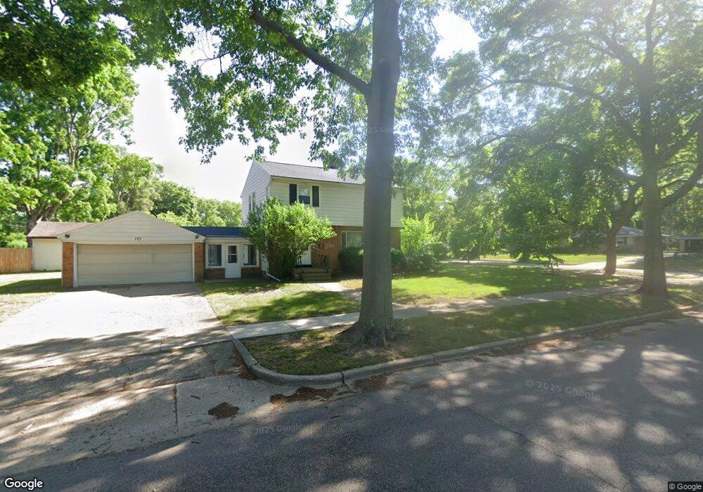
727 Conger St NE Grand Rapids, MI 49505
Creston NeighborhoodEstimated Value: $317,833 - $417,000
--
Bed
1
Bath
1,732
Sq Ft
$221/Sq Ft
Est. Value
About This Home
This home is located at 727 Conger St NE, Grand Rapids, MI 49505 and is currently estimated at $382,458, approximately $220 per square foot. 727 Conger St NE is a home located in Kent County with nearby schools including Riverside Middle School, Union High School, and All Saints Academy - Lower Campus.
Ownership History
Date
Name
Owned For
Owner Type
Purchase Details
Closed on
Nov 20, 2018
Sold by
Turetsky Robin J
Bought by
Turetsky Robin J and Robin J Turetsky Trust
Current Estimated Value
Purchase Details
Closed on
May 25, 2018
Sold by
Turetsky Family Trust and Lewis And Gertrude G Ture Tsky Family
Bought by
Turetsky Robin J
Home Financials for this Owner
Home Financials are based on the most recent Mortgage that was taken out on this home.
Interest Rate
4.66%
Purchase Details
Closed on
Aug 24, 2017
Sold by
Turetsky David A and Estate Of Gertrude Gay Turetsk
Bought by
Turetsky David A and Turetsky Lewis
Create a Home Valuation Report for This Property
The Home Valuation Report is an in-depth analysis detailing your home's value as well as a comparison with similar homes in the area
Home Values in the Area
Average Home Value in this Area
Purchase History
| Date | Buyer | Sale Price | Title Company |
|---|---|---|---|
| Turetsky Robin J | -- | None Available | |
| Turetsky Robin J | -- | -- | |
| Turetsky David A | -- | None Available |
Source: Public Records
Mortgage History
| Date | Status | Borrower | Loan Amount |
|---|---|---|---|
| Closed | Turetsky Robin J | -- |
Source: Public Records
Tax History Compared to Growth
Tax History
| Year | Tax Paid | Tax Assessment Tax Assessment Total Assessment is a certain percentage of the fair market value that is determined by local assessors to be the total taxable value of land and additions on the property. | Land | Improvement |
|---|---|---|---|---|
| 2025 | $2,424 | $151,600 | $0 | $0 |
| 2024 | $2,424 | $141,800 | $0 | $0 |
| 2023 | $2,460 | $121,000 | $0 | $0 |
| 2022 | $2,335 | $110,500 | $0 | $0 |
| 2021 | $2,283 | $105,300 | $0 | $0 |
| 2020 | $2,183 | $98,100 | $0 | $0 |
| 2019 | $2,286 | $91,800 | $0 | $0 |
| 2018 | $2,208 | $85,100 | $0 | $0 |
| 2017 | $2,149 | $76,400 | $0 | $0 |
| 2016 | $2,175 | $69,600 | $0 | $0 |
| 2015 | $2,023 | $69,600 | $0 | $0 |
| 2013 | -- | $62,500 | $0 | $0 |
Source: Public Records
Map
Nearby Homes
- 2550 Borglum Ave NE
- 661 Conger St NE
- 648 Russwood St NE
- 929 Ellsmere St NE
- 518 Russwood St NE
- 2905 Remy Ct NE Unit 1
- 838 Aberdeen St NE
- 2630 Oakwood Ave NE
- 753 Halena St NE
- 1116 Kelsey St NE
- 2480 Lafayette Ave NE
- 1110 Aberdeen St NE
- 1139 Arlington St NE
- 3151 Kendalwood Ct NE
- 3030 Plainfield Ave NE
- 483 Kenwood St NE
- 1115 Ecklund St NE
- 465 Kenwood St NE
- 2624 Monroe Ave NE
- 1313 Ellsmere St NE
- 2613 Borglum Ave NE
- 717 Conger St NE
- 2591 Borglum Ave NE
- 2627 Borglum Ave NE
- 707 Conger St NE
- 718 Conger St NE
- 2585 Borglum Ave NE
- 2610 Borglum Ave NE
- 2604 Borglum Ave NE
- 2635 Borglum Ave NE
- 2622 Borglum Ave NE
- 2592 Borglum Ave NE
- 732 Russwood St NE
- 2634 Borglum Ave NE
- 722 Russwood St NE
- 740 Russwood St NE
- 705 Conger St NE
- 2573 Borglum Ave NE
- 708 Conger St NE
- 2584 Borglum Ave NE