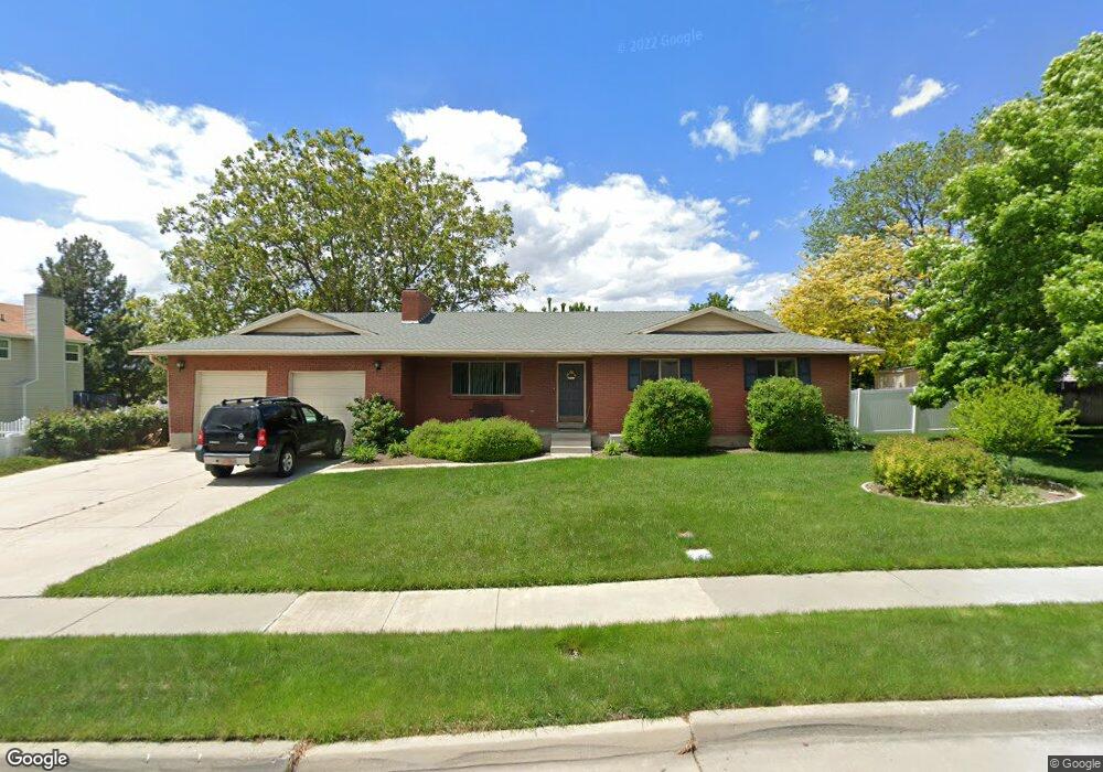
727 N 350 W American Fork, UT 84003
Estimated Value: $505,000 - $611,000
3
Beds
2
Baths
1,612
Sq Ft
$346/Sq Ft
Est. Value
About This Home
This home is located at 727 N 350 W, American Fork, UT 84003 and is currently estimated at $557,921, approximately $346 per square foot. 727 N 350 W is a home located in Utah County with nearby schools including Shelley Elementary School, American Fork Junior High School, and American Fork High School.
Create a Home Valuation Report for This Property
The Home Valuation Report is an in-depth analysis detailing your home's value as well as a comparison with similar homes in the area
Home Values in the Area
Average Home Value in this Area
Tax History Compared to Growth
Tax History
| Year | Tax Paid | Tax Assessment Tax Assessment Total Assessment is a certain percentage of the fair market value that is determined by local assessors to be the total taxable value of land and additions on the property. | Land | Improvement |
|---|---|---|---|---|
| 2025 | $2,441 | $292,600 | $229,600 | $302,400 |
| 2024 | $2,441 | $271,205 | $0 | $0 |
| 2023 | $2,304 | $271,425 | $0 | $0 |
| 2022 | $2,535 | $294,690 | $0 | $0 |
| 2021 | $2,171 | $394,200 | $164,800 | $229,400 |
| 2020 | $2,031 | $357,600 | $147,100 | $210,500 |
| 2019 | $1,889 | $344,100 | $136,100 | $208,000 |
| 2018 | $1,778 | $309,600 | $128,700 | $180,900 |
| 2017 | $1,709 | $160,600 | $0 | $0 |
| 2016 | $1,556 | $135,905 | $0 | $0 |
| 2015 | $1,560 | $129,250 | $0 | $0 |
| 2014 | $1,415 | $115,665 | $0 | $0 |
Source: Public Records
Map
Nearby Homes
- 641 N 420 W
- 540 N 300 W
- 782 N 200 W
- 796 N 200 W
- 914 N 400 W Unit A
- 3889 W 950 Cir N Unit 366
- 621 N 100 W
- 984 N 300 W
- 987 N 410 W
- 602 W 860 N
- 471 W 1040 N
- 356 N 480 W
- 10238 N 6530 W Unit 15
- 1051 N 390 E Unit 103
- 6079 W Whisper Ln Unit 404
- 1220 E 700 N
- 1039 N 390 E Unit 102
- 11338 N Annes Way Unit 8
- 6111 W Whisper Ln Unit 402
- 344 W 1080 N