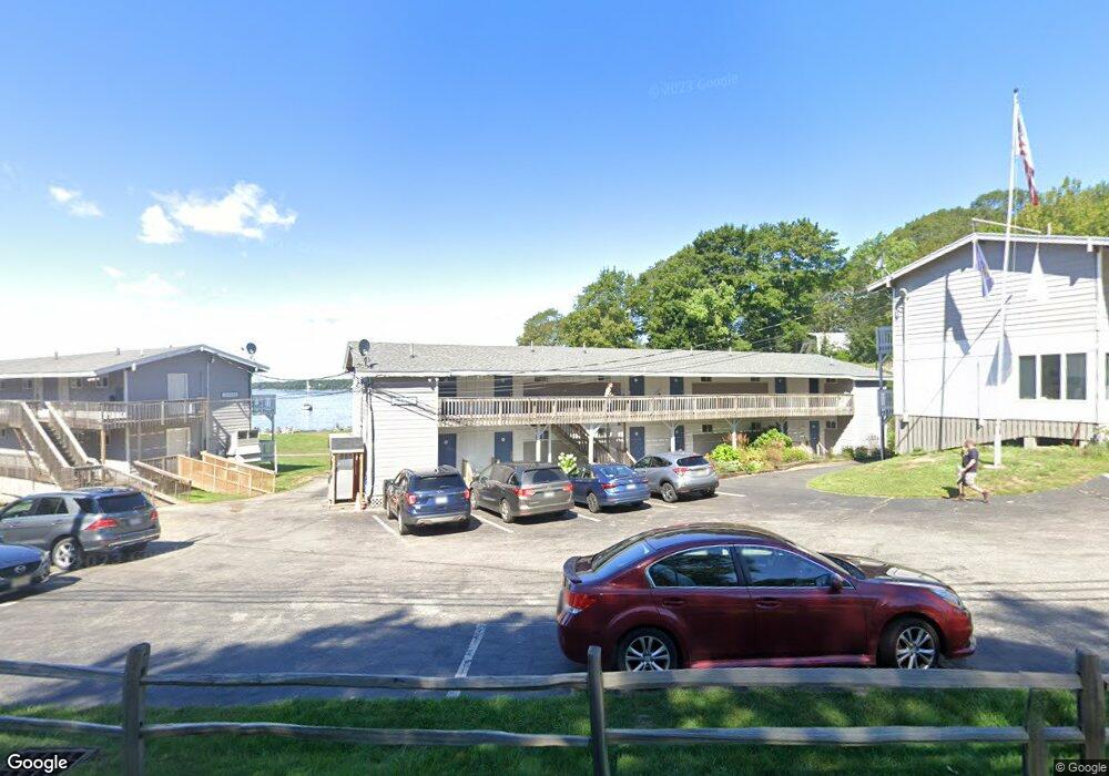
727 Ocean Point Rd East Boothbay, ME 04544
Estimated Value: $2,098,000 - $5,859,325
--
Bed
--
Bath
2,898
Sq Ft
$1,578/Sq Ft
Est. Value
About This Home
This home is located at 727 Ocean Point Rd, East Boothbay, ME 04544 and is currently estimated at $4,571,775, approximately $1,577 per square foot. 727 Ocean Point Rd is a home located in Lincoln County with nearby schools including Boothbay Region Elementary School and Boothbay Region High School.
Ownership History
Date
Name
Owned For
Owner Type
Purchase Details
Closed on
Apr 6, 2023
Sold by
727 Ocean Point Llc
Bought by
Om Sai Ram Llc
Current Estimated Value
Home Financials for this Owner
Home Financials are based on the most recent Mortgage that was taken out on this home.
Original Mortgage
$4,500,000
Outstanding Balance
$4,363,086
Interest Rate
6.5%
Mortgage Type
Purchase Money Mortgage
Estimated Equity
$208,689
Purchase Details
Closed on
Jan 19, 2005
Sold by
Smugglers Cove
Bought by
Smugglers Cove Inn Inc
Home Financials for this Owner
Home Financials are based on the most recent Mortgage that was taken out on this home.
Original Mortgage
$100,000
Interest Rate
5.71%
Mortgage Type
Commercial
Create a Home Valuation Report for This Property
The Home Valuation Report is an in-depth analysis detailing your home's value as well as a comparison with similar homes in the area
Home Values in the Area
Average Home Value in this Area
Purchase History
| Date | Buyer | Sale Price | Title Company |
|---|---|---|---|
| Om Sai Ram Llc | $5,150,000 | None Available | |
| Smugglers Cove Inn Inc | -- | -- | |
| Smugglers Cove Inn Inc | -- | -- |
Source: Public Records
Mortgage History
| Date | Status | Borrower | Loan Amount |
|---|---|---|---|
| Open | Om Sai Ram Llc | $4,500,000 | |
| Previous Owner | Smugglers Cove Inn Inc | $100,000 | |
| Previous Owner | Smugglers Cove Inn Inc | $1,900,000 |
Source: Public Records
Tax History Compared to Growth
Tax History
| Year | Tax Paid | Tax Assessment Tax Assessment Total Assessment is a certain percentage of the fair market value that is determined by local assessors to be the total taxable value of land and additions on the property. | Land | Improvement |
|---|---|---|---|---|
| 2024 | $24,323 | $2,143,023 | $828,650 | $1,314,373 |
| 2023 | $21,537 | $2,143,023 | $828,650 | $1,314,373 |
| 2022 | $19,930 | $2,143,023 | $828,650 | $1,314,373 |
| 2021 | $20,324 | $2,128,137 | $828,650 | $1,299,487 |
| 2020 | $20,430 | $2,128,137 | $828,650 | $1,299,487 |
| 2019 | $20,111 | $2,128,137 | $828,650 | $1,299,487 |
| 2018 | $19,792 | $2,128,137 | $828,650 | $1,299,487 |
| 2017 | $20,081 | $2,182,700 | $454,500 | $1,728,200 |
| 2016 | $19,208 | $2,182,700 | $454,500 | $1,728,200 |
| 2015 | $19,099 | $2,182,700 | $454,500 | $1,728,200 |
| 2014 | $18,553 | $2,182,700 | $454,500 | $1,728,200 |
Source: Public Records
Map
Nearby Homes
- 44 King Phillips Trail
- 12 Westwind Dr
- 127 Appalachee Rd
- 74 & 76 Bay St
- 31 Bay St
- 58 Roads End Rd
- 5 Massachusetts Ave
- 239 Ocean Point Rd
- 27 Townsend Ave
- 37 Townsend Ave
- 53 Commercial St
- 34 Townsend Ave
- 66 Townsend Ave
- 210 Ocean Point Rd
- Lts 23A&24 Birch Island
- 66 Townsend Avenue & 43 Oak St
- 43 Oak St
- Birch Island
- 26 Sea St
- 12 Sea St
- 727 Ocean Point
- 711 Ocean Point Rd
- 711 Ocean Point Rd
- 9 Windward Ln
- 707 Ocean Point Rd
- 726 Ocean Point
- 17 Windward Ln
- 726 Ocean Point Rd
- 709 Ocean Point Rd
- 718 Ocean Point Rd
- 113 Murray Hill Rd
- 736 Ocean Point Rd
- 702 Ocean Point Rd
- 744 Ocean Point Rd
- 13 School St
- 22A School St
- 8 E Tibbetts Rd
- 105 Presley Dr
- 44 Farnham Point Rd
- 696 Ocean Point Rd