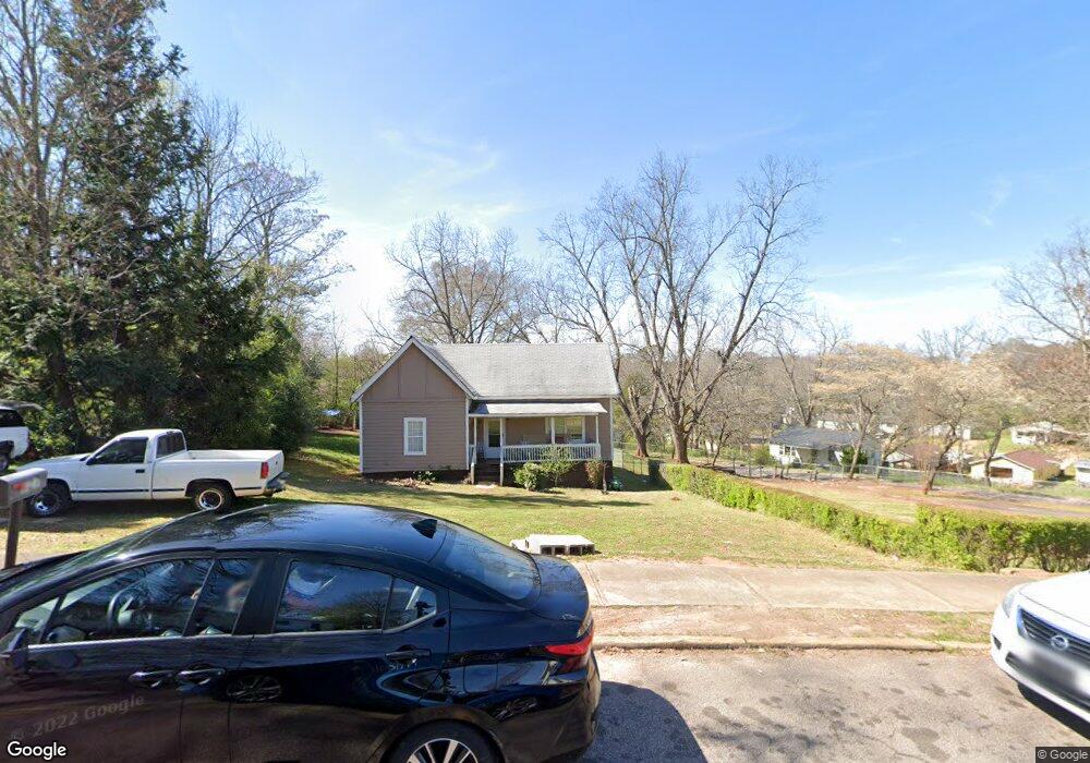
727 Ridley Ave Lagrange, GA 30240
Estimated Value: $114,000 - $151,000
2
Beds
1
Bath
1,165
Sq Ft
$113/Sq Ft
Est. Value
About This Home
This home is located at 727 Ridley Ave, Lagrange, GA 30240 and is currently estimated at $132,012, approximately $113 per square foot. 727 Ridley Ave is a home located in Troup County with nearby schools including Franklin Forest Elementary School, Hollis Hand Elementary School, and Ethel W. Kight Elementary School.
Ownership History
Date
Name
Owned For
Owner Type
Purchase Details
Closed on
Nov 29, 1988
Sold by
Karen Scott and Karen Kramer
Bought by
Ford Sarah Etal
Current Estimated Value
Purchase Details
Closed on
Jun 1, 1988
Sold by
Banks L L
Bought by
Karen Scott and Karen Kramer
Purchase Details
Closed on
Nov 17, 1983
Bought by
Banks L L
Purchase Details
Closed on
Sep 20, 1983
Sold by
Banks L L
Purchase Details
Closed on
Jan 22, 1979
Sold by
Joe Fannon
Bought by
Banks L L
Purchase Details
Closed on
Jan 1, 1968
Sold by
Frank Winn
Bought by
Joe Fannon
Purchase Details
Closed on
Jan 1, 1967
Sold by
C&S Bank
Bought by
Frank Winn
Create a Home Valuation Report for This Property
The Home Valuation Report is an in-depth analysis detailing your home's value as well as a comparison with similar homes in the area
Home Values in the Area
Average Home Value in this Area
Purchase History
| Date | Buyer | Sale Price | Title Company |
|---|---|---|---|
| Ford Sarah Etal | $29,500 | -- | |
| Karen Scott | -- | -- | |
| Banks L L | -- | -- | |
| -- | -- | -- | |
| Banks L L | -- | -- | |
| Joe Fannon | -- | -- | |
| Frank Winn | -- | -- |
Source: Public Records
Tax History Compared to Growth
Tax History
| Year | Tax Paid | Tax Assessment Tax Assessment Total Assessment is a certain percentage of the fair market value that is determined by local assessors to be the total taxable value of land and additions on the property. | Land | Improvement |
|---|---|---|---|---|
| 2024 | $842 | $30,880 | $4,200 | $26,680 |
| 2023 | $628 | $23,040 | $4,200 | $18,840 |
| 2022 | $607 | $21,760 | $4,200 | $17,560 |
| 2021 | $110 | $19,600 | $2,240 | $17,360 |
| 2020 | $291 | $19,600 | $2,240 | $17,360 |
| 2019 | $233 | $17,680 | $2,240 | $15,440 |
| 2018 | $122 | $14,022 | $2,022 | $12,000 |
| 2017 | $122 | $14,022 | $2,022 | $12,000 |
| 2016 | $118 | $13,858 | $2,022 | $11,836 |
| 2015 | $126 | $14,098 | $2,262 | $11,836 |
| 2014 | $107 | $13,475 | $2,262 | $11,212 |
| 2013 | -- | $14,480 | $2,244 | $12,236 |
Source: Public Records
Map
Nearby Homes
- 219 Banks St
- 109 Thomas St
- 900 North St
- 0 Ridley Ave Unit 10550104
- 110 Russell St
- 609 Ridley Ave
- 707 Ridley Ave
- 611 Ridley Ave
- 615 Ridley Ave
- 709 Ridley Ave
- 109 Dogwood Dr
- 301 E Bacon St
- 204 Colonial St
- 145 Turner St
- 806 New Franklin Rd
- 600,606,608,616 S Harlem
- 408 Gordon St
- 102 Ewing St
- 106 Ewing St
- 706 N Harlem Cir