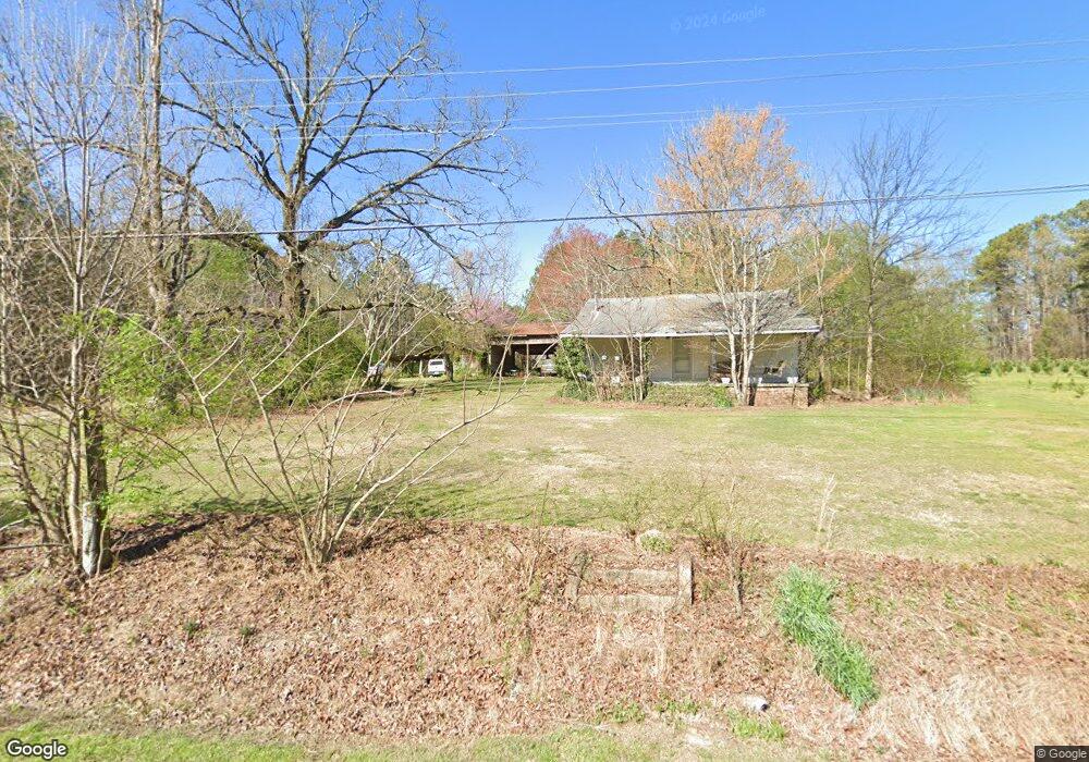
7272 Highway 95 La Fayette, GA 30728
Estimated Value: $173,243 - $273,000
--
Bed
1
Bath
1,152
Sq Ft
$191/Sq Ft
Est. Value
About This Home
This home is located at 7272 Highway 95, La Fayette, GA 30728 and is currently estimated at $220,061, approximately $191 per square foot. 7272 Highway 95 is a home located in Walker County with nearby schools including Rock Spring Elementary School, Lafayette High School, and Alice M Daley Adventist School.
Ownership History
Date
Name
Owned For
Owner Type
Purchase Details
Closed on
Dec 21, 2006
Sold by
Vanhorn Tommy Laine
Bought by
Vanhorn Tommy Laine
Current Estimated Value
Purchase Details
Closed on
May 7, 2003
Sold by
Vanhorn Doris W
Bought by
Vanhorn Tommy Laine
Purchase Details
Closed on
Sep 21, 1993
Sold by
Vanhorn L E
Bought by
Vanhorn Doris W
Purchase Details
Closed on
Jan 1, 1972
Bought by
Vanhorn L E
Create a Home Valuation Report for This Property
The Home Valuation Report is an in-depth analysis detailing your home's value as well as a comparison with similar homes in the area
Home Values in the Area
Average Home Value in this Area
Purchase History
| Date | Buyer | Sale Price | Title Company |
|---|---|---|---|
| Vanhorn Tommy Laine | -- | -- | |
| Vanhorn Tommy Laine | -- | -- | |
| Vanhorn Doris W | -- | -- | |
| Vanhorn L E | -- | -- |
Source: Public Records
Tax History Compared to Growth
Tax History
| Year | Tax Paid | Tax Assessment Tax Assessment Total Assessment is a certain percentage of the fair market value that is determined by local assessors to be the total taxable value of land and additions on the property. | Land | Improvement |
|---|---|---|---|---|
| 2024 | $1,804 | $72,944 | $30,574 | $42,370 |
| 2023 | $1,084 | $24,396 | $0 | $24,396 |
| 2022 | $1,199 | $46,659 | $12,286 | $34,373 |
| 2021 | $1,008 | $34,733 | $12,286 | $22,447 |
| 2020 | $944 | $31,062 | $12,286 | $18,776 |
| 2019 | $961 | $31,062 | $12,286 | $18,776 |
| 2018 | $746 | $28,188 | $12,286 | $15,902 |
| 2017 | $960 | $28,188 | $12,286 | $15,902 |
| 2016 | $820 | $28,188 | $12,286 | $15,902 |
| 2015 | $1,052 | $35,414 | $22,740 | $12,674 |
| 2014 | $958 | $35,414 | $22,740 | $12,674 |
| 2013 | -- | $35,414 | $22,740 | $12,674 |
Source: Public Records
Map
Nearby Homes
- 7606 Highway 95
- 1052 Huffman Rd
- 176 Turkey Ridge Rd
- 1934 Round Pond Rd
- 450 Arnold Ln
- 201 Van Dell Dr
- 533 Van Dell Dr
- 121 Stock Dog Ln
- 901 Dunwoody Rd
- 1039 Dunwoody Rd
- 0 Colbert Hollow Rd Unit 1513202
- 635 Cook Rd
- 3255 Colbert Hollow Rd
- 0 Alabama Hwy Unit 1520958
- 0 Alabama Hwy Unit 21222630
- 0 Alabama Hwy Unit TRACT 3 10244950
- 0 Clyde Byrd Rd
- Old Alabama Hwy Ga-151
- 134 Farm View Cir
- 200 Cattail Dr
- 0 Confederate Dr Unit 1332862
- 0 Confederate Dr
- 7263 Georgia 95
- 7206 Highway 95
- 7263 Highway 95
- 53 Confederate Dr
- 7473 Highway 95
- 7450 Georgia 95
- 7100 Highway 95
- 7450 Highway 95
- 7469 Georgia 95
- 7841 Highway 95
- 7473 Georgia 95
- 132 Learning To Lean Ln
- 95 Highway 27 Bypass
- 6962 Highway 95
- 7554 Highway 95
- 7555 Highway 95
- 278 Famlee Cir
- 87 Sweetbriar Ln