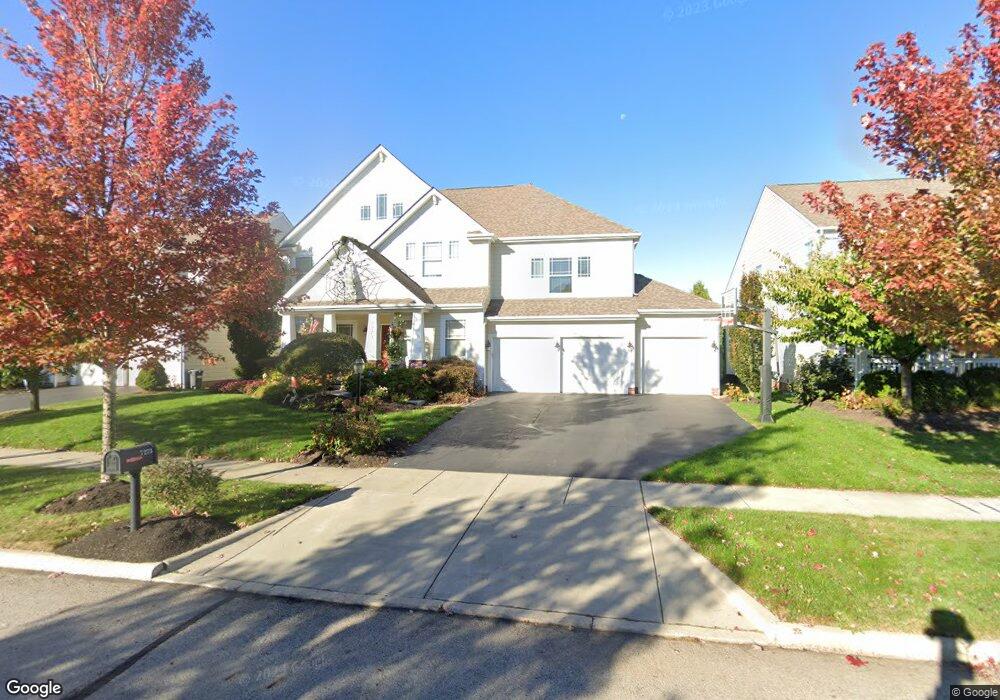
7273 Dean Farm Rd New Albany, OH 43054
Estimated Value: $741,000 - $809,000
4
Beds
4
Baths
3,303
Sq Ft
$236/Sq Ft
Est. Value
About This Home
This home is located at 7273 Dean Farm Rd, New Albany, OH 43054 and is currently estimated at $780,572, approximately $236 per square foot. 7273 Dean Farm Rd is a home located in Franklin County with nearby schools including New Albany Primary School, New Albany Intermediate School, and New Albany Middle School.
Ownership History
Date
Name
Owned For
Owner Type
Purchase Details
Closed on
Nov 18, 2010
Sold by
M/I Homes Of Central Ohio Llc
Bought by
Milburn Jason M and Milburn Megan K
Current Estimated Value
Home Financials for this Owner
Home Financials are based on the most recent Mortgage that was taken out on this home.
Original Mortgage
$329,815
Outstanding Balance
$218,714
Interest Rate
4.37%
Mortgage Type
FHA
Estimated Equity
$561,858
Create a Home Valuation Report for This Property
The Home Valuation Report is an in-depth analysis detailing your home's value as well as a comparison with similar homes in the area
Home Values in the Area
Average Home Value in this Area
Purchase History
| Date | Buyer | Sale Price | Title Company |
|---|---|---|---|
| Milburn Jason M | $334,300 | Transohio |
Source: Public Records
Mortgage History
| Date | Status | Borrower | Loan Amount |
|---|---|---|---|
| Open | Milburn Jason M | $329,815 |
Source: Public Records
Tax History Compared to Growth
Tax History
| Year | Tax Paid | Tax Assessment Tax Assessment Total Assessment is a certain percentage of the fair market value that is determined by local assessors to be the total taxable value of land and additions on the property. | Land | Improvement |
|---|---|---|---|---|
| 2024 | $14,692 | $236,160 | $45,510 | $190,650 |
| 2023 | $13,908 | $236,145 | $45,500 | $190,645 |
| 2022 | $13,982 | $180,680 | $40,260 | $140,420 |
| 2021 | $13,457 | $180,680 | $40,260 | $140,420 |
| 2020 | $13,391 | $180,680 | $40,260 | $140,420 |
| 2019 | $12,783 | $157,130 | $35,010 | $122,120 |
| 2018 | $11,781 | $157,130 | $35,010 | $122,120 |
| 2017 | $12,718 | $157,130 | $35,010 | $122,120 |
| 2016 | $10,910 | $123,600 | $24,090 | $99,510 |
| 2015 | $10,436 | $123,600 | $24,090 | $99,510 |
| 2014 | $10,248 | $123,600 | $24,090 | $99,510 |
| 2013 | $372 | $2,555 | $2,555 | $0 |
Source: Public Records
Map
Nearby Homes
- 7301 Wood Edge Ln
- 7385 Wood Edge Ln
- 7361 Wood Edge Ln
- 7125 Longfield Ct
- 7090 Dean Farm Rd
- 6879 E Walnut St
- 8600 Steeple Wood Dr
- 0 Moonstone Unit Lot 12 225003342
- 0 Moonstone Unit Lot 11 225003341
- 0 Moonstone Unit Lot 5 225003337
- 0 Moonstone Unit LOT 4 225003335
- 0 Moonstone Unit LOT 3 225003334
- 0 Moonstone Unit LOT 2 225003333
- 0 Moonstone Unit LOT 1 225003332
- 0 Luna Unit Lot 10 225003340
- 0 Luna Unit Lot 9 225003339
- 5685 Jersey Dr
- The Iris Residence Plan at Estates at Albany Acres
- Scarlett Custom Plan A at Estates at Albany Acres
- Kline Residence Plan at Estates at Albany Acres
- 7281 Dean Farm Rd
- 7265 Dean Farm Rd
- 7289 Dean Farm Rd
- 7257 Dean Farm Rd
- 8403 Kiernan Dr
- 7297 Dean Farm Rd
- 8402 Galdino Dr
- 8413 Kiernan Dr
- 7305 Dean Farm Rd
- 8412 Galdino Dr
- 8423 Kiernan Dr
- 7313 Dean Farm Rd
- 8401 Galdino Dr Unit 45
- 8401 Galdino Dr
- 8422 Galdino Dr
- 8406 Leisner Ave Unit 84
- 7241 Dean Farm Rd
- 8411 Galdino Dr
- 8433 Kiernan Dr
- 7321 Dean Farm Rd