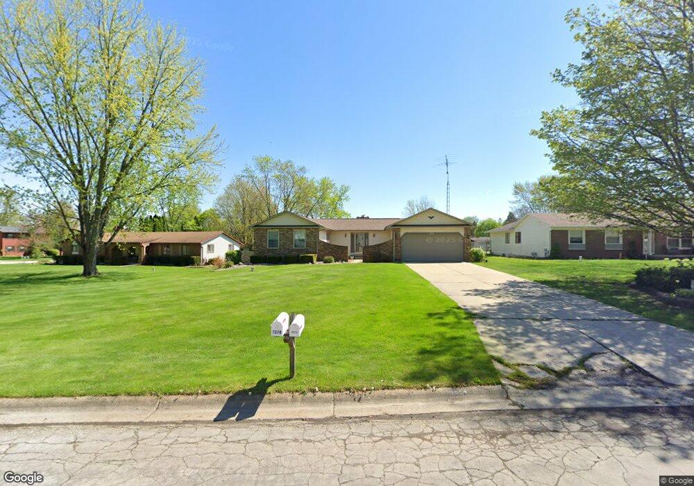
7273 S Fork Dr Swartz Creek, MI 48473
Estimated Value: $223,000 - $254,000
--
Bed
--
Bath
1,440
Sq Ft
$168/Sq Ft
Est. Value
About This Home
This home is located at 7273 S Fork Dr, Swartz Creek, MI 48473 and is currently estimated at $241,364, approximately $167 per square foot. 7273 S Fork Dr is a home located in Genesee County with nearby schools including Elms Road Elementary School, Syring Elementary School, and Dieck Elementary School.
Ownership History
Date
Name
Owned For
Owner Type
Purchase Details
Closed on
Jul 12, 2006
Sold by
Vaughan Lorraine M and Vaughan John G
Bought by
Vaughan John G and Vaughan Lorraine M
Current Estimated Value
Purchase Details
Closed on
Feb 16, 2000
Sold by
Vaughan Lorraine M
Bought by
Vaughn John G and Vaughan Lorraine M
Home Financials for this Owner
Home Financials are based on the most recent Mortgage that was taken out on this home.
Original Mortgage
$65,000
Interest Rate
8.27%
Mortgage Type
Purchase Money Mortgage
Create a Home Valuation Report for This Property
The Home Valuation Report is an in-depth analysis detailing your home's value as well as a comparison with similar homes in the area
Home Values in the Area
Average Home Value in this Area
Purchase History
| Date | Buyer | Sale Price | Title Company |
|---|---|---|---|
| Vaughan John G | -- | First American Title | |
| Vaughn John G | -- | Guardian Title Company |
Source: Public Records
Mortgage History
| Date | Status | Borrower | Loan Amount |
|---|---|---|---|
| Closed | Vaughn John G | $65,000 |
Source: Public Records
Tax History Compared to Growth
Tax History
| Year | Tax Paid | Tax Assessment Tax Assessment Total Assessment is a certain percentage of the fair market value that is determined by local assessors to be the total taxable value of land and additions on the property. | Land | Improvement |
|---|---|---|---|---|
| 2025 | $2,370 | $108,200 | $0 | $0 |
| 2024 | $676 | $99,800 | $0 | $0 |
| 2023 | $645 | $87,000 | $0 | $0 |
| 2022 | $2,090 | $77,700 | $0 | $0 |
| 2021 | $2,072 | $76,400 | $0 | $0 |
| 2020 | $590 | $73,700 | $0 | $0 |
| 2019 | $581 | $75,200 | $0 | $0 |
| 2018 | $1,703 | $62,400 | $0 | $0 |
| 2017 | $1,641 | $62,400 | $0 | $0 |
| 2016 | $1,598 | $61,700 | $0 | $0 |
| 2015 | $1,437 | $60,800 | $0 | $0 |
| 2014 | $535 | $54,200 | $0 | $0 |
| 2012 | -- | $50,300 | $50,300 | $0 |
Source: Public Records
Map
Nearby Homes
- 7070 Aldredge Dr
- 7062 S Fork Dr
- 7094 Crosswinds Dr
- 7065 Crosswinds Dr
- 6507 Corunna Rd Unit 6493 Corunna Rd.
- 7042 Corunna Rd
- 4076 S Morrish Rd
- 6456 W Court St
- 3295 Pine Run Dr
- 00 Corunna Rd
- 1366 S Morrish Rd
- 3155 Elk Creek Dr
- 3160 Elk Creek Dr
- 0 Corunna Rd Unit 20251034900
- 7091 Saratoga Dr
- 1208 Citation Dr
- 000 Corunna Rd
- 7075 Saratoga Dr
- 3147 Elk Creek Dr
- 3154 Elk Creek Dr