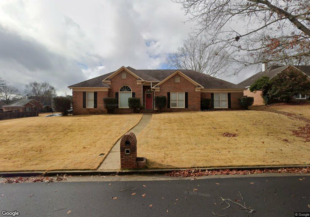
7278 Westport Loop Midland, GA 31820
Midland NeighborhoodEstimated Value: $314,286 - $377,000
3
Beds
4
Baths
2,557
Sq Ft
$136/Sq Ft
Est. Value
About This Home
This home is located at 7278 Westport Loop, Midland, GA 31820 and is currently estimated at $346,822, approximately $135 per square foot. 7278 Westport Loop is a home located in Muscogee County with nearby schools including Mathews Elementary School, Aaron Cohn Middle School, and Shaw High School.
Ownership History
Date
Name
Owned For
Owner Type
Purchase Details
Closed on
Jun 27, 2018
Sold by
Williams George
Bought by
Cross Xavier and Cross Dorothee
Current Estimated Value
Home Financials for this Owner
Home Financials are based on the most recent Mortgage that was taken out on this home.
Original Mortgage
$195,900
Outstanding Balance
$169,777
Interest Rate
4.5%
Mortgage Type
VA
Estimated Equity
$177,045
Purchase Details
Closed on
Dec 30, 2008
Sold by
Young Anthony D
Bought by
Williams George
Home Financials for this Owner
Home Financials are based on the most recent Mortgage that was taken out on this home.
Original Mortgage
$274,800
Interest Rate
5.95%
Mortgage Type
VA
Create a Home Valuation Report for This Property
The Home Valuation Report is an in-depth analysis detailing your home's value as well as a comparison with similar homes in the area
Home Values in the Area
Average Home Value in this Area
Purchase History
| Date | Buyer | Sale Price | Title Company |
|---|---|---|---|
| Cross Xavier | $195,900 | -- | |
| Williams George | $275,400 | None Available |
Source: Public Records
Mortgage History
| Date | Status | Borrower | Loan Amount |
|---|---|---|---|
| Open | Cross Xavier | $195,900 | |
| Previous Owner | Williams George | $274,800 |
Source: Public Records
Tax History
| Year | Tax Paid | Tax Assessment Tax Assessment Total Assessment is a certain percentage of the fair market value that is determined by local assessors to be the total taxable value of land and additions on the property. | Land | Improvement |
|---|---|---|---|---|
| 2025 | $2,551 | $108,828 | $16,840 | $91,988 |
| 2024 | $2,550 | $108,828 | $16,840 | $91,988 |
| 2023 | $1,872 | $108,828 | $16,840 | $91,988 |
| 2022 | $2,660 | $89,876 | $16,840 | $73,036 |
| 2021 | $2,653 | $89,876 | $16,840 | $73,036 |
| 2020 | $2,654 | $89,876 | $16,840 | $73,036 |
| 2019 | $2,664 | $78,360 | $14,320 | $64,040 |
| 2018 | $3,965 | $91,960 | $16,840 | $75,120 |
| 2017 | $3,979 | $91,960 | $16,840 | $75,120 |
| 2016 | $3,995 | $110,123 | $13,708 | $96,415 |
| 2015 | $4,001 | $110,123 | $13,708 | $96,415 |
| 2014 | $4,006 | $110,123 | $13,708 | $96,415 |
| 2013 | -- | $110,123 | $13,708 | $96,415 |
Source: Public Records
Map
Nearby Homes
- 7240 Westport Loop
- 7170 Beaver Run Rd
- 6389 Shagbark Ln
- 6055 Psalmond Rd
- 6925 Pebble Ct
- 7380 Macon Rd
- 7310 Macon Rd
- 5717 Flat Rock Rd
- 6601 Psalmond Rd
- 6831 Beaver Trail
- 7101 Cross Tie Dr
- 5422 Brookview Dr
- 7048 Widgeon Dr
- 5434 Rockhurst Dr
- 6236 Olde Towne Dr
- 6215 Parker Dr
- 5912 Big Oak Dr
- 6502 Tidewater Ct
- 7378 San Vista Dr
- 9020 Scottsdale Ct
- 7286 Westport Loop
- 7223 Westport Ct
- 7262 Westport Loop
- 7294 Westport Loop
- 7293 Westport Loop
- 7285 Westport Loop
- 7219 Westport Ct
- 7222 Westport Ct
- 7301 Westport Loop
- 7214 Westport Ct
- 7277 Westport Loop
- 7128 W Wynfield Loop
- 7256 Westport Loop
- 7302 Westport Loop
- 7269 Westport Loop
- 7124 W Wynfield Loop
- 7132 W Wynfield Loop
- 7309 Westport Loop
- 7120 W Wynfield Loop
- 7320 E Wynfield Loop
Your Personal Tour Guide
Ask me questions while you tour the home.